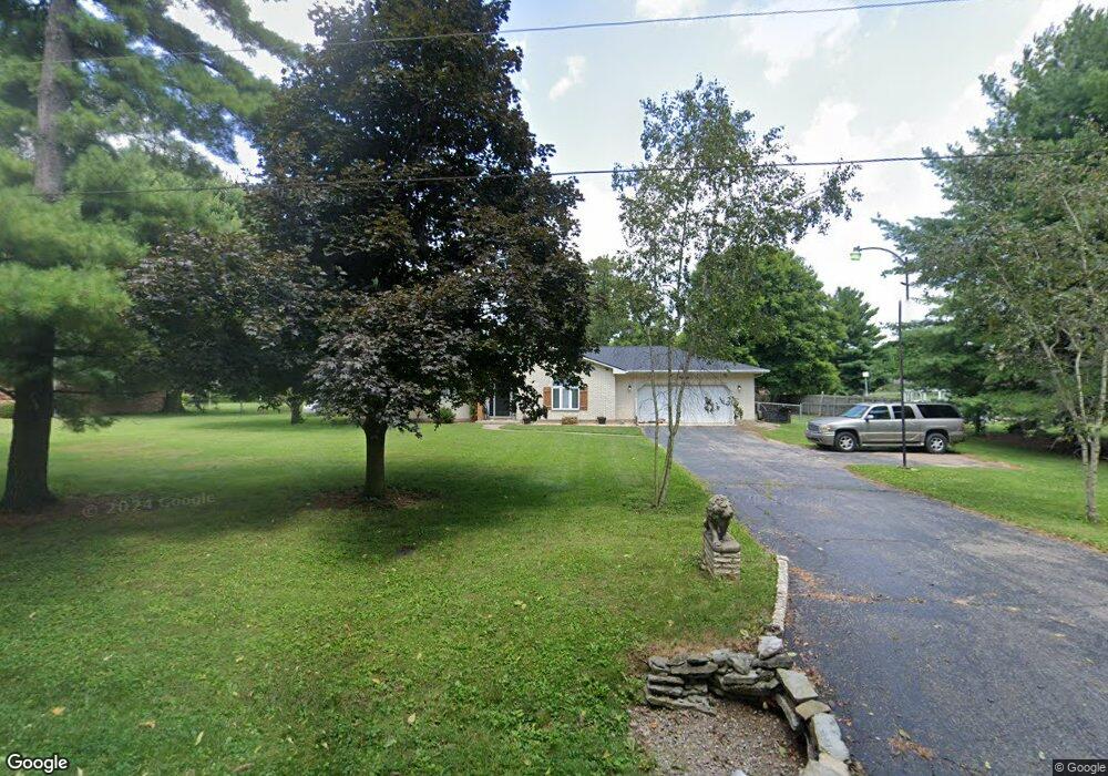
1063 N Factory Rd West Alexandria, OH 45381
Estimated Value: $284,000 - $317,000
3
Beds
3
Baths
1,499
Sq Ft
$195/Sq Ft
Est. Value
About This Home
This home is located at 1063 N Factory Rd, West Alexandria, OH 45381 and is currently estimated at $293,012, approximately $195 per square foot. 1063 N Factory Rd is a home located in Preble County with nearby schools including Twin Valley South Elementary School, Twin Valley South Middle School, and Twin Valley South High School.
Ownership History
Date
Name
Owned For
Owner Type
Purchase Details
Closed on
Sep 16, 2016
Sold by
Gordon Lasaundra
Bought by
Martin Troy D and Martin Lacey D
Current Estimated Value
Home Financials for this Owner
Home Financials are based on the most recent Mortgage that was taken out on this home.
Original Mortgage
$135,325
Outstanding Balance
$108,162
Interest Rate
3.45%
Mortgage Type
New Conventional
Estimated Equity
$184,850
Purchase Details
Closed on
May 14, 2007
Sold by
Castle Corbett N and Castle Emma L
Bought by
Stamper Glen and Stamper Daphne
Purchase Details
Closed on
May 17, 2004
Sold by
Castle Corbett N and Castle Emma L
Bought by
Castle Corbett N and Castle Emma L
Purchase Details
Closed on
Sep 10, 1986
Bought by
Stamper Daphne
Create a Home Valuation Report for This Property
The Home Valuation Report is an in-depth analysis detailing your home's value as well as a comparison with similar homes in the area
Home Values in the Area
Average Home Value in this Area
Purchase History
| Date | Buyer | Sale Price | Title Company |
|---|---|---|---|
| Martin Troy D | $155,000 | Terratitle Llc | |
| Stamper Glen | $154,000 | Sterling Land Title N Llc | |
| Castle Corbett N | -- | None Available | |
| Stamper Daphne | $8,500 | -- |
Source: Public Records
Mortgage History
| Date | Status | Borrower | Loan Amount |
|---|---|---|---|
| Open | Martin Troy D | $135,325 |
Source: Public Records
Tax History Compared to Growth
Tax History
| Year | Tax Paid | Tax Assessment Tax Assessment Total Assessment is a certain percentage of the fair market value that is determined by local assessors to be the total taxable value of land and additions on the property. | Land | Improvement |
|---|---|---|---|---|
| 2024 | $2,431 | $69,900 | $7,000 | $62,900 |
| 2023 | $2,431 | $69,900 | $7,000 | $62,900 |
| 2022 | $2,110 | $57,510 | $6,020 | $51,490 |
| 2021 | $2,287 | $57,510 | $6,020 | $51,490 |
| 2020 | $2,191 | $57,510 | $6,020 | $51,490 |
| 2019 | $1,948 | $49,920 | $5,010 | $44,910 |
| 2018 | $2,016 | $49,920 | $5,010 | $44,910 |
| 2017 | $1,911 | $49,920 | $5,010 | $44,910 |
| 2016 | $1,606 | $52,510 | $4,870 | $47,640 |
| 2014 | $1,588 | $52,510 | $4,870 | $47,640 |
| 2013 | $1,721 | $52,500 | $4,865 | $47,635 |
Source: Public Records
Map
Nearby Homes
- 4801 Fisher Twin Rd
- 60 Hope Ave
- 1389 Leon Dr
- 37 Smith St
- 0 U S 35
- 52 E 2nd St
- 10 Western Dr
- 36 E 3rd St
- 212 E 3rd St
- 6762 U S 35
- 0 State Rt 35 Unit 935251
- 3659 Winston Ln
- 1020 Howard Ct
- 60 Enterprise Rd
- 3292 Twin Creek Rd
- 1148 State Route 503 N
- 15600 Dechant Rd
- 1111 Bull Rd
- 99 Katherine Dr
- 86 Snapdragon Dr
- 979 Boulder Dr
- 1043 N Factory Rd
- 959 Boulder Dr
- 1023 N Factory Rd
- 1000 Boulder Dr
- 950 State Route 503 S
- 980 Boulder Dr
- 983 N Factory Rd
- 960 Boulder Dr
- 0 Stotler Rd Unit 1733810
- 0 Stotler Rd Unit 1764381
- 0 Stotler Rd
- 920 State Route 503 S
- 1052 Stone Dr
- 929 Boulder Dr
- 1032 Stone Dr
- 940 Boulder Dr
- 1112 Stone Dr
- 4674 Us Route 35
- 953 State Route 503 N