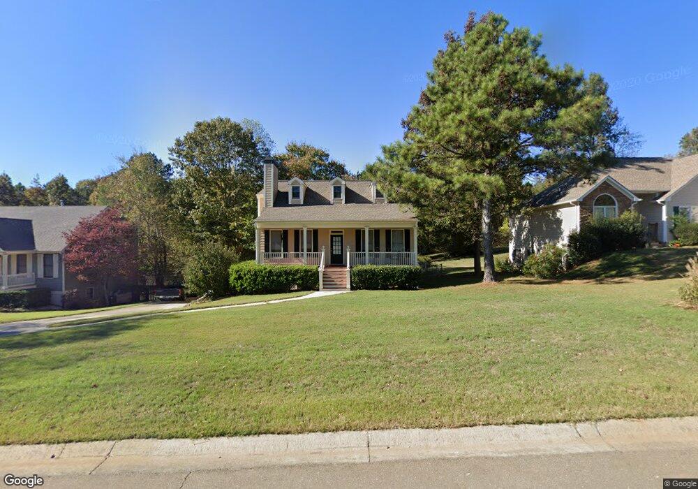
1063 Palm St Canton, GA 30115
Estimated Value: $1,140,281
3
Beds
2
Baths
2,664
Sq Ft
$428/Sq Ft
Est. Value
About This Home
This home is located at 1063 Palm St, Canton, GA 30115 and is currently estimated at $1,140,281, approximately $428 per square foot. 1063 Palm St is a home located in Cherokee County with nearby schools including Holly Springs Elementary School, Rusk Middle School, and Sequoyah High School.
Ownership History
Date
Name
Owned For
Owner Type
Purchase Details
Closed on
Mar 8, 2019
Sold by
Wisehart Larry Steven
Bought by
Share Thomas
Current Estimated Value
Purchase Details
Closed on
May 19, 2011
Sold by
Hillhouse Ronald and Hillhouse Opal
Bought by
Hillhouse Ron C and Edge Rhonda
Purchase Details
Closed on
Sep 30, 2010
Sold by
Hillhouse Ronald
Bought by
Hillhouse Ron C and Hillhouse Rita G
Create a Home Valuation Report for This Property
The Home Valuation Report is an in-depth analysis detailing your home's value as well as a comparison with similar homes in the area
Home Values in the Area
Average Home Value in this Area
Purchase History
| Date | Buyer | Sale Price | Title Company |
|---|---|---|---|
| Share Thomas | $52,000 | -- | |
| Hillhouse Ron C | -- | -- | |
| Hillhouse Ron C | -- | -- |
Source: Public Records
Tax History Compared to Growth
Tax History
| Year | Tax Paid | Tax Assessment Tax Assessment Total Assessment is a certain percentage of the fair market value that is determined by local assessors to be the total taxable value of land and additions on the property. | Land | Improvement |
|---|---|---|---|---|
| 2025 | $3,072 | $579,704 | $459,280 | $120,424 |
| 2024 | $6,139 | $399,864 | $287,040 | $112,824 |
| 2023 | $5,862 | $402,064 | $287,040 | $115,024 |
| 2022 | $5,990 | $369,224 | $287,040 | $82,184 |
| 2021 | $5,153 | $303,744 | $239,200 | $64,544 |
| 2020 | $725 | $83,824 | $26,840 | $56,984 |
| 2019 | $735 | $84,880 | $26,840 | $58,040 |
| 2018 | $727 | $82,520 | $26,840 | $55,680 |
| 2017 | $755 | $208,900 | $26,840 | $56,720 |
| 2016 | $717 | $192,800 | $24,080 | $53,040 |
| 2015 | $672 | $176,900 | $20,360 | $50,400 |
| 2014 | $636 | $167,700 | $17,600 | $49,480 |
Source: Public Records
Map
Nearby Homes
- 1104 Palm St
- 1414 Palm St
- 554 Palm St
- 1620 Palm St
- 1243 Palm Ridge Trace
- 542 Palm St
- 482 Palm St
- 3072 Holly Springs Pkwy
- 3132 Holly Springs Pkwy
- 251 Manous Way
- 102 Magnolia Springs Ln
- 3060 Holly Springs Pkwy
- 3430 Holly Springs Pkwy
- 203 Brookhaven Place
- 152 Palm St
- 1000 Rabbit Hill Rd
- 164 Palm St
- 228 Holly Creek Way
- 1021 Palm St
- 1086 Palm St
- 1020 Palm St
- 154 Barn Rd
- 0 Barn Rd Unit 8046602
- 0 Barn Rd Unit 7176709
- 117 Amanda Ln
- 257 Candy Ln
- 247 Candy Ln
- 289 Candy Ln Unit 2
- 221 Candy Ln
- 1134 Palm St
- 1134 Palm St Unit Lot 1
- 206 Barn Rd
- 155 Barn Rd
- 309 Candy Ln Unit 2
- 179 Barn Rd
- 179 Barn Rd
- 125 Barn Rd
- 0 Amanda Ln Unit 7550035