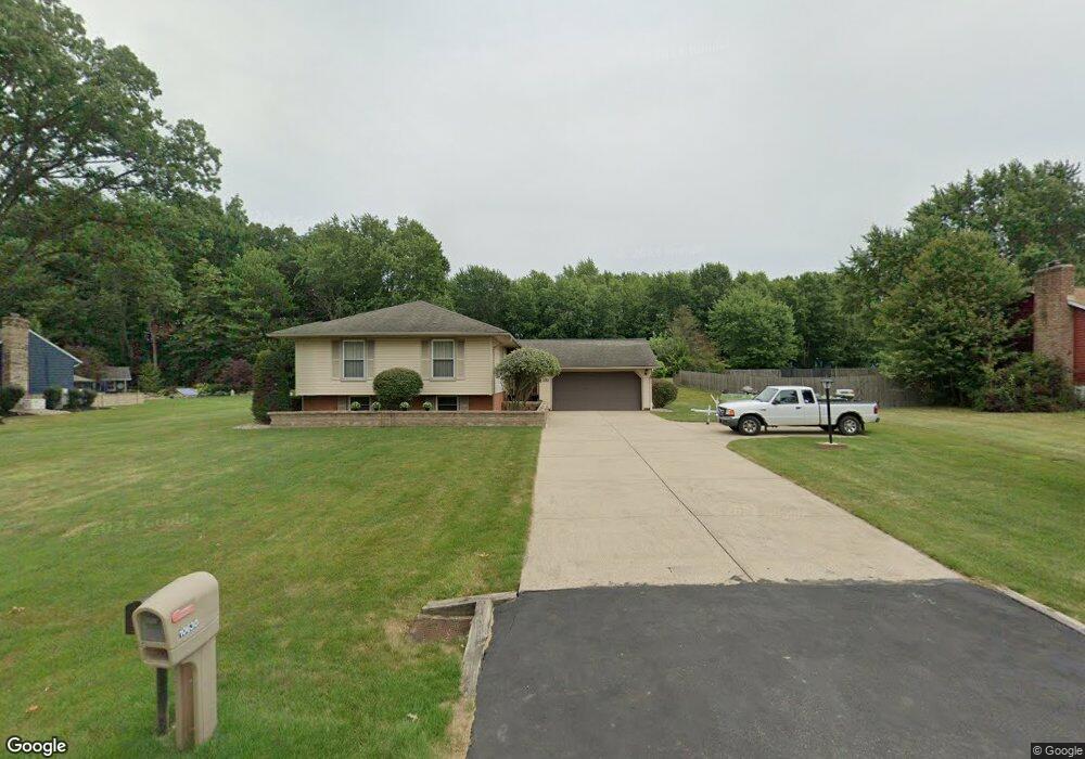
10630 Julie St NE Alliance, OH 44601
Estimated Value: $231,000 - $267,000
3
Beds
3
Baths
1,164
Sq Ft
$220/Sq Ft
Est. Value
About This Home
This home is located at 10630 Julie St NE, Alliance, OH 44601 and is currently estimated at $255,981, approximately $219 per square foot. 10630 Julie St NE is a home located in Stark County with nearby schools including Marlington High School and Regina Coeli/St Joseph School.
Ownership History
Date
Name
Owned For
Owner Type
Purchase Details
Closed on
Feb 27, 1998
Sold by
Evascu Evelyn M
Bought by
Nicholson Roy D and Nicholson Shirley
Current Estimated Value
Home Financials for this Owner
Home Financials are based on the most recent Mortgage that was taken out on this home.
Original Mortgage
$88,000
Interest Rate
6.95%
Mortgage Type
New Conventional
Purchase Details
Closed on
Nov 23, 1993
Purchase Details
Closed on
May 16, 1991
Create a Home Valuation Report for This Property
The Home Valuation Report is an in-depth analysis detailing your home's value as well as a comparison with similar homes in the area
Home Values in the Area
Average Home Value in this Area
Purchase History
| Date | Buyer | Sale Price | Title Company |
|---|---|---|---|
| Nicholson Roy D | $118,000 | -- | |
| -- | -- | -- | |
| -- | $78,900 | -- |
Source: Public Records
Mortgage History
| Date | Status | Borrower | Loan Amount |
|---|---|---|---|
| Closed | Nicholson Roy D | $88,000 |
Source: Public Records
Tax History Compared to Growth
Tax History
| Year | Tax Paid | Tax Assessment Tax Assessment Total Assessment is a certain percentage of the fair market value that is determined by local assessors to be the total taxable value of land and additions on the property. | Land | Improvement |
|---|---|---|---|---|
| 2025 | -- | $82,110 | $23,310 | $58,800 |
| 2024 | -- | $82,110 | $23,310 | $58,800 |
| 2023 | $1,917 | $63,600 | $12,390 | $51,210 |
| 2022 | $1,938 | $63,600 | $12,390 | $51,210 |
| 2021 | $1,945 | $63,600 | $12,390 | $51,210 |
| 2020 | $1,879 | $55,970 | $10,680 | $45,290 |
| 2019 | $1,866 | $55,970 | $10,680 | $45,290 |
| 2018 | $1,869 | $55,970 | $10,680 | $45,290 |
| 2017 | $2,070 | $48,970 | $10,150 | $38,820 |
| 2016 | $1,976 | $46,730 | $10,150 | $36,580 |
| 2015 | $1,881 | $46,730 | $10,150 | $36,580 |
| 2014 | $1,717 | $38,960 | $8,470 | $30,490 |
| 2013 | $854 | $38,960 | $8,470 | $30,490 |
Source: Public Records
Map
Nearby Homes
- 13334 Cindy St NE
- 13061 Beeson St NE
- 0 Meadow St NE
- 10666 Wilma Ave NE
- 0 W Main St Unit 5090123
- 11480 Aebi Ave NE
- 000 Klinger Ave
- 1430 Westwood Ave
- 432 Johnson Ave
- 2081 Marwood Cir
- 0 Klinger Ave NE
- 11940 Freshley Ave NE
- 11960 Freshley Ave NE
- 13109 Edison St NE
- 0 Johnson Ave NE Unit 5142926
- 0 Meadowbrook Ave
- 14422 Sturbridge Rd NE
- 0 Homestead Ave NE
- 565 W Broadway St
- 1201 Overlook Dr
- 10608 Julie St NE
- 10654 Julie St NE
- 10670 Julie St NE
- 10663 Julie St NE
- 10586 Julie St NE
- 10692 Julie St NE
- 13231 Beeson St NE
- 10710 Julie St NE
- 13271 Beeson St NE
- 13285 Beeson St NE
- 10728 Julie St NE
- 13203 Beeson St NE
- 13321 Beeson St NE
- 13295 Beeson St NE
- 13223 Beeson St NE
- 10607 Heltman Ave NE
- 13286 Cindy St NE
- 10645 Heltman Ave NE
- 10667 Heltman Ave NE
- 10687 Heltman Ave NE