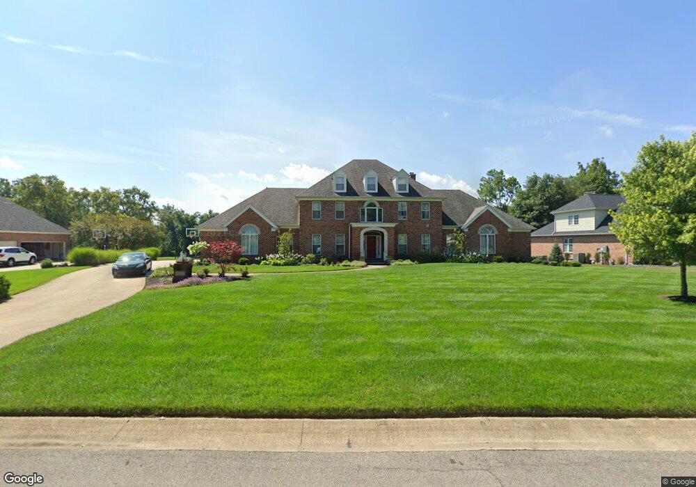
10631 Monte Vista Ct Fort Wayne, IN 46814
Southwest Fort Wayne NeighborhoodEstimated Value: $846,475 - $961,000
4
Beds
6
Baths
3,738
Sq Ft
$241/Sq Ft
Est. Value
About This Home
This home is located at 10631 Monte Vista Ct, Fort Wayne, IN 46814 and is currently estimated at $900,492, approximately $240 per square foot. 10631 Monte Vista Ct is a home located in Allen County with nearby schools including Deer Ridge Elementary School, Woodside Middle School, and Homestead Senior High School.
Ownership History
Date
Name
Owned For
Owner Type
Purchase Details
Closed on
Jan 3, 2002
Sold by
Brockmann Robert C
Bought by
Tsai Eugene and Lai Amy
Current Estimated Value
Home Financials for this Owner
Home Financials are based on the most recent Mortgage that was taken out on this home.
Original Mortgage
$480,000
Outstanding Balance
$197,824
Interest Rate
7.16%
Estimated Equity
$702,668
Create a Home Valuation Report for This Property
The Home Valuation Report is an in-depth analysis detailing your home's value as well as a comparison with similar homes in the area
Home Values in the Area
Average Home Value in this Area
Purchase History
| Date | Buyer | Sale Price | Title Company |
|---|---|---|---|
| Tsai Eugene | -- | Columbia Land Title Inc |
Source: Public Records
Mortgage History
| Date | Status | Borrower | Loan Amount |
|---|---|---|---|
| Open | Tsai Eugene | $480,000 |
Source: Public Records
Tax History Compared to Growth
Tax History
| Year | Tax Paid | Tax Assessment Tax Assessment Total Assessment is a certain percentage of the fair market value that is determined by local assessors to be the total taxable value of land and additions on the property. | Land | Improvement |
|---|---|---|---|---|
| 2024 | $6,877 | $850,400 | $106,600 | $743,800 |
| 2023 | $6,872 | $812,400 | $101,800 | $710,600 |
| 2022 | $6,357 | $777,800 | $101,800 | $676,000 |
| 2021 | $5,795 | $694,100 | $101,800 | $592,300 |
| 2020 | $5,351 | $636,200 | $101,800 | $534,400 |
| 2019 | $5,414 | $622,800 | $101,800 | $521,000 |
| 2018 | $5,017 | $587,200 | $101,800 | $485,400 |
| 2017 | $5,371 | $587,400 | $101,800 | $485,600 |
| 2016 | $5,391 | $579,100 | $101,800 | $477,300 |
| 2014 | $5,511 | $588,300 | $124,000 | $464,300 |
| 2013 | $5,556 | $567,200 | $124,000 | $443,200 |
Source: Public Records
Map
Nearby Homes
- 10528 Indian Ridge Dr
- 11136 Creekwood Ct
- 850 Pleasant Hill Place
- 10216 Chestnut Plaza Dr Unit 1
- Aldridge Plan at Signal Ridge - Estates at Signal Ridge Villas
- Harmony Plan at Signal Ridge - Estates at Signal Ridge Villas
- Chatham Plan at Signal Ridge - Estates at Signal Ridge Villas
- Freeport Plan at Signal Ridge - Estates at Signal Ridge Villas
- 10215 Chestnut Plaza Dr Unit 69
- 10237 Chestnut Plaza Dr Unit 68
- 10576 Chestnut Plaza Dr Unit 15
- 10238 Chestnut Plaza Dr Unit 2
- 1015 Catesby Ct
- 1037 Catesby Ct
- 821 S Scott Rd
- 1163 Catesby Ct
- 1302 Tamalpais Dr
- 1292 Pleasant Hill Place
- 1217 Catesby Ct
- 1319 Tamalpais Dr
- 10705 Monte Vista Ct
- 10623 Monte Vista Ct
- 10717 Monte Vista Ct
- 10630 Monte Vista Ct
- 10712 Monte Vista Ct
- 10615 Monte Vista Ct
- 10620 Monte Vista Ct
- 10724 Monte Vista Ct
- 10610 Monte Vista Ct
- 10729 Monte Vista Ct
- 10808 Monte Vista Ct
- 10811 Monte Vista Ct
- 10816 Monte Vista Ct
- 10819 Monte Vista Ct
- 10516 Indian Ridge Dr
- 10510 Indian Ridge Dr
- 10522 Indian Ridge Dr
- 10504 Indian Ridge Dr
- 10430 Indian Ridge Dr
- 10906 Monte Vista Ct