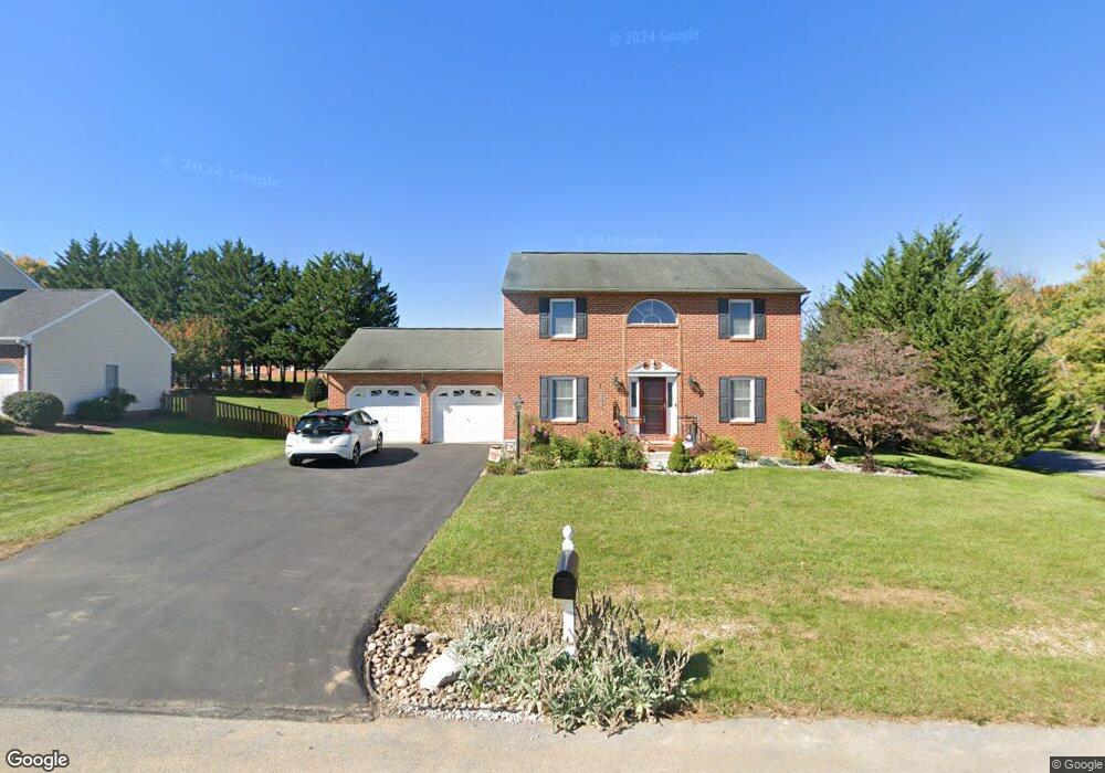
10632 August Ct Williamsport, MD 21795
Estimated Value: $415,182 - $480,000
3
Beds
3
Baths
1,904
Sq Ft
$240/Sq Ft
Est. Value
About This Home
This home is located at 10632 August Ct, Williamsport, MD 21795 and is currently estimated at $456,296, approximately $239 per square foot. 10632 August Ct is a home located in Washington County with nearby schools including Williamsport Elementary School, Springfield Middle School, and Williamsport High School.
Ownership History
Date
Name
Owned For
Owner Type
Purchase Details
Closed on
Jul 14, 1999
Sold by
Wolff Ronald D and Wolff Kimberly S
Bought by
Stresewski Vincent A and Stresewski Sandra L
Current Estimated Value
Purchase Details
Closed on
Oct 21, 1996
Sold by
Roy Sylvester
Bought by
Wolff Ronald D and Wolff Kimberly S
Purchase Details
Closed on
Apr 10, 1996
Sold by
Lee Downey R
Bought by
Roy Sylvester
Create a Home Valuation Report for This Property
The Home Valuation Report is an in-depth analysis detailing your home's value as well as a comparison with similar homes in the area
Home Values in the Area
Average Home Value in this Area
Purchase History
| Date | Buyer | Sale Price | Title Company |
|---|---|---|---|
| Stresewski Vincent A | $171,000 | -- | |
| Wolff Ronald D | $162,500 | -- | |
| Roy Sylvester | $36,800 | -- |
Source: Public Records
Mortgage History
| Date | Status | Borrower | Loan Amount |
|---|---|---|---|
| Closed | Wolff Ronald D | -- |
Source: Public Records
Tax History Compared to Growth
Tax History
| Year | Tax Paid | Tax Assessment Tax Assessment Total Assessment is a certain percentage of the fair market value that is determined by local assessors to be the total taxable value of land and additions on the property. | Land | Improvement |
|---|---|---|---|---|
| 2025 | $3,536 | $382,500 | $67,500 | $315,000 |
| 2024 | $3,536 | $341,533 | $0 | $0 |
| 2023 | $3,112 | $300,567 | $0 | $0 |
| 2022 | $2,688 | $259,600 | $67,500 | $192,100 |
| 2021 | $2,618 | $253,867 | $0 | $0 |
| 2020 | $2,618 | $248,133 | $0 | $0 |
| 2019 | $2,569 | $242,400 | $67,500 | $174,900 |
| 2018 | $2,536 | $239,200 | $0 | $0 |
| 2017 | $2,502 | $236,000 | $0 | $0 |
| 2016 | -- | $232,800 | $0 | $0 |
| 2015 | $2,583 | $232,800 | $0 | $0 |
| 2014 | $2,583 | $232,800 | $0 | $0 |
Source: Public Records
Map
Nearby Homes
- 10642 Hershey Dr
- 10608 Hershey Dr
- 10730 Hershey Dr
- 10701 Bratton Ct
- 10808 Archer Ln
- 10813 Wilcox Dr
- 10818 Anderson Dr
- 11015 Donelson Dr
- 16722 Custer Ct
- 17125 Miner Ave
- 17218 Tamarack Dr
- 10705 Timothy Dr
- 16804 Longfellow Ct Unit 652
- 10744 Apple Tree Ln
- 11015 Beckley Rd
- 16802 Alcott Rd
- 16810 Alcott Rd
- 11307 Hawthorne Ct
- 16847 Longfellow Ct
- 10903 Allen Ave
- 10628 August Ct
- 10643 Hershey Dr
- 16715 Paxton Dr
- 10624 August Ct
- 10639 Hershey Dr
- 10625 August Ct
- 16717 Paxton Dr
- 10620 August Ct
- 10633 Hershey Dr
- 10621 August Ct
- 10705 Hershey Dr
- 10629 Hershey Dr
- 10638 Hershey Dr
- 10616 August Ct
- 10618 Connor Dr
- 16721 Paxton Dr
- 10711 Hershey Dr
- 10634 Hershey Dr
- 10617 August Ct
- 10614 Connor Dr