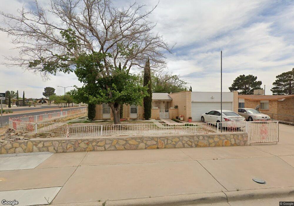
10632 Cardigan Dr El Paso, TX 79925
Eastwood NeighborhoodEstimated Value: $202,000 - $246,000
--
Bed
2
Baths
1,457
Sq Ft
$154/Sq Ft
Est. Value
About This Home
This home is located at 10632 Cardigan Dr, El Paso, TX 79925 and is currently estimated at $224,775, approximately $154 per square foot. 10632 Cardigan Dr is a home located in El Paso County with nearby schools including Edgemere International School, Eastwood Middle School, and Eastwood High School.
Ownership History
Date
Name
Owned For
Owner Type
Purchase Details
Closed on
May 9, 2024
Sold by
Johnson Charles W
Bought by
Meraz Ramon
Current Estimated Value
Purchase Details
Closed on
Dec 4, 2000
Sold by
Meraz Ramon
Bought by
Johnson Socorro U and Meraz Ramon
Purchase Details
Closed on
Mar 15, 2000
Sold by
Meraz Ramon
Bought by
Johnson Socorro U and Johnson Ii Charles W
Purchase Details
Closed on
Mar 3, 1999
Sold by
Johnson Socorro U
Bought by
Johnson Socorro U and Meraz Ramon
Purchase Details
Closed on
Feb 3, 1995
Sold by
Mcleod Jean M and Mcleod William D
Bought by
Johnson Socorro Oriquidi
Create a Home Valuation Report for This Property
The Home Valuation Report is an in-depth analysis detailing your home's value as well as a comparison with similar homes in the area
Home Values in the Area
Average Home Value in this Area
Purchase History
| Date | Buyer | Sale Price | Title Company |
|---|---|---|---|
| Meraz Ramon | -- | None Listed On Document | |
| Johnson Socorro U | -- | -- | |
| Johnson Socorro U | -- | -- | |
| Johnson Socorro U | -- | -- | |
| Johnson Socorro Oriquidi | -- | -- |
Source: Public Records
Tax History Compared to Growth
Tax History
| Year | Tax Paid | Tax Assessment Tax Assessment Total Assessment is a certain percentage of the fair market value that is determined by local assessors to be the total taxable value of land and additions on the property. | Land | Improvement |
|---|---|---|---|---|
| 2025 | $2,290 | $176,813 | -- | -- |
| 2024 | $2,290 | $160,739 | -- | -- |
| 2023 | $2,121 | $146,126 | $0 | $0 |
| 2022 | $4,125 | $132,842 | $0 | $0 |
| 2021 | $3,925 | $145,598 | $22,630 | $122,968 |
| 2020 | $3,468 | $109,786 | $20,193 | $89,593 |
| 2018 | $3,423 | $110,083 | $20,193 | $89,890 |
| 2017 | $3,093 | $101,197 | $20,193 | $81,004 |
| 2016 | $3,093 | $101,197 | $20,193 | $81,004 |
| 2015 | $2,495 | $105,852 | $20,193 | $85,659 |
| 2014 | $2,495 | $106,472 | $20,193 | $86,279 |
Source: Public Records
Map
Nearby Homes
- 3425 Brookrock St
- 10602 Drillstone Dr
- 3400 Brookrock St
- 3453 Guthrie St
- 10405 Darin Rd
- 3369 Freeport Dr
- 10816 Cardigan Dr
- 3332 Dungarvan Dr
- 10605 Kinross Ave Unit B
- 3213 Isla Cocoa Ln
- 10216 Cardigan Dr
- 3317 Dungarvan Dr
- 3345 Wexford Dr
- 10649 Islerock Dr
- 3318 Limerick Rd
- 3320 Tyrone Rd
- 10905 Sagebrush Way Unit A & B
- 3300 Tyrone Rd
- 3150 N Yarbrough Dr Unit A1
- 3112 Eads Place
- 10628 Cardigan Dr
- 10633 Birthstone Dr
- 10629 Birthstone Dr
- 10624 Cardigan Dr
- 10633 Cardigan Dr
- 10625 Birthstone Dr
- 10640 Cardigan Dr
- 10629 Cardigan Dr
- 10620 Cardigan Dr
- 10642 Cardigan Dr
- 10625 Cardigan Dr
- 10641 Birthstone Dr
- 10621 Birthstone Dr
- 10621 Birthstone Dr Unit 1
- 10641 Cardigan Dr
- 10644 Cardigan Dr
- 10621 Cardigan Dr
- 10616 Cardigan Dr
- 10632 Birthstone Dr
- 10643 Cardigan Dr