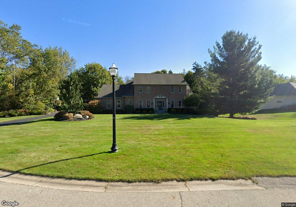
10634 MacAtawa Ln Unit 28 Holland, MI 49423
Estimated Value: $721,621 - $1,004,000
4
Beds
5
Baths
3,612
Sq Ft
$231/Sq Ft
Est. Value
About This Home
This home is located at 10634 MacAtawa Ln Unit 28, Holland, MI 49423 and is currently estimated at $834,905, approximately $231 per square foot. 10634 MacAtawa Ln Unit 28 is a home located in Ottawa County with nearby schools including Woodbridge Elementary School, Cityside Middle School, and Zeeland East High School.
Ownership History
Date
Name
Owned For
Owner Type
Purchase Details
Closed on
Oct 3, 2019
Sold by
Hill James and Hill Stacey
Bought by
Hill James and Hill Stacey
Current Estimated Value
Purchase Details
Closed on
Jul 25, 2005
Sold by
Lowe Tim and Lowe Karla
Bought by
Hill James
Home Financials for this Owner
Home Financials are based on the most recent Mortgage that was taken out on this home.
Original Mortgage
$300,000
Interest Rate
7.25%
Mortgage Type
Fannie Mae Freddie Mac
Create a Home Valuation Report for This Property
The Home Valuation Report is an in-depth analysis detailing your home's value as well as a comparison with similar homes in the area
Home Values in the Area
Average Home Value in this Area
Purchase History
| Date | Buyer | Sale Price | Title Company |
|---|---|---|---|
| Hill James | -- | None Available | |
| Hill James | $375,000 | None Available |
Source: Public Records
Mortgage History
| Date | Status | Borrower | Loan Amount |
|---|---|---|---|
| Previous Owner | Hill James | $300,000 |
Source: Public Records
Tax History Compared to Growth
Tax History
| Year | Tax Paid | Tax Assessment Tax Assessment Total Assessment is a certain percentage of the fair market value that is determined by local assessors to be the total taxable value of land and additions on the property. | Land | Improvement |
|---|---|---|---|---|
| 2025 | $7,494 | $324,200 | $0 | $0 |
| 2024 | $4,727 | $323,100 | $0 | $0 |
| 2023 | $4,513 | $322,400 | $0 | $0 |
| 2022 | $6,790 | $284,800 | $0 | $0 |
| 2021 | $6,593 | $235,300 | $0 | $0 |
| 2020 | $6,524 | $222,100 | $0 | $0 |
| 2019 | $6,421 | $179,300 | $0 | $0 |
| 2018 | $5,914 | $219,300 | $40,000 | $179,300 |
| 2017 | $5,829 | $222,800 | $0 | $0 |
| 2016 | $5,787 | $212,100 | $0 | $0 |
| 2015 | $5,447 | $190,700 | $0 | $0 |
| 2014 | $5,447 | $181,500 | $0 | $0 |
Source: Public Records
Map
Nearby Homes
- 1391 Quarterline Commons
- Lot 17 of Peppermint Dr
- Lot 16 Peppermint Dr
- Lot 15 Peppermint Dr
- 179 Peppermint Dr
- 165 Peppermint Dr
- 171 Peppermint Dr
- VL Ottogan St
- 403 Stratford Way
- 160 Sorrento Dr
- 10058 Prairie Grass Ct
- 1214 Euna Vista Dr
- 5232 E Sunfield Ln
- 5216 Mulberry Ln
- 1433 Savannah Dr Unit 18
- 955 Kenwood Dr
- 1568 Stockington Path
- 5219 Hollow Ln
- 5221 Hollow Ln
- 0 96th Ave Unit 1.94 25027197
- 10646 MacAtawa Ln
- 10622 MacAtawa Ln
- 10641 MacAtawa Ln
- 10623 MacAtawa Ln
- 25 MacAtawa Ln
- 10659 Northridge Ct Unit 32
- 10681 Northridge Ct
- 490 Northridge Dr
- 10642 Northridge Ct
- 679 Garden Ridge Dr
- 584 Northridge Dr
- 591 104th Ave
- 10707 Northridge Ct
- 510 Northridge Dr
- 0 Northridge Ct
- 550 Northridge Dr
- 10664 Northridge Ct Unit 34
- 616 Northridge Dr
- 616 Northridge Dr Unit 20
- 0 Northridge Dr