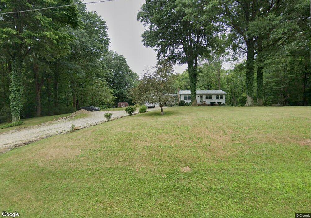
10635 Mccallum Ave NE Alliance, OH 44601
Estimated Value: $234,000 - $301,000
3
Beds
1
Bath
1,584
Sq Ft
$162/Sq Ft
Est. Value
About This Home
This home is located at 10635 Mccallum Ave NE, Alliance, OH 44601 and is currently estimated at $256,978, approximately $162 per square foot. 10635 Mccallum Ave NE is a home located in Stark County with nearby schools including Marlington High School and Regina Coeli/St Joseph School.
Ownership History
Date
Name
Owned For
Owner Type
Purchase Details
Closed on
Apr 27, 1992
Current Estimated Value
Create a Home Valuation Report for This Property
The Home Valuation Report is an in-depth analysis detailing your home's value as well as a comparison with similar homes in the area
Home Values in the Area
Average Home Value in this Area
Purchase History
| Date | Buyer | Sale Price | Title Company |
|---|---|---|---|
| -- | $69,900 | -- |
Source: Public Records
Tax History Compared to Growth
Tax History
| Year | Tax Paid | Tax Assessment Tax Assessment Total Assessment is a certain percentage of the fair market value that is determined by local assessors to be the total taxable value of land and additions on the property. | Land | Improvement |
|---|---|---|---|---|
| 2025 | -- | $66,860 | $16,560 | $50,300 |
| 2024 | -- | $66,860 | $16,560 | $50,300 |
| 2023 | $1,993 | $56,430 | $15,160 | $41,270 |
| 2022 | $1,019 | $57,480 | $15,160 | $42,320 |
| 2021 | $2,045 | $57,480 | $15,160 | $42,320 |
| 2020 | $1,976 | $49,500 | $13,060 | $36,440 |
| 2019 | $1,963 | $49,510 | $13,060 | $36,450 |
| 2018 | $1,966 | $49,510 | $13,060 | $36,450 |
| 2017 | $1,895 | $44,680 | $9,590 | $35,090 |
| 2016 | $1,645 | $38,760 | $10,020 | $28,740 |
| 2015 | $1,567 | $38,760 | $10,020 | $28,740 |
| 2014 | $1,594 | $36,000 | $9,280 | $26,720 |
| 2013 | $793 | $36,000 | $9,280 | $26,720 |
Source: Public Records
Map
Nearby Homes
- 10666 Wilma Ave NE
- 0 Reeder Ave NE
- 12355 Edison St NE
- 13334 Cindy St NE
- 0 Meadow St NE
- 11960 Freshley Ave NE
- 13109 Edison St NE
- 11480 Aebi Ave NE
- 1430 Westwood Ave
- 12415 Snode St NE
- 0 W Main St Unit 5090123
- 2081 Marwood Cir
- 2377 Ansley St Unit 2377
- 2851 Patriots Path Unit 3D
- 2435 Queensbury Rd
- 000 Klinger Ave
- 432 Johnson Ave
- 0 Valewood Cir Unit 5006281
- 14422 Sturbridge Rd NE
- 1201 Overlook Dr
- 10717 Mccallum Ave NE
- 10632 Mccallum Ave NE
- 11815 Beeson St NE
- 11751 Beeson St NE
- 10801 Mccallum Ave NE
- 11655 Beeson St NE
- 11977 Beeson St NE
- 10444 Mccallum Ave NE
- 10845 Mccallum Ave NE
- 10788 Mccallum Ave NE
- 11621 Beeson St NE
- 10555 May Ave NE
- 10874 Mccallum Ave NE
- 11575 Beeson St NE
- 10905 Mccallum Ave NE
- 10906 Mccallum Ave NE
- 12080 Beeson St NE
- 10953 Mccallum Ave NE
- 0 Beeson St NE Unit 3963277
- 0 Beeson St NE Unit 3933099