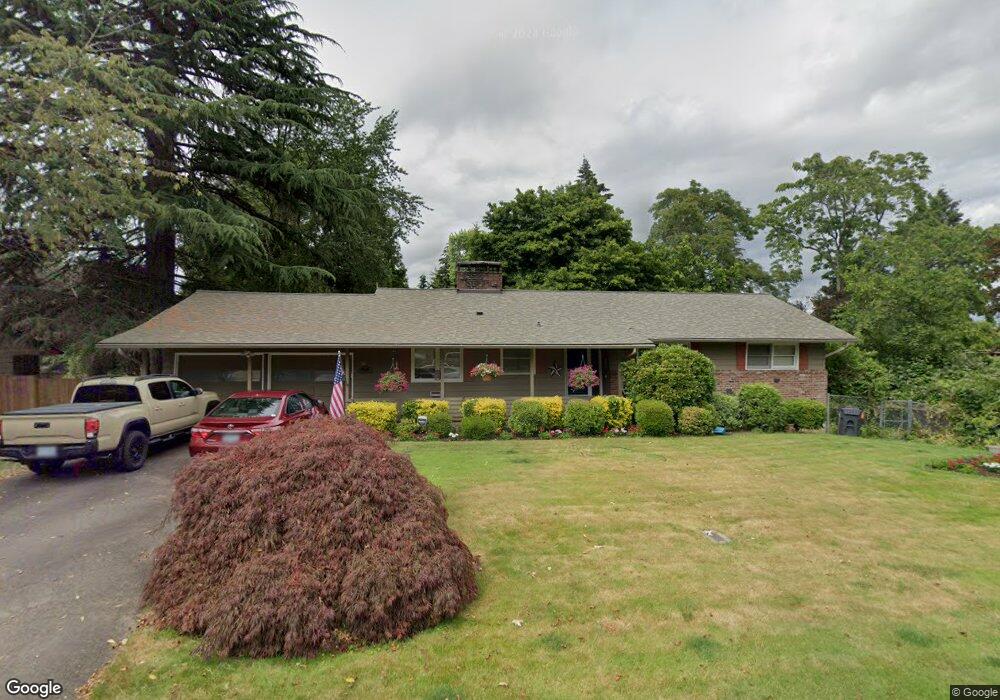
10635 SW Derry Dell Ct Portland, OR 97223
Derry Dell NeighborhoodEstimated Value: $597,000 - $705,000
3
Beds
2
Baths
1,342
Sq Ft
$484/Sq Ft
Est. Value
About This Home
This home is located at 10635 SW Derry Dell Ct, Portland, OR 97223 and is currently estimated at $649,850, approximately $484 per square foot. 10635 SW Derry Dell Ct is a home located in Washington County with nearby schools including Charles F. Tigard Elementary School, Thomas R. Fowler Middle School, and Tigard High School.
Ownership History
Date
Name
Owned For
Owner Type
Purchase Details
Closed on
Oct 13, 1997
Sold by
Kile Bert V and Kile Judy M
Bought by
Kile Bert V and Kile Judy M
Current Estimated Value
Home Financials for this Owner
Home Financials are based on the most recent Mortgage that was taken out on this home.
Original Mortgage
$90,000
Interest Rate
7.49%
Mortgage Type
Purchase Money Mortgage
Create a Home Valuation Report for This Property
The Home Valuation Report is an in-depth analysis detailing your home's value as well as a comparison with similar homes in the area
Home Values in the Area
Average Home Value in this Area
Purchase History
| Date | Buyer | Sale Price | Title Company |
|---|---|---|---|
| Kile Bert V | -- | Chicago Title Insurance Co |
Source: Public Records
Mortgage History
| Date | Status | Borrower | Loan Amount |
|---|---|---|---|
| Closed | Kile Bert V | $90,000 |
Source: Public Records
Tax History Compared to Growth
Tax History
| Year | Tax Paid | Tax Assessment Tax Assessment Total Assessment is a certain percentage of the fair market value that is determined by local assessors to be the total taxable value of land and additions on the property. | Land | Improvement |
|---|---|---|---|---|
| 2025 | $5,217 | $305,980 | -- | -- |
| 2024 | $5,077 | $297,070 | -- | -- |
| 2023 | $5,077 | $288,420 | $0 | $0 |
| 2022 | $4,931 | $288,420 | $0 | $0 |
| 2021 | $4,807 | $271,870 | $0 | $0 |
| 2020 | $4,663 | $263,960 | $0 | $0 |
| 2019 | $4,461 | $256,280 | $0 | $0 |
| 2018 | $4,280 | $248,820 | $0 | $0 |
| 2017 | $4,126 | $241,580 | $0 | $0 |
| 2016 | $3,940 | $234,550 | $0 | $0 |
| 2015 | $3,787 | $227,720 | $0 | $0 |
| 2014 | $3,674 | $221,090 | $0 | $0 |
Source: Public Records
Map
Nearby Homes
- 10635 SW Watkins Place
- 11010 SW Fonner St
- 10985 SW Mira Ct
- 13465 SW 107th Ave
- 10097 SW Woodard Ln
- 10060 SW Molly Ct
- 12230 SW 106th Dr
- 13235 SW Ash Dr
- 12065 SW Karol Ct
- 12557 SW 115th Ave
- 12393 SW 114th Terrace
- 10455 SW Meadow St
- 14180 SW 103rd Ave
- 13154 SW 121st Ave
- 10200 SW Tigard St
- 12175 SW Alberta St
- 12370 SW 121st Ave
- 13979 SW 95th Ave
- 10715 SW Canterbury Ln Unit 102
- 12435 SW 121st Ave
- 10665 SW Derry Dell Ct
- 10675 SW Watkins Place
- 13075 SW Watkins Ave
- 10675 SW Watkins Pl Relisted
- 13035 SW Watkins Ave
- 10665 SW Watkins Place
- 12940 SW 107th Ct
- 13115 SW Watkins Ave
- 12960 SW 107th Ct
- 10695 SW Derry Dell Ct
- 10610 SW Derry Dell Ct
- 10640 SW Derry Dell Ct
- 12975 SW Watkins Ave
- 13060 SW Watkins Ave
- 10655 SW Watkins Place
- 12920 SW 107th Ct
- 10670 SW Derry Dell Ct
- 12980 SW 107th Ct
- 13145 SW Watkins Ave
- 13090 SW Watkins Ave