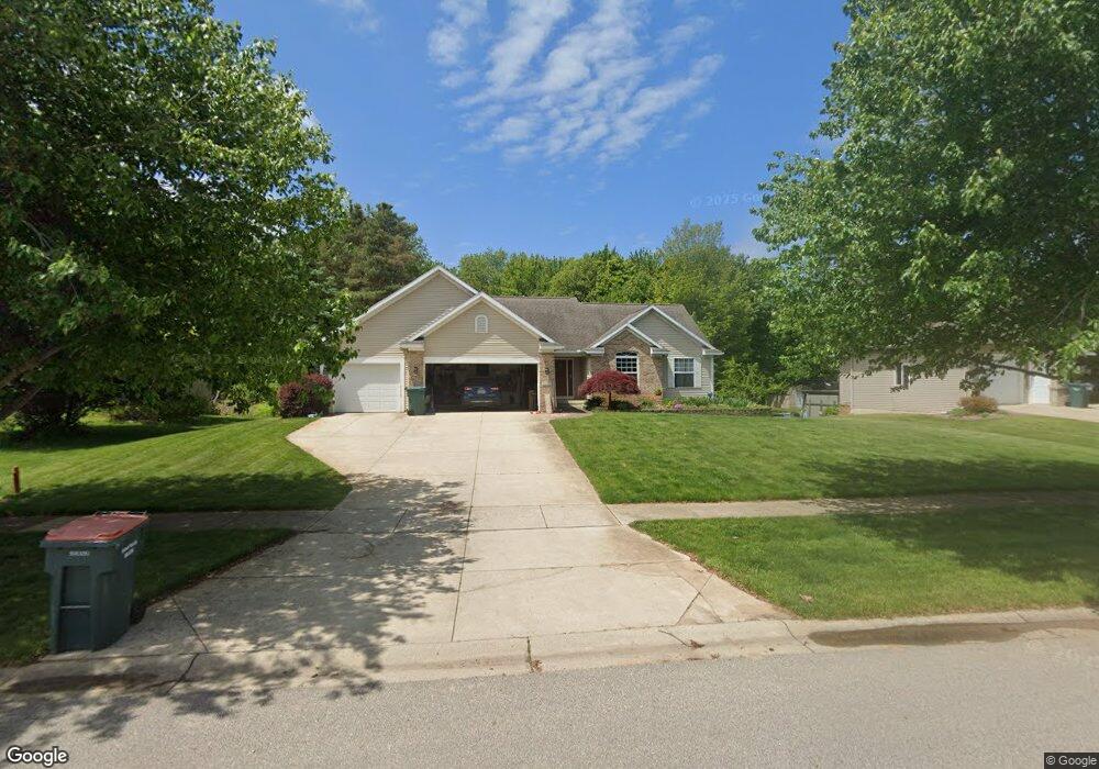
10635 Tallpine Ln Allendale, MI 49401
Estimated Value: $431,000 - $487,239
5
Beds
3
Baths
2,590
Sq Ft
$178/Sq Ft
Est. Value
About This Home
This home is located at 10635 Tallpine Ln, Allendale, MI 49401 and is currently estimated at $461,810, approximately $178 per square foot. 10635 Tallpine Ln is a home located in Ottawa County with nearby schools including Evergreen Elementary School, Allendale Middle School, and Allendale High School.
Ownership History
Date
Name
Owned For
Owner Type
Purchase Details
Closed on
Jul 30, 2009
Sold by
Kowalczk Brian A and Kowalczk Kristin J
Bought by
Francis Ryan K and Francis Valerie A
Current Estimated Value
Home Financials for this Owner
Home Financials are based on the most recent Mortgage that was taken out on this home.
Original Mortgage
$168,640
Outstanding Balance
$111,514
Interest Rate
5.49%
Mortgage Type
New Conventional
Estimated Equity
$350,296
Create a Home Valuation Report for This Property
The Home Valuation Report is an in-depth analysis detailing your home's value as well as a comparison with similar homes in the area
Home Values in the Area
Average Home Value in this Area
Purchase History
| Date | Buyer | Sale Price | Title Company |
|---|---|---|---|
| Francis Ryan K | $210,800 | Chicago Title |
Source: Public Records
Mortgage History
| Date | Status | Borrower | Loan Amount |
|---|---|---|---|
| Open | Francis Ryan K | $168,640 |
Source: Public Records
Tax History Compared to Growth
Tax History
| Year | Tax Paid | Tax Assessment Tax Assessment Total Assessment is a certain percentage of the fair market value that is determined by local assessors to be the total taxable value of land and additions on the property. | Land | Improvement |
|---|---|---|---|---|
| 2025 | $4,762 | $231,500 | $0 | $0 |
| 2024 | $4,059 | $230,600 | $0 | $0 |
| 2023 | $3,874 | $202,600 | $0 | $0 |
| 2022 | $4,270 | $182,500 | $0 | $0 |
| 2021 | $4,150 | $164,000 | $0 | $0 |
| 2020 | $4,102 | $154,800 | $0 | $0 |
| 2019 | $4,025 | $135,600 | $0 | $0 |
| 2018 | $3,780 | $126,900 | $0 | $0 |
| 2017 | $3,683 | $123,200 | $0 | $0 |
| 2016 | $3,537 | $123,900 | $0 | $0 |
| 2015 | -- | $121,500 | $0 | $0 |
| 2014 | -- | $115,200 | $0 | $0 |
Source: Public Records
Map
Nearby Homes
- The Silverton Plan at Pearline Estates
- The Breckenridge Plan at Pearline Estates
- The McKinley Plan at Pearline Estates
- The Emerson Plan at Pearline Estates
- The Whitney Plan at Pearline Estates
- The Harper Plan at Pearline Estates
- The Sierra Plan at Pearline Estates
- The Poppy Plan at Pearline Estates
- The Dickenson Plan at Pearline Estates
- The Yukon Plan at Pearline Estates
- The Austen Plan at Pearline Estates
- The Oakwood Plan at Pearline Estates
- The Walden Plan at Pearline Estates
- 10724 Greyhound Ave
- 10713 Melanie Dr
- 10725 Melanie Dr
- 5779 Huber St
- 5842 Lynn Dr
- 10718 Melanie Dr
- 10786 Melanie Dr
- 10621 Tallpine Ln
- 10649 Tallpine Ln
- 10607 Tallpine Ln
- 10667 Tallpine Ln
- 10624 Tallpine Ln
- 10640 Tallpine Ln
- 10683 Tallpine Ln
- 10656 Tallpine Ln
- 22 Tallpine Ln
- 20 Tallpine Ln
- 27 Tallpine Ln
- 19 Tallpine Ln
- 18 Tallpine Ln
- 21 Tallpine Ln
- 17 Tallpine Ln
- 16 Tallpine Ln
- 15 Tallpine Ln
- 13 Tallpine Ln
- 12 Tallpine Ln
- 14 Tallpine Ln