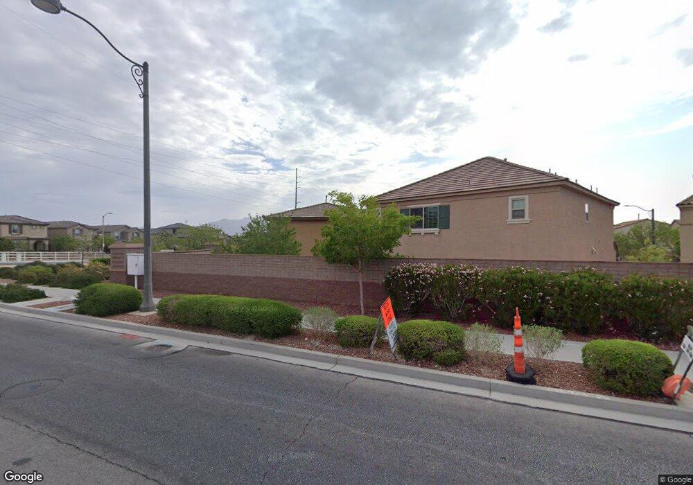
10638 Axis Mountain Ct Las Vegas, NV 89166
La Madre Foothills NeighborhoodEstimated Value: $400,000 - $430,000
3
Beds
3
Baths
1,607
Sq Ft
$259/Sq Ft
Est. Value
About This Home
This home is located at 10638 Axis Mountain Ct, Las Vegas, NV 89166 and is currently estimated at $416,828, approximately $259 per square foot. 10638 Axis Mountain Ct is a home with nearby schools including Henry & Evelyn Bozarth Elementary School, Edmundo "Eddie" Escobedo, Sr. Middle School, and Arbor View High School.
Ownership History
Date
Name
Owned For
Owner Type
Purchase Details
Closed on
Sep 4, 2013
Sold by
Estancia Desert Llc
Bought by
Marentes Fortino and Marentes Isabel
Current Estimated Value
Home Financials for this Owner
Home Financials are based on the most recent Mortgage that was taken out on this home.
Original Mortgage
$15,000
Outstanding Balance
$11,220
Interest Rate
4.46%
Mortgage Type
Unknown
Estimated Equity
$405,608
Purchase Details
Closed on
Sep 22, 2009
Sold by
Estancia West Llc
Bought by
Estancia Desert Llc
Create a Home Valuation Report for This Property
The Home Valuation Report is an in-depth analysis detailing your home's value as well as a comparison with similar homes in the area
Home Values in the Area
Average Home Value in this Area
Purchase History
| Date | Buyer | Sale Price | Title Company |
|---|---|---|---|
| Marentes Fortino | $178,847 | Nevada Title | |
| Estancia Desert Llc | -- | Accommodation | |
| Estancia West Llc | -- | Accommodation |
Source: Public Records
Mortgage History
| Date | Status | Borrower | Loan Amount |
|---|---|---|---|
| Open | Marentes Fortino | $15,000 |
Source: Public Records
Tax History Compared to Growth
Tax History
| Year | Tax Paid | Tax Assessment Tax Assessment Total Assessment is a certain percentage of the fair market value that is determined by local assessors to be the total taxable value of land and additions on the property. | Land | Improvement |
|---|---|---|---|---|
| 2025 | $2,051 | $116,991 | $30,800 | $86,191 |
| 2024 | $1,991 | $116,991 | $30,800 | $86,191 |
| 2023 | $1,991 | $115,367 | $34,300 | $81,067 |
| 2022 | $1,933 | $100,978 | $27,300 | $73,678 |
| 2021 | $1,877 | $95,734 | $25,900 | $69,834 |
| 2020 | $1,820 | $93,445 | $24,500 | $68,945 |
| 2019 | $1,767 | $88,841 | $21,350 | $67,491 |
| 2018 | $1,715 | $76,038 | $18,550 | $57,488 |
| 2017 | $1,625 | $71,155 | $16,100 | $55,055 |
| 2016 | $1,625 | $60,313 | $12,600 | $47,713 |
| 2015 | $1,621 | $50,815 | $10,500 | $40,315 |
| 2014 | $1,573 | $7,000 | $7,000 | $0 |
Source: Public Records
Map
Nearby Homes
- 10612 Capitol Peak Ave
- 10663 Sariah Skye Ave
- 10643 Sariah Skye Ave
- 7919 Bartlett Peak St
- 8036 Foxfield Springs St
- 10537 Thor Mountain Ln
- 8043 Tank Loop St
- 8123 Skye Chalet St
- 7851 Torreys Peak St
- 7815 Shingle Beach St
- 8138 Skye Dragon St
- 7823 Granite City Ct
- 10431 Prairie Mountain Ave
- 8168 Desert Madera St
- 10523 Laurel Mountain Ln
- 7745 Donner Peak St
- 10825 Beach House Ave
- 8099 Rams Collide St
- 8104 Rams Collide St
- 8048 Skye Bridge St
- 10634 Axis Mountain Ct
- 10642 Axis Mountain Ct
- 10630 Axis Mountain Ct
- 10646 Axis Mountain Ct
- 10626 Axis Mountain Ct
- 10633 Axis Mountain Ct
- 10629 Axis Mountain Ct
- 10637 Axis Mountain Ct
- 10641 Axis Mountain Ct
- 10622 Axis Mountain Ct
- 10625 Axis Mountain Ct
- 10621 Axis Mountain Ct
- 10618 Axis Mountain Ct
- 10648 Capitol Peak Ave
- 10656 Capitol Peak Ave
- 10660 Capitol Peak Ave
- 10640 Capitol Peak Ave
- 10617 Axis Mountain Ct
- 10695 Sariah Skye Ave
- 10687 Sariah Skye Ave