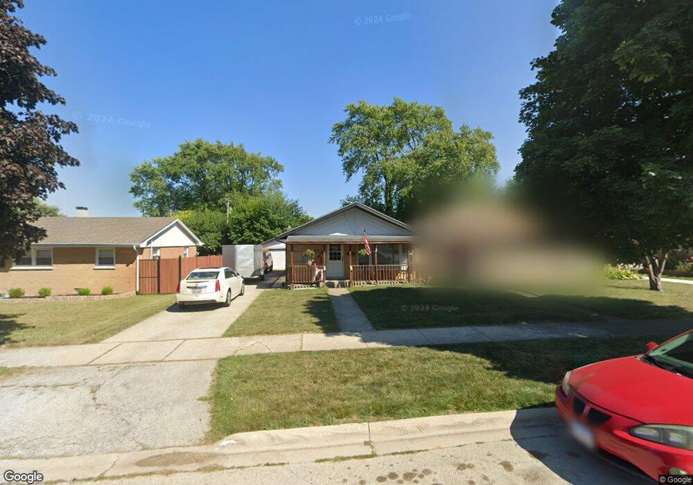
10639 Lombard Ave Chicago Ridge, IL 60415
Estimated Value: $229,000 - $290,946
3
Beds
1
Bath
1,033
Sq Ft
$257/Sq Ft
Est. Value
About This Home
This home is located at 10639 Lombard Ave, Chicago Ridge, IL 60415 and is currently estimated at $264,987, approximately $256 per square foot. 10639 Lombard Ave is a home located in Cook County with nearby schools including Ridge Central Elementary School, Elden D Finley Jr High School, and Harold L. Richards High School.
Ownership History
Date
Name
Owned For
Owner Type
Purchase Details
Closed on
Apr 1, 2021
Sold by
Annunziata Helen and The Robert James Lisante Revoc
Bought by
Brown Thomas
Current Estimated Value
Home Financials for this Owner
Home Financials are based on the most recent Mortgage that was taken out on this home.
Original Mortgage
$148,750
Outstanding Balance
$109,481
Interest Rate
2%
Mortgage Type
New Conventional
Estimated Equity
$155,506
Purchase Details
Closed on
Sep 21, 2018
Sold by
Lisante Robert James
Bought by
Lisante Robert James and The Robert James Lisante Revocable Trust
Create a Home Valuation Report for This Property
The Home Valuation Report is an in-depth analysis detailing your home's value as well as a comparison with similar homes in the area
Home Values in the Area
Average Home Value in this Area
Purchase History
| Date | Buyer | Sale Price | Title Company |
|---|---|---|---|
| Brown Thomas | $175,000 | Stewart Title | |
| Lisante Robert James | -- | None Available |
Source: Public Records
Mortgage History
| Date | Status | Borrower | Loan Amount |
|---|---|---|---|
| Open | Brown Thomas | $148,750 |
Source: Public Records
Tax History Compared to Growth
Tax History
| Year | Tax Paid | Tax Assessment Tax Assessment Total Assessment is a certain percentage of the fair market value that is determined by local assessors to be the total taxable value of land and additions on the property. | Land | Improvement |
|---|---|---|---|---|
| 2024 | $7,460 | $21,188 | $4,020 | $17,168 |
| 2023 | $6,494 | $23,000 | $4,020 | $18,980 |
| 2022 | $6,494 | $16,577 | $3,518 | $13,059 |
| 2021 | $6,214 | $16,575 | $3,517 | $13,058 |
| 2020 | $6,138 | $16,575 | $3,517 | $13,058 |
| 2019 | $4,118 | $16,719 | $3,182 | $13,537 |
| 2018 | $1,364 | $16,719 | $3,182 | $13,537 |
| 2017 | $1,343 | $16,719 | $3,182 | $13,537 |
| 2016 | $5,653 | $14,170 | $2,680 | $11,490 |
| 2015 | $5,545 | $14,170 | $2,680 | $11,490 |
| 2014 | $3,743 | $14,170 | $2,680 | $11,490 |
| 2013 | $2,186 | $16,831 | $2,680 | $14,151 |
Source: Public Records
Map
Nearby Homes
- 10706 Oak Ave
- 10529 Lyman Ave
- 10825 Oxford Ave
- 10854 Lyman Ave
- 10755 Mason Ave
- 10429 Austin Ave Unit A
- 10912 Princess Ave
- 6131 Marshall Ave Unit 1W
- 10925 Lyman Ave
- 10501 Forest Ln
- 10840 S Ridgeland Ave
- 6345 Birmingham St Unit 3C
- 5924 W 109th St
- 10301 Mcvicker Ave
- 10306 Kerry Ridge Ct
- 5810 107th Court Way
- 6027 103rd St Unit 1
- 10330 Mayfield Ave Unit 2N
- 10701 S Nashville Ave
- 10306 Ridgeland Ave Unit 104
- 10635 Lombard Ave
- 10641 Lombard Ave
- 10633 Lombard Ave
- 10645 Lombard Ave
- 10638 Moody Ave
- 10636 Moody Ave
- 10640 Moody Ave
- 10631 Lombard Ave
- 10649 Lombard Ave
- 10628 Moody Ave
- 10646 Moody Ave
- 10640 Lombard Ave
- 10624 Moody Ave
- 10629 Lombard Ave
- 10652 Moody Ave
- 10644 Lombard Ave
- 10636 Lombard Ave
- 10655 Lombard Ave
- 10634 Lombard Ave
- 10648 Lombard Ave