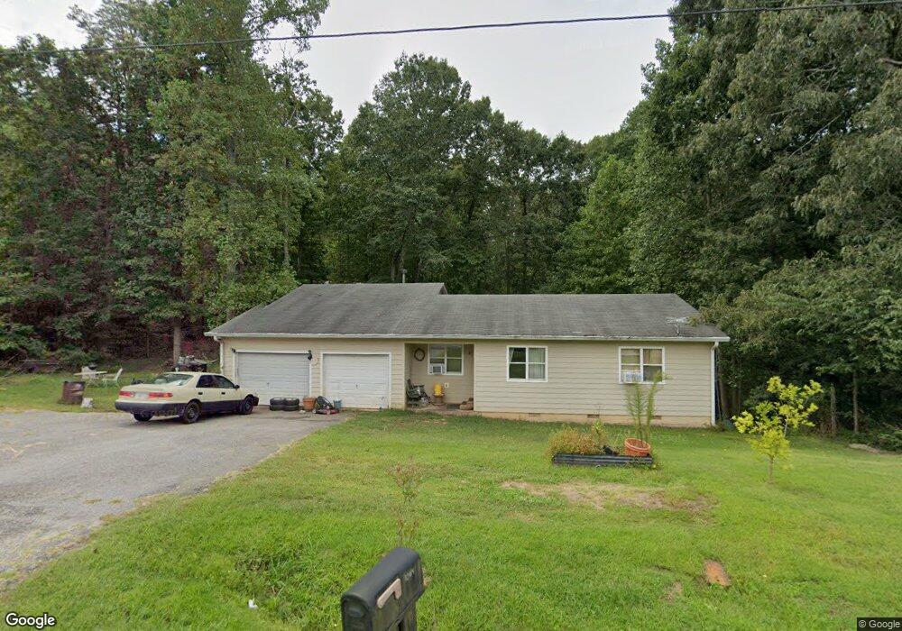
1064 Burnt Stand Rd Dawsonville, GA 30534
Estimated Value: $297,000 - $338,000
4
Beds
2
Baths
1,575
Sq Ft
$203/Sq Ft
Est. Value
About This Home
This home is located at 1064 Burnt Stand Rd, Dawsonville, GA 30534 and is currently estimated at $319,130, approximately $202 per square foot. 1064 Burnt Stand Rd is a home located in Lumpkin County with nearby schools including Lumpkin County High School.
Ownership History
Date
Name
Owned For
Owner Type
Purchase Details
Closed on
Sep 2, 2014
Sold by
Knight Rita Marie
Bought by
Christopher Bryan and Christopher Wendy
Current Estimated Value
Purchase Details
Closed on
Oct 14, 2010
Sold by
Citimortgage Inc
Bought by
Knight Rita Marie
Purchase Details
Closed on
Aug 3, 2010
Sold by
Williford Robert
Bought by
Citimortgage Inc
Purchase Details
Closed on
May 4, 2001
Sold by
Ensley Rodney D
Bought by
Williford Robert and Williford Jenaya
Purchase Details
Closed on
Jul 2, 1998
Sold by
Whitehead Harry C
Bought by
Ensley Rodney D
Purchase Details
Closed on
Jul 29, 1991
Bought by
Whitehead Harry C
Create a Home Valuation Report for This Property
The Home Valuation Report is an in-depth analysis detailing your home's value as well as a comparison with similar homes in the area
Home Values in the Area
Average Home Value in this Area
Purchase History
| Date | Buyer | Sale Price | Title Company |
|---|---|---|---|
| Christopher Bryan | -- | -- | |
| Knight Rita Marie | $107,900 | -- | |
| Citimortgage Inc | $105,040 | -- | |
| Williford Robert | $87,300 | -- | |
| Ensley Rodney D | $55,000 | -- | |
| Whitehead Harry C | -- | -- |
Source: Public Records
Tax History Compared to Growth
Tax History
| Year | Tax Paid | Tax Assessment Tax Assessment Total Assessment is a certain percentage of the fair market value that is determined by local assessors to be the total taxable value of land and additions on the property. | Land | Improvement |
|---|---|---|---|---|
| 2024 | $1,774 | $77,435 | $12,076 | $65,359 |
| 2023 | $1,256 | $72,956 | $11,286 | $61,670 |
| 2022 | $1,563 | $65,116 | $9,406 | $55,710 |
| 2021 | $1,426 | $57,694 | $9,406 | $48,288 |
| 2020 | $1,432 | $56,288 | $9,012 | $47,276 |
| 2019 | $1,498 | $56,288 | $9,012 | $47,276 |
| 2018 | $1,464 | $51,608 | $9,012 | $42,596 |
| 2017 | $1,469 | $50,776 | $9,012 | $41,764 |
| 2016 | $1,386 | $46,349 | $9,012 | $37,337 |
| 2015 | $1,234 | $46,349 | $9,012 | $37,337 |
| 2014 | $1,234 | $46,816 | $9,012 | $37,804 |
| 2013 | -- | $47,278 | $9,012 | $38,266 |
Source: Public Records
Map
Nearby Homes
- 99 Glen Oaks Dr
- 7-/+ Charlie Lemley Rd
- 0 Charlie Lemley Rd Unit 23726251
- 0 Charlie Lemley Rd Unit 10534500
- 0 Charlie Lemley Rd Unit 7589685
- 192 Wild Deer Trace
- 70 Deerwood Cir
- 291 Kerns Ridge Ct
- TRACT1 Panorama Dr
- 499 Pine Trail
- 1 Grey Swan Way
- 323 Grey Swan Way
- 109 Odgers Trail
- 335 Grey Swan Way
- 54 Odgers Trail
- 307 Eagle Overlook Dr
- 29 Chestatee Springs Ln
- 5195 S Chestatee
- 131 Chestatee Springs Ridge
- 105 Sandhill Dr
- 1034 Burnt Stand Rd
- 00 Robert Jones Rd
- 0 Robert Jones Rd Unit 7306960
- 0 Robert Jones Rd Unit 3065147
- 0 Robert Jones Rd Unit 4223913
- 0 Robert Jones Rd Unit 4282381
- 20 Pearl Hill
- 23 Robert Jones Rd
- 998 Burnt Stand Rd
- 1051 Burnt Stand Rd
- 28 Robert Jones Rd
- 108 Pearl Hill
- 89 Robert Jones Rd
- 1152 Burnt Stand Rd
- 148 Robert Jones Rd
- 944 Burnt Stand Rd
- 15 Tom Ben Josh Rd
- 63 Robert Jones Rd
- 943 Lumpkin County Pkwy
- 1236 Burnt Stand Rd