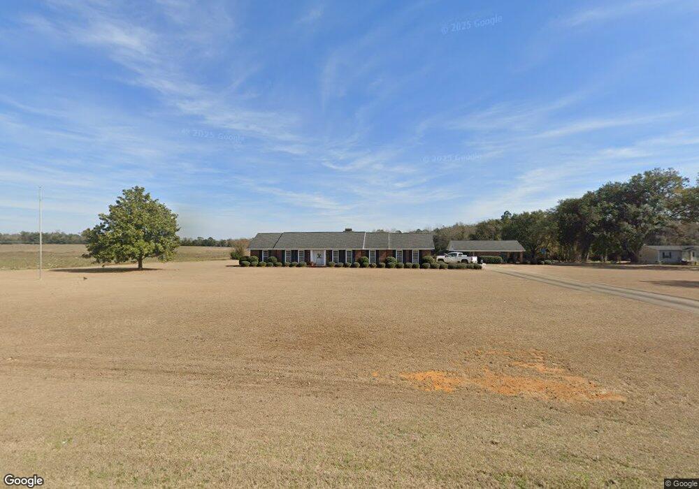
1064 Ga Highway 45 N Colquitt, GA 39837
Estimated Value: $214,000 - $228,000
3
Beds
3
Baths
2,078
Sq Ft
$107/Sq Ft
Est. Value
About This Home
This home is located at 1064 Ga Highway 45 N, Colquitt, GA 39837 and is currently estimated at $221,485, approximately $106 per square foot. 1064 Ga Highway 45 N is a home located in Miller County with nearby schools including Miller County Elementary School, Miller County Middle School, and Miller County High School.
Ownership History
Date
Name
Owned For
Owner Type
Purchase Details
Closed on
Jan 6, 2023
Sold by
Mock Brandon Jarrott
Bought by
Mock Brandon Jarrott and Mock Mandi
Current Estimated Value
Purchase Details
Closed on
Jul 28, 2021
Sold by
Rouse Wauneithe M
Bought by
Mock Brandon Jarrott
Purchase Details
Closed on
Aug 5, 2015
Sold by
Rouse Wauneithe M
Bought by
Rouse Wauneithe M and Wright Pamela Rouse
Purchase Details
Closed on
Sep 7, 2005
Sold by
Mitchell Hilda Craft Estate
Bought by
Rouse Wauneithe M
Purchase Details
Closed on
Mar 27, 1980
Sold by
Mitchell W D
Bought by
Mitchell Hilda Craft
Create a Home Valuation Report for This Property
The Home Valuation Report is an in-depth analysis detailing your home's value as well as a comparison with similar homes in the area
Home Values in the Area
Average Home Value in this Area
Purchase History
| Date | Buyer | Sale Price | Title Company |
|---|---|---|---|
| Mock Brandon Jarrott | -- | -- | |
| Mock Brandon Jarrott | $163,000 | -- | |
| Rouse Wauneithe M | -- | -- | |
| Rouse Wauneithe M | -- | -- | |
| Mitchell Hilda Craft | -- | -- |
Source: Public Records
Tax History Compared to Growth
Tax History
| Year | Tax Paid | Tax Assessment Tax Assessment Total Assessment is a certain percentage of the fair market value that is determined by local assessors to be the total taxable value of land and additions on the property. | Land | Improvement |
|---|---|---|---|---|
| 2024 | $2,947 | $87,685 | $2,083 | $85,602 |
| 2023 | $2,279 | $64,001 | $2,083 | $61,918 |
| 2022 | $1,879 | $49,119 | $2,083 | $47,036 |
| 2021 | $1,859 | $49,119 | $2,082 | $47,037 |
| 2020 | $1,859 | $49,119 | $2,083 | $47,036 |
| 2019 | $1,865 | $49,119 | $2,083 | $47,036 |
| 2018 | $1,811 | $49,119 | $2,083 | $47,036 |
| 2017 | $1,754 | $47,557 | $2,083 | $45,474 |
| 2016 | $1,754 | $47,557 | $2,083 | $45,474 |
| 2015 | -- | $49,758 | $4,800 | $44,958 |
| 2014 | -- | $49,758 | $4,800 | $44,958 |
| 2013 | -- | $49,758 | $4,800 | $44,958 |
Source: Public Records
Map
Nearby Homes
- 745 Harmony Church Rd
- 113 Crooked Oak Ln
- 000 Phillipsburg Rd
- 1545 Phillipsburg Rd
- 300 N First St
- 210 N First St
- 570 E Pine St
- 157 E Pine St
- 74 Harmony Church Rd
- 356 E Main St
- 1563 Ga Highway 27 N
- 2835 Georgia 91
- US 27 Us Highway 27
- 102 Bremond St
- 000 Bellview Rd
- 430 Cox Rd
- 000 Thompson Town Rd
- 708 E Crawford St
- 721 E Crawford St
- 7855 Joe Bryan St
- 1064 N 45 Hwy
- 1064 45
- 1045 Ga Highway 45 N
- 1075 Ga Highway 45 N
- 1048 Ga Highway 45 N
- 1037 Ga Highway 45 N
- 1032 Ga Highway 45 N
- 1027 Ga Highway 45 N
- 1013 Ga Highway 45 N
- 52 Clay Brown Rd
- 165 Old Damascus Rd
- 115 Rail Rd
- 75 Old Damascus Rd
- 21 Kyles Dr
- 119 Rail Rd
- 17 Kyles Dr
- 115 Booker Rd
- 9 Kyles Dr
- 18 Kyles Dr
- 3 Kyles Dr