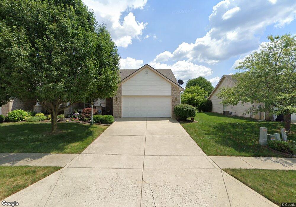
1064 Hilltop Commons Blvd Whiteland, IN 46184
Estimated Value: $248,000 - $258,000
2
Beds
2
Baths
1,350
Sq Ft
$187/Sq Ft
Est. Value
About This Home
This home is located at 1064 Hilltop Commons Blvd, Whiteland, IN 46184 and is currently estimated at $253,006, approximately $187 per square foot. 1064 Hilltop Commons Blvd is a home located in Johnson County with nearby schools including Break-O-Day Elementary School, Clark-Pleasant Middle School, and Whiteland Community High School.
Ownership History
Date
Name
Owned For
Owner Type
Purchase Details
Closed on
Feb 5, 2025
Sold by
Stipp John E and Stipp Caroline J
Bought by
Stipp Caroline J
Current Estimated Value
Purchase Details
Closed on
Aug 8, 2006
Sold by
David Brizendine Inc
Bought by
Stipp John E and Stipp Caroline J
Purchase Details
Closed on
Mar 1, 2005
Sold by
Thomas & Thomas Developers Inc
Bought by
David Brizendine Inc
Home Financials for this Owner
Home Financials are based on the most recent Mortgage that was taken out on this home.
Original Mortgage
$15,000
Interest Rate
5.67%
Create a Home Valuation Report for This Property
The Home Valuation Report is an in-depth analysis detailing your home's value as well as a comparison with similar homes in the area
Home Values in the Area
Average Home Value in this Area
Purchase History
| Date | Buyer | Sale Price | Title Company |
|---|---|---|---|
| Stipp Caroline J | -- | None Listed On Document | |
| Stipp John E | -- | None Available | |
| David Brizendine Inc | -- | None Available |
Source: Public Records
Mortgage History
| Date | Status | Borrower | Loan Amount |
|---|---|---|---|
| Previous Owner | David Brizendine Inc | $15,000 |
Source: Public Records
Tax History Compared to Growth
Tax History
| Year | Tax Paid | Tax Assessment Tax Assessment Total Assessment is a certain percentage of the fair market value that is determined by local assessors to be the total taxable value of land and additions on the property. | Land | Improvement |
|---|---|---|---|---|
| 2025 | $1,457 | $254,700 | $45,000 | $209,700 |
| 2024 | $1,457 | $203,500 | $45,000 | $158,500 |
| 2023 | $1,428 | $199,200 | $45,000 | $154,200 |
| 2022 | $1,400 | $175,200 | $34,100 | $141,100 |
| 2021 | $1,373 | $154,600 | $31,000 | $123,600 |
| 2020 | $1,346 | $142,500 | $21,000 | $121,500 |
| 2019 | $1,319 | $143,900 | $21,000 | $122,900 |
| 2018 | $1,293 | $140,400 | $22,000 | $118,400 |
| 2017 | $1,278 | $126,800 | $22,000 | $104,800 |
| 2016 | $1,264 | $126,800 | $22,000 | $104,800 |
| 2014 | $1,239 | $123,900 | $19,100 | $104,800 |
| 2013 | $1,239 | $123,900 | $19,100 | $104,800 |
Source: Public Records
Map
Nearby Homes
- 106 Tracy Ridge Blvd
- 1119 Chateaugay Ct
- 190 Tracy Ridge Blvd
- 821 Princeton Dr
- 256 Bittersweet Dr
- 12 Rypma Row
- 250 Southlane Dr
- 731 W 600 N
- 53 Oakden Ct
- 57 Oakden Ct
- 840 Sweetbriar Ave
- 6540 N Us Highway 31
- 0 E 700 N Unit MBR22036500
- 647 Bluestem Cir
- 239 Shelton Place
- 230 Parkview Dr
- 539 Delbrook Dr
- Liberty Plan at Crossroads at Southport
- 7331 Deerberg Dr
- Jefferson Plan at Crossroads at Southport
- 1068 Hilltop Commons Blvd
- 1060 Hilltop Commons Blvd
- 1072 Hilltop Commons Blvd
- 55 Hilltop Commons Blvd
- 181 Hilltop Commons Blvd
- 54 Hilltop Commons Blvd
- 1052 Hilltop Commons Blvd
- 156 Arabian Ct
- 164 Arabian Ct
- 148 Arabian Ct
- 1076 Hilltop Commons Blvd
- 1067 Hilltop Commons Blvd
- 1063 Hilltop Commons Blvd
- 1059 Hilltop Commons Blvd
- 140 Arabian Ct
- 1055 Hilltop Commons Blvd
- 1080 Hilltop Commons Blvd
- 1051 Hilltop Commons Blvd
- 1075 Hilltop Commons Blvd
- 1032 Hilltop Commons Blvd