Estimated Value: $278,110 - $706,000
--
Bed
--
Bath
--
Sq Ft
6,490
Sq Ft Lot
About This Home
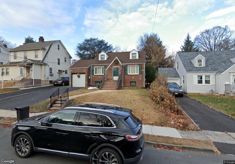
This home is located at 1064 Sterling Rd, Union, NJ 07083 and is currently estimated at $529,278. 1064 Sterling Rd is a home located in Union County with nearby schools including Livingston Elementary School and Union High School.
Ownership History
Date
Name
Owned For
Owner Type
Purchase Details
Closed on
Jul 15, 1999
Sold by
Mcqueen Steven and Mcqueen Gladys
Bought by
Phelan Thomas and Phelan Cynthia
Current Estimated Value
Home Financials for this Owner
Home Financials are based on the most recent Mortgage that was taken out on this home.
Original Mortgage
$122,100
Outstanding Balance
$34,012
Interest Rate
7.49%
Mortgage Type
Stand Alone First
Estimated Equity
$495,266
Purchase Details
Closed on
Jun 22, 1995
Sold by
Knapp Robert J and Knapp Karin
Bought by
Mcqueen Steven and Mcqueen Gladys
Create a Home Valuation Report for This Property
The Home Valuation Report is an in-depth analysis detailing your home's value as well as a comparison with similar homes in the area
Home Values in the Area
Average Home Value in this Area
Purchase History
| Date | Buyer | Sale Price | Title Company |
|---|---|---|---|
| Phelan Thomas | $170,100 | Fidelity National Title Ins | |
| Mcqueen Steven | $159,000 | -- |
Source: Public Records
Mortgage History
| Date | Status | Borrower | Loan Amount |
|---|---|---|---|
| Open | Phelan Thomas | $122,100 |
Source: Public Records
Tax History Compared to Growth
Tax History
| Year | Tax Paid | Tax Assessment Tax Assessment Total Assessment is a certain percentage of the fair market value that is determined by local assessors to be the total taxable value of land and additions on the property. | Land | Improvement |
|---|---|---|---|---|
| 2025 | $9,656 | $43,200 | $21,000 | $22,200 |
| 2024 | $9,361 | $43,200 | $21,000 | $22,200 |
| 2023 | $9,361 | $43,200 | $21,000 | $22,200 |
| 2022 | $9,036 | $43,200 | $21,000 | $22,200 |
| 2021 | $8,817 | $43,200 | $21,000 | $22,200 |
| 2020 | $8,581 | $42,900 | $21,000 | $21,900 |
| 2019 | $8,465 | $42,900 | $21,000 | $21,900 |
| 2018 | $8,321 | $42,900 | $21,000 | $21,900 |
| 2017 | $8,198 | $42,900 | $21,000 | $21,900 |
| 2016 | $7,998 | $42,900 | $21,000 | $21,900 |
| 2015 | $7,866 | $42,900 | $21,000 | $21,900 |
| 2014 | $7,689 | $42,900 | $21,000 | $21,900 |
Source: Public Records
Map
Nearby Homes
- 1322 Marcella Dr
- 1393 Cornell Place
- 969 Arnet Ave
- 1370 Beverly Rd
- 600 Plymouth Rd
- 314 Fitzpatrick St
- 292 Crann St
- 507 Locust Ave
- 410 Rutgers Ave
- 875 Salem Rd
- 1040 Cranbrook Rd
- 750 Midland Blvd
- 553 Harvard Ave
- 1267 Erhardt St
- 557 Yale Ave
- 365 Broadwell Ave
- 1048 Chester St
- 393 Harvard Ave
- 286 Mclean Place
- 257 Herbert Ave
- 1068 Sterling Rd
- 1060 Sterling Rd
- 1056 Sterling Rd
- 1072 Sterling Rd
- 1063 Lorraine Ave
- 1061 Lorraine Ave
- 1065 Lorraine Ave
- 1054 Sterling Rd
- 1078 Sterling Rd
- 1057 Lorraine Ave
- 1071 Lorraine Ave
- 1071 Sterling Rd
- 1065 Sterling Rd
- 1075 Sterling Rd
- 1061 Sterling Rd
- 1055 Lorraine Ave
- 1075 Lorraine Ave
- 1050 Sterling Rd
- 1080 Sterling Rd
- 1057 Sterling Rd