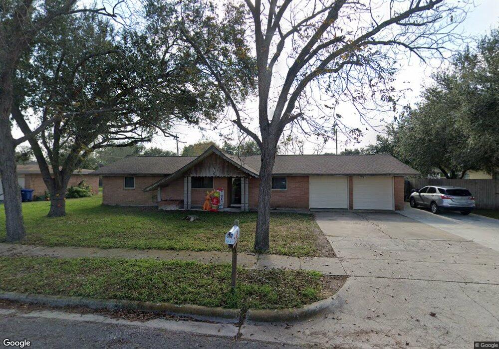
10641 Emmord Loop Corpus Christi, TX 78410
Northwest Corpus Christi NeighborhoodEstimated Value: $190,246 - $239,000
3
Beds
2
Baths
1,498
Sq Ft
$141/Sq Ft
Est. Value
About This Home
This home is located at 10641 Emmord Loop, Corpus Christi, TX 78410 and is currently estimated at $210,812, approximately $140 per square foot. 10641 Emmord Loop is a home located in Nueces County with nearby schools including Tuloso-Midway Primary School, Tuloso-Midway Intermediate School, and Tuloso-Midway Middle.
Ownership History
Date
Name
Owned For
Owner Type
Purchase Details
Closed on
Apr 5, 2010
Sold by
Dunham Walter and Dunham Letha M
Bought by
Garcia Jeremy M and Freeman Cecil A
Current Estimated Value
Home Financials for this Owner
Home Financials are based on the most recent Mortgage that was taken out on this home.
Original Mortgage
$122,637
Outstanding Balance
$83,677
Interest Rate
5.5%
Mortgage Type
FHA
Estimated Equity
$127,135
Create a Home Valuation Report for This Property
The Home Valuation Report is an in-depth analysis detailing your home's value as well as a comparison with similar homes in the area
Home Values in the Area
Average Home Value in this Area
Purchase History
| Date | Buyer | Sale Price | Title Company |
|---|---|---|---|
| Garcia Jeremy M | -- | Stewart Title Of Corpus Chri |
Source: Public Records
Mortgage History
| Date | Status | Borrower | Loan Amount |
|---|---|---|---|
| Open | Garcia Jeremy M | $122,637 |
Source: Public Records
Tax History Compared to Growth
Tax History
| Year | Tax Paid | Tax Assessment Tax Assessment Total Assessment is a certain percentage of the fair market value that is determined by local assessors to be the total taxable value of land and additions on the property. | Land | Improvement |
|---|---|---|---|---|
| 2025 | $1,882 | $167,801 | -- | -- |
| 2024 | $3,455 | $152,546 | $0 | $0 |
| 2023 | $1,639 | $138,678 | $0 | $0 |
| 2022 | $1,795 | $70,853 | $17,875 | $52,978 |
| 2021 | $1,835 | $69,668 | $17,875 | $51,793 |
| 2020 | $3,752 | $140,795 | $35,750 | $105,045 |
| 2019 | $3,999 | $142,254 | $35,750 | $106,504 |
| 2018 | $3,931 | $142,076 | $35,750 | $106,326 |
| 2017 | $4,012 | $143,493 | $35,750 | $107,743 |
| 2016 | $3,844 | $137,492 | $35,750 | $101,742 |
| 2015 | $3,259 | $123,864 | $21,875 | $101,989 |
| 2014 | $3,259 | $116,362 | $21,875 | $94,487 |
Source: Public Records
Map
Nearby Homes
- 10639 Emmord Loop
- 10614 Emmord Loop
- 2838 Bridle Ln
- 10610 Hurst Dr
- 10518 Heizer Dr
- 2838 Sage Brush Dr
- 10725 Westview Dr
- 2742 Blue Grass Dr
- 2721 Tumbleweed Dr
- 3014 Stone Creek Dr
- Upton Plan at Woodside
- Lakeway Plan at Woodside
- 10313 Stone Creek Dr
- 3101 Creek Side Dr
- 2729 Gold Rush Ln
- 10506 Hemlock Rd
- 4249 Starlite Ln
- 4241 Starlite Ln
- 10802 Timbergrove Ln
- 3229 Creek Side Dr
- 10648 Emmord Loop
- 10652 Emmord Loop
- 10618 Outpost Dr
- 10637 Emmord Loop
- 10630 Outpost Dr
- 10622 Outpost Dr
- 10626 Outpost Dr
- 10658 Emmord Loop
- 10649 Emmord Loop
- 10614 Outpost Dr
- 10632 Emmord Loop
- 10634 Outpost Dr
- 10655 Emmord Loop
- 10623 Emmord Loop
- 10630 Emmord Loop
- 10650 Emmord Loop
- 10638 Outpost Dr
- 2854 Blue Grass Dr