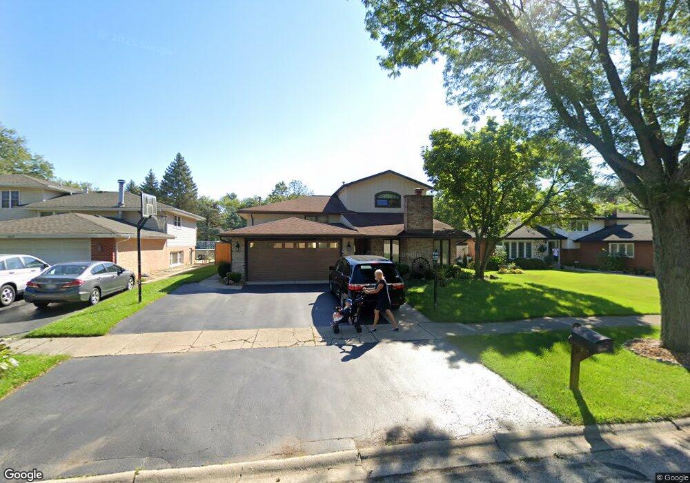
10643 S Michael Dr Palos Hills, IL 60465
Estimated Value: $379,000 - $471,000
5
Beds
3
Baths
2,164
Sq Ft
$198/Sq Ft
Est. Value
About This Home
This home is located at 10643 S Michael Dr, Palos Hills, IL 60465 and is currently estimated at $428,528, approximately $198 per square foot. 10643 S Michael Dr is a home located in Cook County with nearby schools including Sorrick Elementary School, Oak Ridge Elementary School, and H H Conrady Jr High School.
Ownership History
Date
Name
Owned For
Owner Type
Purchase Details
Closed on
Jul 20, 2007
Sold by
Bell Anthony and Bell Danielle M
Bought by
Bell Anthony and Bell Danielle M
Current Estimated Value
Purchase Details
Closed on
Dec 8, 1995
Sold by
Cantele James A
Bought by
Bell Anthony and Bell Danielle M
Home Financials for this Owner
Home Financials are based on the most recent Mortgage that was taken out on this home.
Original Mortgage
$130,000
Outstanding Balance
$2,670
Interest Rate
7.41%
Estimated Equity
$425,858
Purchase Details
Closed on
Aug 30, 1993
Sold by
Heidenreich William and Heidenreich Roberta
Bought by
Cantele James A
Home Financials for this Owner
Home Financials are based on the most recent Mortgage that was taken out on this home.
Original Mortgage
$103,000
Interest Rate
7.26%
Create a Home Valuation Report for This Property
The Home Valuation Report is an in-depth analysis detailing your home's value as well as a comparison with similar homes in the area
Home Values in the Area
Average Home Value in this Area
Purchase History
| Date | Buyer | Sale Price | Title Company |
|---|---|---|---|
| Bell Anthony | -- | None Available | |
| Bell Anthony | $188,000 | Attorneys Natl Title Network | |
| Cantele James A | -- | -- |
Source: Public Records
Mortgage History
| Date | Status | Borrower | Loan Amount |
|---|---|---|---|
| Open | Bell Anthony | $130,000 | |
| Previous Owner | Cantele James A | $103,000 |
Source: Public Records
Tax History Compared to Growth
Tax History
| Year | Tax Paid | Tax Assessment Tax Assessment Total Assessment is a certain percentage of the fair market value that is determined by local assessors to be the total taxable value of land and additions on the property. | Land | Improvement |
|---|---|---|---|---|
| 2024 | $8,885 | $34,064 | $6,599 | $27,465 |
| 2023 | $8,816 | $34,064 | $6,599 | $27,465 |
| 2022 | $8,816 | $27,581 | $5,748 | $21,833 |
| 2021 | $8,575 | $27,580 | $5,747 | $21,833 |
| 2020 | $8,473 | $27,580 | $5,747 | $21,833 |
| 2019 | $8,312 | $27,538 | $5,321 | $22,217 |
| 2018 | $7,999 | $27,538 | $5,321 | $22,217 |
| 2017 | $7,734 | $27,538 | $5,321 | $22,217 |
| 2016 | $6,713 | $21,930 | $4,683 | $17,247 |
| 2015 | $6,576 | $21,930 | $4,683 | $17,247 |
| 2014 | $7,144 | $23,926 | $4,683 | $19,243 |
| 2013 | $6,485 | $23,320 | $4,683 | $18,637 |
Source: Public Records
Map
Nearby Homes
- 10440 S 75th Ct
- 10531 S Roberts Rd Unit 2D
- 10409 Sheffield Dr Unit 13
- 10300 S Kathy Ct
- 10820 Kathleen Ct Unit D
- 7357 W 109th St
- 10233 Concord Ln Unit C
- 7810 W 102nd St
- 10225 Camden Ln Unit K
- 10926 Circle Ct
- 7801 W 111th St
- 10927 Circle Dr
- 10324 S 81st Ave
- 8057 Valley Dr
- 7420 W 111th St Unit 501
- 11050 S Roberts Rd
- 7434 W 111th St Unit 812
- 7402 W 111th St Unit 111
- 7213 W 109th St
- 7248 W 110th St
- 10637 S Michael Dr
- 10649 S Michael Dr
- 10631 S Michael Dr
- 10642 S Terry Dr
- 10636 S Terry Dr
- 10648 S Terry Dr
- 10655 S Michael Dr
- 7726 W 107th St
- 10630 S Terry Dr
- 10625 S Michael Dr
- 10642 S Michael Dr
- 10656 S Terry Dr
- 10636 S Michael Dr
- 10656 S Michael Dr
- 10624 S Terry Dr
- 10630 S Michael Dr
- 10619 S Michael Dr
- 7800 W 107th St
- 10618 S Terry Dr
- 10624 S Michael Dr