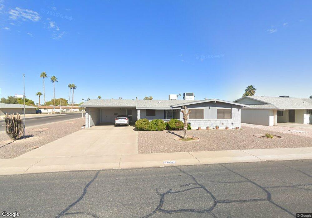
10644 W Kelso Dr Sun City, AZ 85351
Estimated Value: $237,747 - $310,000
3
Beds
2
Baths
1,448
Sq Ft
$198/Sq Ft
Est. Value
About This Home
This home is located at 10644 W Kelso Dr, Sun City, AZ 85351 and is currently estimated at $286,937, approximately $198 per square foot. 10644 W Kelso Dr is a home located in Maricopa County with nearby schools including Ombudsman - Northwest Charter and Peoria Accelerated High School.
Ownership History
Date
Name
Owned For
Owner Type
Purchase Details
Closed on
Nov 14, 2012
Sold by
Neary Betty J
Bought by
Neary Michele R
Current Estimated Value
Purchase Details
Closed on
Aug 3, 1998
Sold by
Neary Thomas F and Hilliard Shirley J
Bought by
Neary Betty J and Neary Michele R
Home Financials for this Owner
Home Financials are based on the most recent Mortgage that was taken out on this home.
Original Mortgage
$92,000
Outstanding Balance
$19,243
Interest Rate
6.95%
Mortgage Type
New Conventional
Estimated Equity
$267,694
Purchase Details
Closed on
Mar 8, 1996
Sold by
Tall George L and Tall Edith M
Bought by
Neary Thomas F and Hilliard Shirley J
Home Financials for this Owner
Home Financials are based on the most recent Mortgage that was taken out on this home.
Original Mortgage
$52,000
Interest Rate
7.82%
Mortgage Type
New Conventional
Create a Home Valuation Report for This Property
The Home Valuation Report is an in-depth analysis detailing your home's value as well as a comparison with similar homes in the area
Home Values in the Area
Average Home Value in this Area
Purchase History
| Date | Buyer | Sale Price | Title Company |
|---|---|---|---|
| Neary Michele R | -- | None Available | |
| Neary Betty J | $119,000 | First American Title | |
| Neary Thomas F | $92,000 | North American Title Agency |
Source: Public Records
Mortgage History
| Date | Status | Borrower | Loan Amount |
|---|---|---|---|
| Open | Neary Betty J | $92,000 | |
| Previous Owner | Neary Thomas F | $52,000 | |
| Closed | Neary Betty J | $11,500 |
Source: Public Records
Tax History Compared to Growth
Tax History
| Year | Tax Paid | Tax Assessment Tax Assessment Total Assessment is a certain percentage of the fair market value that is determined by local assessors to be the total taxable value of land and additions on the property. | Land | Improvement |
|---|---|---|---|---|
| 2025 | $918 | $11,340 | -- | -- |
| 2024 | $825 | $10,800 | -- | -- |
| 2023 | $825 | $20,620 | $4,120 | $16,500 |
| 2022 | $777 | $16,170 | $3,230 | $12,940 |
| 2021 | $802 | $15,060 | $3,010 | $12,050 |
| 2020 | $781 | $12,970 | $2,590 | $10,380 |
| 2019 | $766 | $12,020 | $2,400 | $9,620 |
| 2018 | $738 | $10,810 | $2,160 | $8,650 |
| 2017 | $713 | $9,560 | $1,910 | $7,650 |
| 2016 | $665 | $9,000 | $1,800 | $7,200 |
| 2015 | $635 | $8,030 | $1,600 | $6,430 |
Source: Public Records
Map
Nearby Homes
- 10707 W Mission Ln
- 9202 N 107th Ave Unit 8
- 10726 W Kelso Dr Unit 172
- 10731 W Mission Ln Unit 200
- 10726 W Denham Dr Unit 16
- 10732 W Denham Dr Unit 17
- 10825 W Caron Dr
- 10816 W Venturi Dr
- 10801 W Mountain View Rd
- 8800 N 107th Ave Unit 17
- 8800 N 107th Ave Unit 19
- 8800 N 107th Ave Unit 52
- 8803 N 105th Dr
- 10788 W Cinnebar Ave
- 9802 N 107th Ave
- 11005 W Kelso Dr
- 9415 N 111th Ave
- 10326 W Caron Dr
- 9459 N 111th Ave
- 10754 W Cinnebar Ave Unit 48
- 10638 W Kelso Dr
- 10651 W Mission Ln
- 10647 W Mission Ln
- 10634 W Kelso Dr
- 10639 W Kelso Dr
- 10701 W Mission Ln
- 10706 W Kelso Dr Unit 9
- 10643 W Mission Ln
- 10701 W Kelso Dr
- 10635 W Kelso Dr
- 10628 W Kelso Dr
- 9201 N 107th Ave
- 10633 W Kelso Dr Unit 7
- 10705 W Kelso Dr
- 10648 W Caron Dr
- 10640 W Caron Dr
- 10712 W Kelso Dr Unit 9
- 10631 W Mission Ln
- 10622 W Kelso Dr
- 10636 W Caron Dr