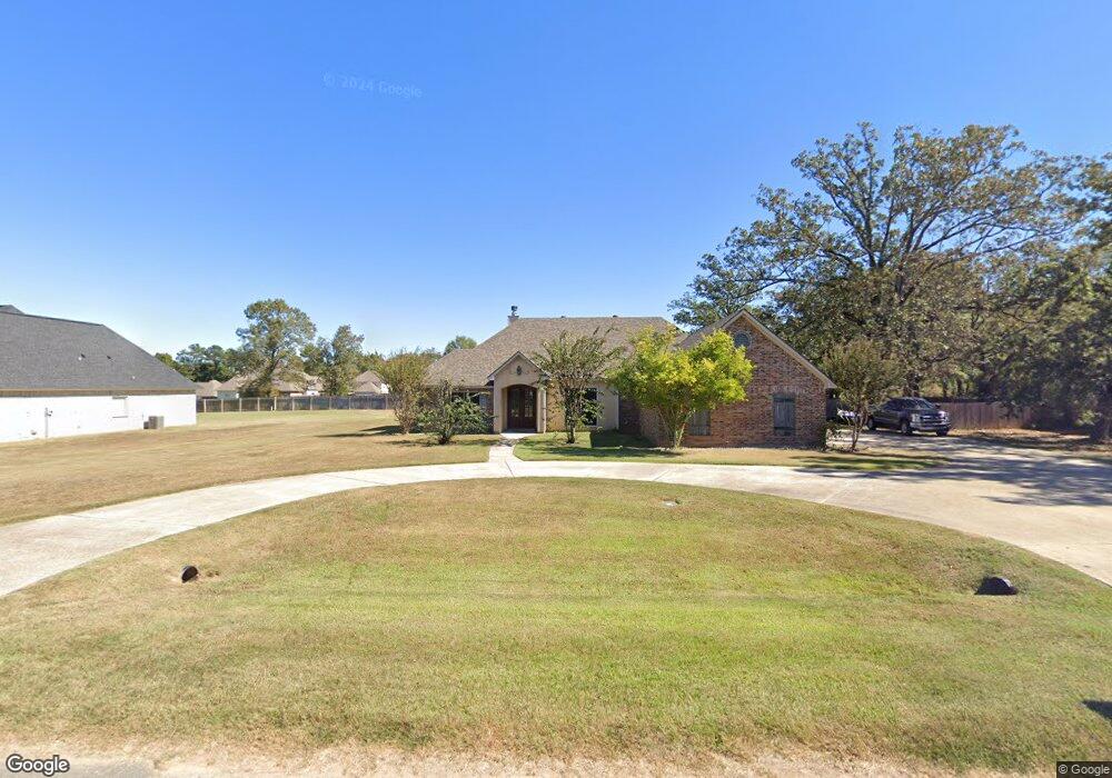
10647 Pelican Point Dr Keithville, LA 71047
Staples NeighborhoodEstimated Value: $327,000 - $401,000
4
Beds
7
Baths
2,324
Sq Ft
$159/Sq Ft
Est. Value
About This Home
This home is located at 10647 Pelican Point Dr, Keithville, LA 71047 and is currently estimated at $370,675, approximately $159 per square foot. 10647 Pelican Point Dr is a home located in Caddo Parish with nearby schools including Fairfield Magnet School, Judson Fundamental Elementary School, and Eden Gardens Fundamental Elementary School.
Ownership History
Date
Name
Owned For
Owner Type
Purchase Details
Closed on
Feb 5, 2016
Sold by
Taylor Rio Willa Dean
Bought by
Williams Roberto
Current Estimated Value
Purchase Details
Closed on
Feb 2, 2011
Sold by
Rio Del Andrew and Rio Ronald J
Bought by
Rio Willa Dean Taylor
Purchase Details
Closed on
Jun 12, 2008
Sold by
Dixieland Construction Inc
Bought by
Taylor Adams Willa Dean and Rio Kermit Eugene
Create a Home Valuation Report for This Property
The Home Valuation Report is an in-depth analysis detailing your home's value as well as a comparison with similar homes in the area
Home Values in the Area
Average Home Value in this Area
Purchase History
| Date | Buyer | Sale Price | Title Company |
|---|---|---|---|
| Williams Roberto | $269,000 | Bayou Title Inc | |
| Rio Willa Dean Taylor | $50,000 | None Available | |
| Taylor Adams Willa Dean | $250,000 | First Commerece Ttle Co | |
| Dixieland Construction Inc | $35,000 | None Available |
Source: Public Records
Tax History Compared to Growth
Tax History
| Year | Tax Paid | Tax Assessment Tax Assessment Total Assessment is a certain percentage of the fair market value that is determined by local assessors to be the total taxable value of land and additions on the property. | Land | Improvement |
|---|---|---|---|---|
| 2024 | $4,474 | $27,747 | $3,140 | $24,607 |
| 2023 | $4,273 | $25,937 | $2,990 | $22,947 |
| 2022 | $4,273 | $25,937 | $2,990 | $22,947 |
| 2021 | $4,267 | $25,937 | $2,990 | $22,947 |
| 2020 | $4,267 | $25,937 | $2,990 | $22,947 |
| 2019 | $4,182 | $25,684 | $2,990 | $22,694 |
| 2018 | $3,809 | $25,684 | $2,990 | $22,694 |
| 2017 | $3,802 | $25,684 | $2,990 | $22,694 |
| 2015 | $2,599 | $24,630 | $3,430 | $21,200 |
| 2014 | $2,616 | $24,630 | $3,430 | $21,200 |
| 2013 | -- | $24,630 | $3,430 | $21,200 |
Source: Public Records
Map
Nearby Homes
- 6080 Pelican Pointe Loop
- 6117 Colquitt Rd
- 5882 Sunset Trace Dr
- 10416 Manchester Ct
- 10315 Meadowview Dr
- 6531 N Liberty St
- 10135 Freedoms Way
- 10246 Castanedo Ct
- 10014 Freedoms Way
- 10198 Castanedo Ct
- 9918 Freedoms Way
- 9841 Freedoms Way
- 0 Dorchester Cir
- 9846 Freedoms Way
- 6095 Keithville Springridge Rd
- 10248 Cardiff Dr
- 10290 Scout Dr
- 10150 Lalaurie Ln
- 3804 Farmridge Rd
- 1 Bledsoe Rd
- 10651 Pelican Point Dr
- 10651 Pelican Pointe Dr
- 10650 Pelican Point Dr
- 10634 Pelican Point Dr
- 6105 Pelican Point Loop
- 10639 Pelican Point Dr
- 6101 Pelican Point Loop
- 6109 Pelican Pointe Loop
- 10635 Pelican Point Dr
- 6102 Pelican Point Loop
- 6085 Pelican Point Loop
- 6100 Pelican Point Loop
- 6265 Colquitt Rd
- 0 Pelican Pointe Unit 169062NL
- 0 Pelican Pointe Unit 244986NL
- 0 Pelican Pointe Unit 244985NL
- 0 Pelican Pointe Unit 244981NL
- 0 Pelican Pointe Unit 244990NL
- 0 Pelican Pointe Unit 244989NL
- 0 Pelican Pointe Unit 244988NL