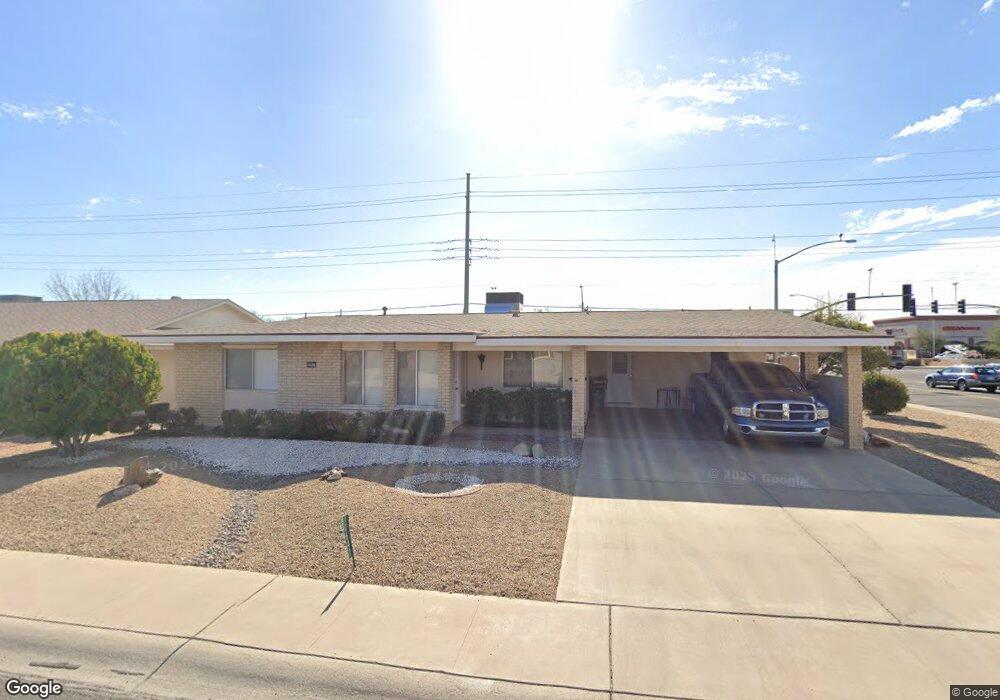
10647 W Caron Dr Sun City, AZ 85351
Estimated Value: $241,155 - $311,000
--
Bed
2
Baths
1,311
Sq Ft
$216/Sq Ft
Est. Value
About This Home
This home is located at 10647 W Caron Dr, Sun City, AZ 85351 and is currently estimated at $283,789, approximately $216 per square foot. 10647 W Caron Dr is a home located in Maricopa County with nearby schools including Ombudsman - Northwest Charter and Peoria Accelerated High School.
Ownership History
Date
Name
Owned For
Owner Type
Purchase Details
Closed on
Jan 28, 2014
Sold by
Wilson Thomas M and Wilson Nancy E
Bought by
Tom & Nancy Wilson Family Living Trust
Current Estimated Value
Purchase Details
Closed on
Mar 14, 2002
Sold by
Howell Robert H and Howell Omedia M
Bought by
Wilson Thomas M and Wilson Nancy E
Home Financials for this Owner
Home Financials are based on the most recent Mortgage that was taken out on this home.
Original Mortgage
$81,600
Outstanding Balance
$33,414
Interest Rate
6.78%
Mortgage Type
New Conventional
Estimated Equity
$250,375
Purchase Details
Closed on
Oct 13, 1999
Sold by
Lemke Marion and The Sylvia M Flanigan Trust
Bought by
Howell Robert H and Howell Omedia M
Home Financials for this Owner
Home Financials are based on the most recent Mortgage that was taken out on this home.
Original Mortgage
$58,800
Interest Rate
7.82%
Mortgage Type
New Conventional
Create a Home Valuation Report for This Property
The Home Valuation Report is an in-depth analysis detailing your home's value as well as a comparison with similar homes in the area
Home Values in the Area
Average Home Value in this Area
Purchase History
| Date | Buyer | Sale Price | Title Company |
|---|---|---|---|
| Tom & Nancy Wilson Family Living Trust | -- | None Available | |
| Wilson Thomas M | $102,000 | Capital Title Agency Inc | |
| Howell Robert H | $73,500 | Capital Title Agency |
Source: Public Records
Mortgage History
| Date | Status | Borrower | Loan Amount |
|---|---|---|---|
| Open | Wilson Thomas M | $81,600 | |
| Previous Owner | Howell Robert H | $58,800 |
Source: Public Records
Tax History Compared to Growth
Tax History
| Year | Tax Paid | Tax Assessment Tax Assessment Total Assessment is a certain percentage of the fair market value that is determined by local assessors to be the total taxable value of land and additions on the property. | Land | Improvement |
|---|---|---|---|---|
| 2025 | $916 | $11,323 | -- | -- |
| 2024 | $823 | $10,783 | -- | -- |
| 2023 | $823 | $20,010 | $4,000 | $16,010 |
| 2022 | $776 | $15,700 | $3,140 | $12,560 |
| 2021 | $801 | $14,630 | $2,920 | $11,710 |
| 2020 | $779 | $12,600 | $2,520 | $10,080 |
| 2019 | $765 | $11,670 | $2,330 | $9,340 |
| 2018 | $736 | $10,450 | $2,090 | $8,360 |
| 2017 | $712 | $9,150 | $1,830 | $7,320 |
| 2016 | $664 | $8,580 | $1,710 | $6,870 |
| 2015 | $634 | $8,000 | $1,600 | $6,400 |
Source: Public Records
Map
Nearby Homes
- 10707 W Mission Ln
- 10726 W Kelso Dr Unit 172
- 9202 N 107th Ave Unit 8
- 10731 W Mission Ln Unit 200
- 10825 W Caron Dr
- 9219 N 107th Dr Unit 13
- 10726 W Denham Dr Unit 16
- 10732 W Denham Dr Unit 17
- 8800 N 107th Ave Unit 17
- 8800 N 107th Ave Unit 19
- 8800 N 107th Ave Unit 52
- 8803 N 105th Dr
- 9402 N 109th Dr
- 10512 W Ruth Ave
- 10603 W Ruth Ave
- 10326 W Caron Dr
- 8582 N 107th Ln
- 10816 W Venturi Dr
- 11005 W Kelso Dr
- 10788 W Cinnebar Ave
- 10641 W Caron Dr
- 10637 W Caron Dr
- 10701 W Caron Dr
- 10648 W Caron Dr
- 10640 W Caron Dr
- 10705 W Caron Dr Unit 9
- 10636 W Caron Dr
- 10702 W Caron Dr Unit 123
- 10631 W Caron Dr Unit REMDL
- 10631 W Caron Dr
- 10706 W Caron Dr
- 10711 W Caron Dr
- 10639 W Kelso Dr
- 10630 W Caron Dr
- 10629 W Caron Dr
- 10715 W Caron Dr
- 10714 W Caron Dr
- 10635 W Kelso Dr
- 10701 W Kelso Dr
- 10705 W Kelso Dr