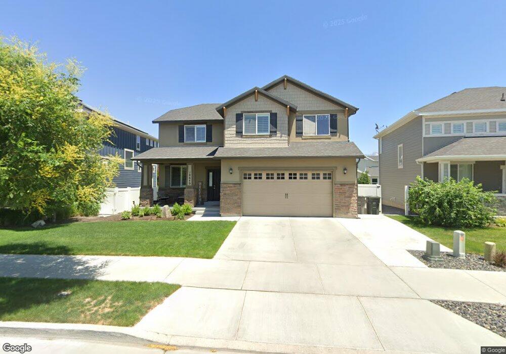
10649 S Harvest Pointe Dr Unit 126 South Jordan, UT 84095
Estimated Value: $718,000 - $780,000
4
Beds
3
Baths
3,498
Sq Ft
$214/Sq Ft
Est. Value
About This Home
This home is located at 10649 S Harvest Pointe Dr Unit 126, South Jordan, UT 84095 and is currently estimated at $747,360, approximately $213 per square foot. 10649 S Harvest Pointe Dr Unit 126 is a home located in Salt Lake County with nearby schools including Welby Elementary School, Elk Ridge Middle School, and Mountain West Montessori Academy.
Ownership History
Date
Name
Owned For
Owner Type
Purchase Details
Closed on
Mar 15, 2022
Sold by
Mark Mclemore Hyrum and Mark Larissa
Bought by
Kardouni Daniel and Dunn Annmarie
Current Estimated Value
Home Financials for this Owner
Home Financials are based on the most recent Mortgage that was taken out on this home.
Original Mortgage
$647,200
Outstanding Balance
$604,693
Interest Rate
3.92%
Mortgage Type
VA
Estimated Equity
$142,667
Purchase Details
Closed on
Mar 11, 2015
Sold by
Mcarthur Homes 14 Lc
Bought by
Mclemore Hyrum Mark and Mclemore Larissa
Create a Home Valuation Report for This Property
The Home Valuation Report is an in-depth analysis detailing your home's value as well as a comparison with similar homes in the area
Home Values in the Area
Average Home Value in this Area
Purchase History
| Date | Buyer | Sale Price | Title Company |
|---|---|---|---|
| Kardouni Daniel | -- | Synergy Title | |
| Kardouni Daniel | -- | Synergy Title | |
| Mclemore Hyrum Mark | -- | Surety Title |
Source: Public Records
Mortgage History
| Date | Status | Borrower | Loan Amount |
|---|---|---|---|
| Open | Kardouni Daniel | $647,200 | |
| Closed | Kardouni Daniel | $647,200 |
Source: Public Records
Tax History Compared to Growth
Tax History
| Year | Tax Paid | Tax Assessment Tax Assessment Total Assessment is a certain percentage of the fair market value that is determined by local assessors to be the total taxable value of land and additions on the property. | Land | Improvement |
|---|---|---|---|---|
| 2025 | $3,076 | $706,500 | $161,900 | $544,600 |
| 2024 | $3,076 | $675,900 | $150,300 | $525,600 |
| 2023 | $3,161 | $653,400 | $145,900 | $507,500 |
| 2022 | $3,514 | $668,600 | $143,100 | $525,500 |
| 2021 | $3,149 | $507,300 | $109,200 | $398,100 |
| 2020 | $3,028 | $457,300 | $105,800 | $351,500 |
| 2019 | $2,934 | $435,500 | $105,800 | $329,700 |
| 2018 | $2,768 | $408,900 | $105,800 | $303,100 |
| 2017 | $2,675 | $387,200 | $78,000 | $309,200 |
| 2016 | $2,707 | $371,300 | $78,000 | $293,300 |
| 2015 | $2,601 | $346,800 | $79,500 | $267,300 |
Source: Public Records
Map
Nearby Homes
- 3878 W Sage Willow Dr
- 3884 Coral Dune Dr Unit 222
- 10847 S Big Meadow Dr
- 3677 W Golden Sky Ln
- 10447 S Garden Sage Cir
- 3667 S Jordan Pkwy W
- 10931 S Glamis Dune Dr
- 10918 Little Sahara Dr Unit 1001
- 10941 Little Sahara Dr
- Princeton Plan at High Pointe
- Sheridan Plan at High Pointe
- Dashell Plan at High Pointe
- Dakota Plan at High Pointe
- Olympus Plan at High Pointe
- Sweetwater Plan at High Pointe
- Roosevelt Plan at High Pointe
- Witzel Plan at High Pointe
- 10934 Little Sahara Dr
- 10448 S Sage Vista Way
- 10459 S Sage Wood Way
- 10649 S Harvest Pointe Dr
- 10657 S Harvest Pointe Dr Unit 127
- 10637 S Harvest Pointe Dr
- 10634 S Poppy Meadow Ln
- 10644 S Poppy Meadow Ln Unit 315
- 10644 S Poppy Meadow Ln
- 10669 S Harvest Pointe Dr
- 3763 W Grassy Meadow Dr Unit 408
- 10654 S Poppy Meadow Ln
- 3773 W Grassy Meadow Dr Unit 409
- 3773 W Grassy Meadow Dr
- 3757 W Grassy Meadow Dr
- 10662 S Harvest Pointe Dr Unit 116
- 10681 S Harvest Pointe Dr
- 10652 S Harvest Pointe Dr
- 10664 S Poppy Meadow Ln Unit 313
- 10674 S Harvest Pointe Dr Unit 115
- 3787 W Grassy Meadow Dr
- 10642 S Harvest Pointe Dr
- 10682 S Harvest Pointe Dr Unit 114