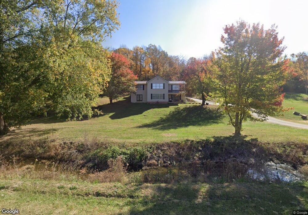
1065 Anderson Rd Georgetown, KY 40324
Muddy Ford NeighborhoodEstimated Value: $356,000 - $512,000
4
Beds
3
Baths
2,630
Sq Ft
$154/Sq Ft
Est. Value
About This Home
This home is located at 1065 Anderson Rd, Georgetown, KY 40324 and is currently estimated at $404,961, approximately $153 per square foot. 1065 Anderson Rd is a home located in Scott County with nearby schools including Northern Elementary School, Scott County Middle School, and Scott County High School.
Ownership History
Date
Name
Owned For
Owner Type
Purchase Details
Closed on
Mar 11, 2008
Sold by
Lasalle Bank National Association
Bought by
Anderson Miles and Anderson Erica
Current Estimated Value
Home Financials for this Owner
Home Financials are based on the most recent Mortgage that was taken out on this home.
Original Mortgage
$132,050
Outstanding Balance
$82,857
Interest Rate
6.22%
Mortgage Type
New Conventional
Estimated Equity
$322,104
Purchase Details
Closed on
Jul 5, 2007
Sold by
Blanckenship Mike
Bought by
Lasalle Bank National Association
Purchase Details
Closed on
Jun 15, 2006
Sold by
Cummins Ralph W and Cummins Tina M
Bought by
Blankenship Mike
Home Financials for this Owner
Home Financials are based on the most recent Mortgage that was taken out on this home.
Original Mortgage
$209,000
Interest Rate
9.35%
Mortgage Type
Adjustable Rate Mortgage/ARM
Create a Home Valuation Report for This Property
The Home Valuation Report is an in-depth analysis detailing your home's value as well as a comparison with similar homes in the area
Home Values in the Area
Average Home Value in this Area
Purchase History
| Date | Buyer | Sale Price | Title Company |
|---|---|---|---|
| Anderson Miles | $139,000 | None Available | |
| Lasalle Bank National Association | $155,000 | None Available | |
| Blankenship Mike | $220,000 | Flagship Title Corporation |
Source: Public Records
Mortgage History
| Date | Status | Borrower | Loan Amount |
|---|---|---|---|
| Open | Anderson Miles | $132,050 | |
| Previous Owner | Blankenship Mike | $209,000 |
Source: Public Records
Tax History
| Year | Tax Paid | Tax Assessment Tax Assessment Total Assessment is a certain percentage of the fair market value that is determined by local assessors to be the total taxable value of land and additions on the property. | Land | Improvement |
|---|---|---|---|---|
| 2025 | $1,983 | $222,600 | $0 | $0 |
| 2024 | $1,939 | $215,600 | $0 | $0 |
| 2023 | $1,918 | $211,500 | $62,500 | $149,000 |
| 2022 | $1,798 | $211,500 | $62,500 | $149,000 |
| 2021 | $1,754 | $200,000 | $53,000 | $147,000 |
| 2020 | $1,690 | $196,700 | $53,000 | $143,700 |
| 2019 | $1,693 | $194,000 | $0 | $0 |
| 2018 | $1,640 | $189,040 | $0 | $0 |
| 2017 | $1,595 | $182,860 | $0 | $0 |
| 2016 | $1,472 | $182,860 | $0 | $0 |
| 2015 | $1,431 | $178,800 | $0 | $0 |
| 2014 | $1,320 | $172,780 | $0 | $0 |
| 2011 | $1,256 | $172,780 | $0 | $0 |
Source: Public Records
Map
Nearby Homes
- 1090 Gunnell Rd
- 446 Anderson Rd
- 161 Blackberry Ln
- 173 Blackberry Ln
- 167 Blackberry Ln
- 155 Blackberry Ln
- 165 Blackberry Ln
- 1105 Old Delaplain Rd
- 279 Harbor Village Dr
- 113 Flamingo Cir
- 237-281 Harbor Village Dr
- 116 Harborside Ct
- 142 Dove Run Cir
- 117 Chickadee Trail
- 140 Dove Run Cir
- 103 Harborside Ct
- 165 Bueno Crossing
- 134 Dove Run Cir
- 127 Chickadee Trail
- 146 Bueno Crossing
- 1076 Anderson Rd
- 1061 Anderson Rd
- 1095 Anderson Rd
- 1103 Anderson Rd
- 1015 Anderson Rd
- 1126 Anderson Rd
- 1130 Anderson Rd
- 1135 Anderson Rd
- 5314 Muddy Ford Rd
- 5258 Muddy Ford Rd
- 1138 Anderson Rd
- 1145 Anderson Rd
- 5360 Muddy Ford Rd
- 5354 Muddy Ford Rd
- 5348 Muddy Ford Rd
- 5320 Muddy Ford Rd
- 5350 Muddy Ford Rd
- 5346 Muddy Ford Rd
- 5332 Muddy Ford Rd
Your Personal Tour Guide
Ask me questions while you tour the home.