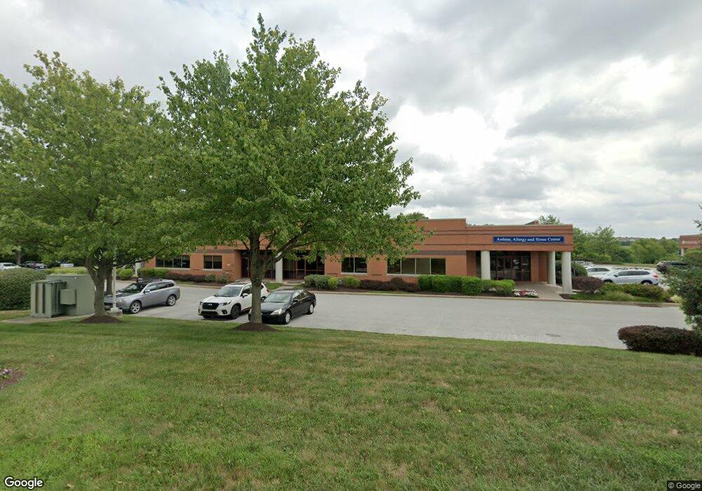
1065 Andrew Dr Unit B2 West Chester, PA 19380
--
Bed
--
Bath
5,160
Sq Ft
5,184
Sq Ft Lot
About This Home
This home is located at 1065 Andrew Dr Unit B2, West Chester, PA 19380. 1065 Andrew Dr Unit B2 is a home located in Chester County with nearby schools including Fern Hill Elementary School, E.N. Peirce Middle School, and Henderson High School.
Ownership History
Date
Name
Owned For
Owner Type
Purchase Details
Closed on
Jun 9, 2011
Sold by
1065 Andrew Drive Llc
Bought by
Reinhart Real Estate Group L P
Purchase Details
Closed on
Aug 30, 2005
Sold by
Deer Run Development Group Llc
Bought by
1065 Andrews Drive Llc
Home Financials for this Owner
Home Financials are based on the most recent Mortgage that was taken out on this home.
Original Mortgage
$1,360,000
Interest Rate
5.81%
Mortgage Type
Commercial
Create a Home Valuation Report for This Property
The Home Valuation Report is an in-depth analysis detailing your home's value as well as a comparison with similar homes in the area
Home Values in the Area
Average Home Value in this Area
Purchase History
| Date | Buyer | Sale Price | Title Company |
|---|---|---|---|
| Reinhart Real Estate Group L P | $1,200,000 | None Available | |
| 1065 Andrews Drive Llc | $1,042,605 | -- |
Source: Public Records
Mortgage History
| Date | Status | Borrower | Loan Amount |
|---|---|---|---|
| Previous Owner | 1065 Andrews Drive Llc | $1,360,000 |
Source: Public Records
Tax History Compared to Growth
Tax History
| Year | Tax Paid | Tax Assessment Tax Assessment Total Assessment is a certain percentage of the fair market value that is determined by local assessors to be the total taxable value of land and additions on the property. | Land | Improvement |
|---|---|---|---|---|
| 2025 | $16,994 | $586,240 | $49,850 | $536,390 |
| 2024 | $16,994 | $586,240 | $49,850 | $536,390 |
| 2023 | $16,994 | $586,240 | $49,850 | $536,390 |
| 2022 | $16,773 | $586,240 | $49,850 | $536,390 |
| 2021 | $16,540 | $586,240 | $49,850 | $536,390 |
| 2020 | $16,433 | $586,240 | $49,850 | $536,390 |
| 2019 | $16,204 | $586,240 | $49,850 | $536,390 |
| 2018 | $15,860 | $586,240 | $49,850 | $536,390 |
| 2017 | $15,516 | $586,240 | $49,850 | $536,390 |
| 2016 | $715 | $586,240 | $49,850 | $536,390 |
| 2015 | $715 | $586,240 | $49,850 | $536,390 |
| 2014 | $715 | $586,240 | $49,850 | $536,390 |
Source: Public Records
Map
Nearby Homes
- 1708 Frost Ln
- 2237 Poe Ln
- 1614 Phillips Dr
- 1405 Gorky Ln
- 1210 Ashbridge Rd
- 306 Greenhill Rd
- 1302 Ashbridge Rd
- 904 Sylvania Ln
- 1131 Nottingham Dr
- Magnolia Plan at The Woodlands at Brandywine
- Savannah Plan at The Woodlands at Brandywine
- Nottingham Plan at The Woodlands at Brandywine
- Covington Plan at The Woodlands at Brandywine
- Hawthorne Plan at The Woodlands at Brandywine
- Kipling Plan at The Woodlands at Brandywine
- Ethan Plan at The Woodlands at Brandywine
- Devonshire Plan at The Woodlands at Brandywine
- Augusta Plan at The Woodlands at Brandywine
- Woodford Plan at The Woodlands at Brandywine
- 300 Kirkland Ave Unit AUGUSTA
- 1075 Andrew Dr
- 1085 Andrew Dr
- 1060 Andrew Dr Unit 190
- 1060 Andrew Dr Unit 120
- 1060 Andrew Dr
- 1045 Andrew Dr Unit C
- 1045 Andrew Dr Unit C1A
- 1045 Andrew Dr Unit D
- 1045 Andrew Dr Unit B
- 1045 Andrew Dr Unit C1
- 1045 Andrew Dr Unit CF
- 1045 Andrew Dr Unit C2
- 1101 Phoenixville Pike
- 1036 Phoenixville Pike
- General Delivery
- 941 Dutton Mill Rd
- 1038 Phoenixville Pike
- 910 Camaro Run Dr
- 1100 Ashbridge Rd
- 1100 Phoenixville Pike