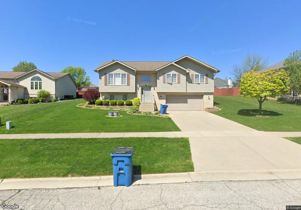
1065 Doe Path Ln Crown Point, IN 46307
Estimated Value: $330,000 - $439,000
3
Beds
3
Baths
2,256
Sq Ft
$175/Sq Ft
Est. Value
About This Home
This home is located at 1065 Doe Path Ln, Crown Point, IN 46307 and is currently estimated at $393,935, approximately $174 per square foot. 1065 Doe Path Ln is a home located in Lake County with nearby schools including Solon Robinson Elementary School, Colonel John Wheeler Middle School, and Crown Point High School.
Ownership History
Date
Name
Owned For
Owner Type
Purchase Details
Closed on
Jun 3, 2005
Sold by
Jones Jerrel J and Jones Bonita Ordogne
Bought by
Martinoski Bogdan and Martinoski Ristana
Current Estimated Value
Home Financials for this Owner
Home Financials are based on the most recent Mortgage that was taken out on this home.
Original Mortgage
$170,000
Outstanding Balance
$62,014
Interest Rate
1.45%
Mortgage Type
Fannie Mae Freddie Mac
Estimated Equity
$331,921
Create a Home Valuation Report for This Property
The Home Valuation Report is an in-depth analysis detailing your home's value as well as a comparison with similar homes in the area
Home Values in the Area
Average Home Value in this Area
Purchase History
We collect this data history from publicly available records. To have your information removed, we recommend requesting removal directly through your county’s website.
| Date | Buyer | Sale Price | Title Company |
|---|---|---|---|
| Martinoski Bogdan | -- | Ticor |
Source: Public Records
Mortgage History
We collect this data history from publicly available records. To have your information removed, we recommend requesting removal directly through your county’s website.
| Date | Status | Borrower | Loan Amount |
|---|---|---|---|
| Open | Martinoski Bogdan | $170,000 |
Source: Public Records
Tax History
| Year | Tax Paid | Tax Assessment Tax Assessment Total Assessment is a certain percentage of the fair market value that is determined by local assessors to be the total taxable value of land and additions on the property. | Land | Improvement |
|---|---|---|---|---|
| 2025 | $2,900 | $309,000 | $62,600 | $246,400 |
| 2024 | $7,127 | $284,900 | $62,600 | $222,300 |
| 2023 | $2,717 | $259,300 | $62,600 | $196,700 |
| 2022 | $2,717 | $245,000 | $62,600 | $182,400 |
| 2021 | $2,638 | $238,100 | $52,200 | $185,900 |
| 2020 | $2,605 | $235,200 | $52,200 | $183,000 |
| 2019 | $2,561 | $227,300 | $52,200 | $175,100 |
| 2018 | $2,917 | $223,000 | $52,200 | $170,800 |
| 2017 | $2,973 | $224,200 | $52,200 | $172,000 |
| 2016 | $3,125 | $230,100 | $52,200 | $177,900 |
| 2014 | $2,846 | $225,800 | $52,300 | $173,500 |
| 2013 | $2,814 | $221,800 | $52,200 | $169,600 |
Source: Public Records
Map
Nearby Homes
- 1785 E 110th Place
- 1835 E 110th Place
- 1865 E 110th Place
- 11150 Putnam Dr
- 13143 Rutledge Place
- 975 Driftwood Trail
- 1040 Stillwater Pkwy
- 1205 Waterside Ln
- 1285 Greenview Place
- 1270 E Greenview Place
- 1191 Churchill Ln
- 1190 E Greenview Place
- 206 U S 231
- 11840 Broadway
- 1150 Greenview Place
- 12430 Van Buren St
- 517 E 120th Place
- 519 E 120th Place
- 512 E 120th Place
- 521 E 120th Place
- 1055 Doe Path Ln
- 1075 Doe Path Ln
- 1331 Hollowtree Ct
- 1045 Doe Path Ln
- 1105 Doe Path Ln
- 1320 Hollowtree Ct
- 1321 Hollowtree Ct
- 1060 Doe Path Ln
- 1070 Doe Path Ln
- 1050 Doe Path Ln
- 1025 Doe Path Ln
- 1100 Doe Path Ln
- 1115 Doe Path Ln
- 1040 Doe Path Ln
- 1310 Hollowtree Ct
- 11161 Putnam Dr
- 11162 Putnam Dr
- 223 Nomo Place
- 229 Nomo Place
- 11155 Putnam Dr
Your Personal Tour Guide
Ask me questions while you tour the home.