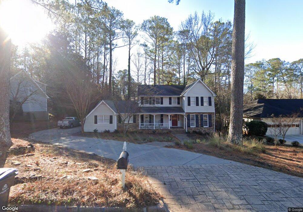
1065 Northshore Dr Unit 1 Roswell, GA 30076
Martin's Landing NeighborhoodEstimated Value: $613,000 - $657,000
4
Beds
3
Baths
2,650
Sq Ft
$238/Sq Ft
Est. Value
About This Home
This home is located at 1065 Northshore Dr Unit 1, Roswell, GA 30076 and is currently estimated at $631,292, approximately $238 per square foot. 1065 Northshore Dr Unit 1 is a home located in Fulton County with nearby schools including Jackson Elementary School, Holcomb Bridge Middle School, and Centennial High School.
Ownership History
Date
Name
Owned For
Owner Type
Purchase Details
Closed on
May 19, 2000
Sold by
Corsetti Louis
Bought by
Corsetti Louis and Corsetti Mary Jo
Current Estimated Value
Purchase Details
Closed on
Jun 16, 1998
Sold by
Corsetti Mary Jo
Bought by
Corsetti Louis
Purchase Details
Closed on
Mar 30, 1995
Sold by
Dinteman Walter A Linda B
Bought by
Corsetti Louis Mary J
Create a Home Valuation Report for This Property
The Home Valuation Report is an in-depth analysis detailing your home's value as well as a comparison with similar homes in the area
Home Values in the Area
Average Home Value in this Area
Purchase History
| Date | Buyer | Sale Price | Title Company |
|---|---|---|---|
| Corsetti Louis | -- | -- | |
| Corsetti Louis | -- | -- | |
| Corsetti Louis Mary J | $184,900 | -- |
Source: Public Records
Mortgage History
| Date | Status | Borrower | Loan Amount |
|---|---|---|---|
| Closed | Corsetti Louis Mary J | $0 |
Source: Public Records
Tax History Compared to Growth
Tax History
| Year | Tax Paid | Tax Assessment Tax Assessment Total Assessment is a certain percentage of the fair market value that is determined by local assessors to be the total taxable value of land and additions on the property. | Land | Improvement |
|---|---|---|---|---|
| 2025 | $969 | $198,480 | $37,000 | $161,480 |
| 2023 | $5,225 | $185,120 | $50,400 | $134,720 |
| 2022 | $4,426 | $168,240 | $30,680 | $137,560 |
| 2021 | $4,589 | $144,080 | $25,840 | $118,240 |
| 2020 | $4,662 | $142,360 | $25,520 | $116,840 |
| 2019 | $652 | $131,520 | $24,320 | $107,200 |
| 2018 | $3,625 | $128,440 | $23,760 | $104,680 |
| 2017 | $2,572 | $88,160 | $16,320 | $71,840 |
| 2016 | $2,573 | $88,160 | $16,320 | $71,840 |
| 2015 | $3,064 | $88,160 | $16,320 | $71,840 |
| 2014 | $2,702 | $88,160 | $16,320 | $71,840 |
Source: Public Records
Map
Nearby Homes
- 1140 Northshore Dr
- 1045 Martin Ridge Rd
- 1265 Northshore Dr
- 300 Cedar Knoll Ct
- 0 Riverside Rd Unit 7421838
- 0 Riverside Rd Unit 10339509
- 2020 Rivermont Way
- 9470 Hillside Dr
- 130 Lakeview Ridge W
- 230 Lakeview Ridge E
- 2104 Queen Anne Ct
- 502 Brandywine Cir
- 306 Brandywine Cir
- 303 Brandywine Cir Unit 303
- 610 Trailmore Place
- 1010 Wedgewood Way
- 263 Quail Run
- 206 River Run Dr
- 704 River Run Dr Unit 704
- 1085 Northshore Dr
- 1055 Northshore Dr Unit 1
- 9300 Martins Lake Dr
- 1105 Northshore Dr
- 1070 Northshore Dr
- 1060 N Shore Dr
- 1060 Northshore Dr
- 9310 Martins Lake Dr Unit 1
- 1090 Northshore Dr
- 0 Northshore Dr Unit 7568784
- 0 Northshore Dr Unit 7467448
- 0 Northshore Dr Unit 7392703
- 0 Northshore Dr Unit 3229241
- 0 Northshore Dr Unit 8295250
- 0 Northshore Dr Unit 8677621
- 0 Northshore Dr Unit 8475946
- 0 Northshore Dr Unit 8176261
- 0 Northshore Dr
- 1050 N Shore Dr
- 1040 Martins Lake Close