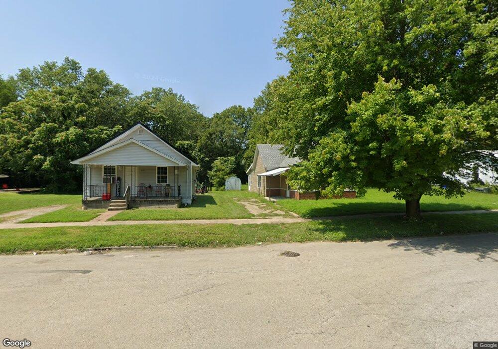
1065 S Silas St Decatur, IL 62521
Mueller Park NeighborhoodEstimated Value: $43,390 - $71,000
2
Beds
1
Bath
--
Sq Ft
6,534
Sq Ft Lot
About This Home
This home is located at 1065 S Silas St, Decatur, IL 62521 and is currently estimated at $54,348. 1065 S Silas St is a home located in Macon County with nearby schools including South Shores Elementary School, Stephen Decatur Middle School, and St. Patrick School.
Ownership History
Date
Name
Owned For
Owner Type
Purchase Details
Closed on
Apr 13, 2021
Sold by
Johnson Tanesha R
Bought by
Brown Gloria
Current Estimated Value
Purchase Details
Closed on
Mar 11, 2016
Sold by
Macon County
Bought by
Johnson Tanesha R
Purchase Details
Closed on
Aug 21, 2015
Sold by
Atwell Curtis R
Bought by
Macon County
Purchase Details
Closed on
May 18, 2011
Sold by
Plank Daniel
Bought by
Atwell Curtis R
Purchase Details
Closed on
Oct 26, 2006
Sold by
Lucas Dorothy I and Malloy Virginia M
Bought by
Cohen Alvin
Home Financials for this Owner
Home Financials are based on the most recent Mortgage that was taken out on this home.
Original Mortgage
$12,000
Interest Rate
6.5%
Mortgage Type
Future Advance Clause Open End Mortgage
Create a Home Valuation Report for This Property
The Home Valuation Report is an in-depth analysis detailing your home's value as well as a comparison with similar homes in the area
Home Values in the Area
Average Home Value in this Area
Purchase History
| Date | Buyer | Sale Price | Title Company |
|---|---|---|---|
| Brown Gloria | -- | None Available | |
| Johnson Tanesha R | -- | None Available | |
| Macon County | -- | None Available | |
| Atwell Curtis R | -- | None Available | |
| Cohen Alvin | $15,000 | None Available |
Source: Public Records
Mortgage History
| Date | Status | Borrower | Loan Amount |
|---|---|---|---|
| Previous Owner | Cohen Alvin | $12,000 |
Source: Public Records
Tax History
| Year | Tax Paid | Tax Assessment Tax Assessment Total Assessment is a certain percentage of the fair market value that is determined by local assessors to be the total taxable value of land and additions on the property. | Land | Improvement |
|---|---|---|---|---|
| 2024 | $708 | $7,316 | $1,221 | $6,095 |
| 2023 | $702 | $7,057 | $1,178 | $5,879 |
| 2022 | $676 | $6,613 | $1,090 | $5,523 |
| 2021 | $635 | $6,176 | $1,018 | $5,158 |
| 2020 | $626 | $5,889 | $970 | $4,919 |
| 2019 | $626 | $5,889 | $970 | $4,919 |
| 2018 | $651 | $6,192 | $196 | $5,996 |
| 2017 | $666 | $6,357 | $201 | $6,156 |
| 2016 | $0 | $98 | $49 | $49 |
| 2015 | $645 | $6,308 | $199 | $6,109 |
| 2014 | $603 | $6,246 | $197 | $6,049 |
| 2013 | $619 | $6,480 | $204 | $6,276 |
Source: Public Records
Map
Nearby Homes
- 1225 S Silas St
- 1283 S Illinois St
- 936 E Moore St
- 855 S Stone St
- 1403 Parkwood Place
- 90 Webster Ct
- 409 Southmoreland Place
- 228 Southmoreland Place
- 612 S Jackson St
- 246 Southmoreland Place
- 602 E Decatur St
- 0 S Water St
- 910 S Main St
- 1422 Sedgwick St
- 632 S 17th St
- 1872 Shady Crest St
- 1901 Indiana Ct
- 1202 Florida Ave
- 66 Eastmoreland Dr
- 1135 S 21st St
- 1075 S Silas St
- 1043 S Silas St
- 1107 S Silas St
- 1023 S Silas St
- 1115 S Silas St
- 1010 E Rogers Ave
- 1125 S Silas St
- 1060 S Maffit St
- 1019 S Silas St
- 1052 S Maffit St
- 1046 S Maffit St
- 1110 S Silas St
- 1145 S Silas + 1155 Silas Incl! St
- 1020 E Rogers Ave
- 1145 S Silas St
- 1058 S Silas St
- 1030 E Rogers Ave
- 1040 S Silas St
- 961 E Cleveland Ave
- 1155 S Silas St
Your Personal Tour Guide
Ask me questions while you tour the home.