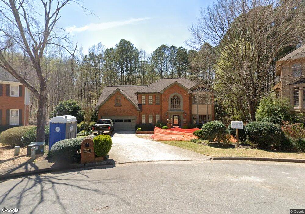
10650 Dunoon Dr Unit 1 Alpharetta, GA 30022
Estimated Value: $754,000 - $846,000
4
Beds
3
Baths
2,764
Sq Ft
$286/Sq Ft
Est. Value
About This Home
This home is located at 10650 Dunoon Dr Unit 1, Alpharetta, GA 30022 and is currently estimated at $790,333, approximately $285 per square foot. 10650 Dunoon Dr Unit 1 is a home located in Fulton County with nearby schools including Ocee Elementary School, Taylor Road Middle School, and Chattahoochee High School.
Ownership History
Date
Name
Owned For
Owner Type
Purchase Details
Closed on
Feb 28, 2005
Sold by
Hart Kelle B
Bought by
Karnes Craig H and Karnes Lisa
Current Estimated Value
Home Financials for this Owner
Home Financials are based on the most recent Mortgage that was taken out on this home.
Original Mortgage
$190,000
Outstanding Balance
$96,070
Interest Rate
5.57%
Mortgage Type
New Conventional
Estimated Equity
$694,263
Purchase Details
Closed on
Sep 29, 1994
Sold by
Mcdonnell Michael A Heidi A
Bought by
Hall Richard T
Home Financials for this Owner
Home Financials are based on the most recent Mortgage that was taken out on this home.
Original Mortgage
$228,150
Interest Rate
8.46%
Create a Home Valuation Report for This Property
The Home Valuation Report is an in-depth analysis detailing your home's value as well as a comparison with similar homes in the area
Home Values in the Area
Average Home Value in this Area
Purchase History
| Date | Buyer | Sale Price | Title Company |
|---|---|---|---|
| Karnes Craig H | $365,000 | -- | |
| Hall Richard T | $253,500 | -- |
Source: Public Records
Mortgage History
| Date | Status | Borrower | Loan Amount |
|---|---|---|---|
| Open | Karnes Craig H | $190,000 | |
| Previous Owner | Hall Richard T | $228,150 |
Source: Public Records
Tax History Compared to Growth
Tax History
| Year | Tax Paid | Tax Assessment Tax Assessment Total Assessment is a certain percentage of the fair market value that is determined by local assessors to be the total taxable value of land and additions on the property. | Land | Improvement |
|---|---|---|---|---|
| 2025 | $874 | $342,440 | $125,320 | $217,120 |
| 2023 | $8,362 | $296,240 | $91,440 | $204,800 |
| 2022 | $4,106 | $221,440 | $62,120 | $159,320 |
| 2021 | $4,825 | $196,000 | $60,360 | $135,640 |
| 2020 | $4,659 | $155,320 | $19,600 | $135,720 |
| 2019 | $700 | $155,320 | $19,600 | $135,720 |
| 2018 | $3,886 | $190,160 | $54,440 | $135,720 |
| 2017 | $4,021 | $149,760 | $33,400 | $116,360 |
| 2016 | $4,020 | $149,760 | $33,400 | $116,360 |
| 2015 | $4,697 | $149,760 | $33,400 | $116,360 |
| 2014 | $3,821 | $137,400 | $37,200 | $100,200 |
Source: Public Records
Map
Nearby Homes
- 125 Sandridge Ct
- 610 Varina Way
- 465 Kirkstall Trail
- 825 Highland Bend Cove
- 10845 Carrissa Trail
- 710 Country Manor Way
- 10880 Windham Way
- 10530 Tuxford Dr
- 235 Wood Shoals Ct
- 120 Thome Dr
- 415 Wood Trace Ct
- 345 Kincardine Way Unit IIIA
- 285 Rolling Mist Ct
- 3430 Waters Mill Dr
- 10515 Colony Glen Dr Unit 2
- 3396 Carverton Ln
- 105 Kimball Bridge Cove
- 10415 Plantation Bridge Dr
- 10655 Dunoon Dr
- 10670 Dunoon Dr Unit 1
- 10665 Dunoon Dr
- 10675 Dunoon Dr
- 390 Welwyn Walk
- 10680 Dunoon Dr
- 385 Rosalie Ct
- 10685 Dunoon Dr
- 430 Rosalie Ct Unit 2
- 380 Welwyn Walk
- 10690 Dunoon Dr
- 400 Welwyn Walk
- 375 Rosalie Ct
- 370 Welwyn Walk
- 10695 Dunoon Dr
- 310 Woodbury Way
- 10700 Dunoon Dr
- 420 Rosalie Ct Unit 2
- 385 Welwyn Walk Unit III
- 320 Woodbury Way