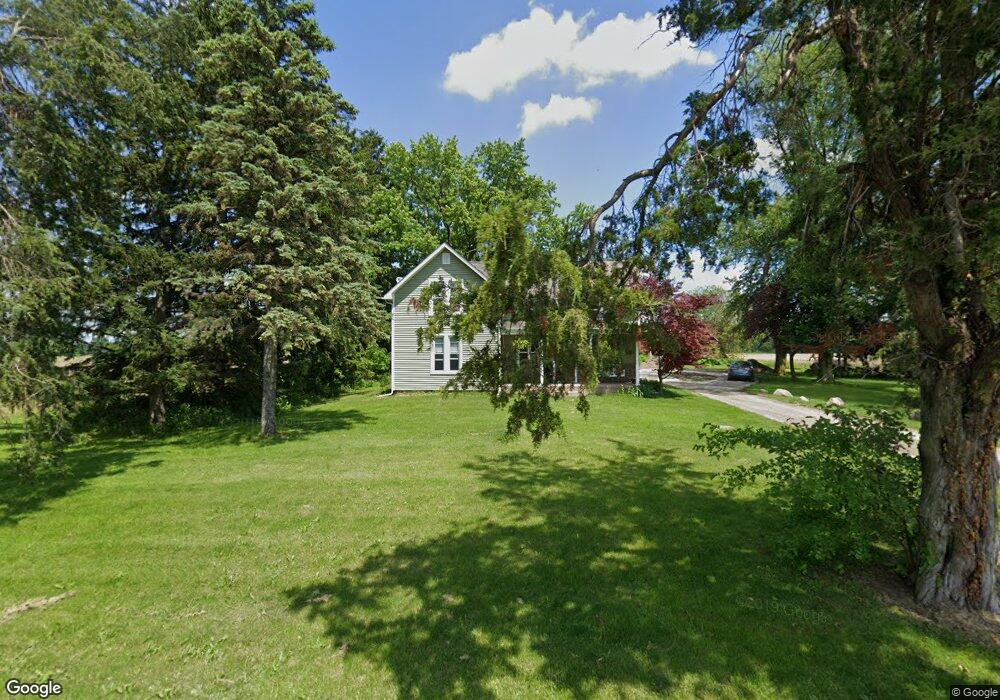
10650 Maxwell Rd Carleton, MI 48117
Estimated Value: $303,394 - $392,000
3
Beds
1
Bath
1,700
Sq Ft
$208/Sq Ft
Est. Value
About This Home
This home is located at 10650 Maxwell Rd, Carleton, MI 48117 and is currently estimated at $352,849, approximately $207 per square foot. 10650 Maxwell Rd is a home located in Monroe County with nearby schools including Airport Senior High School, St. Patrick Elementary School, and Carleton Community Baptist.
Ownership History
Date
Name
Owned For
Owner Type
Purchase Details
Closed on
Feb 5, 2025
Sold by
Smart Jeremy M and Smart Catherine R
Bought by
Smart Revocable Trust and Smart
Current Estimated Value
Purchase Details
Closed on
Apr 25, 2023
Sold by
Smart Catherine R
Bought by
Smart Catherine R and Smart Jeremy
Home Financials for this Owner
Home Financials are based on the most recent Mortgage that was taken out on this home.
Original Mortgage
$185,500
Interest Rate
5.95%
Mortgage Type
New Conventional
Purchase Details
Closed on
Apr 15, 2011
Sold by
Otter James M and Sanders Carol E
Bought by
Smart Catherine M
Purchase Details
Closed on
Feb 9, 2011
Sold by
Otter James M and Sanders Carol E
Bought by
Beste Dennis M and Dennis M Beste Revocable Trust
Create a Home Valuation Report for This Property
The Home Valuation Report is an in-depth analysis detailing your home's value as well as a comparison with similar homes in the area
Home Values in the Area
Average Home Value in this Area
Purchase History
| Date | Buyer | Sale Price | Title Company |
|---|---|---|---|
| Smart Revocable Trust | -- | None Listed On Document | |
| Smart Catherine R | -- | Devon Title | |
| Smart Catherine M | $128,600 | -- | |
| Beste Dennis M | $71,640 | -- |
Source: Public Records
Mortgage History
| Date | Status | Borrower | Loan Amount |
|---|---|---|---|
| Previous Owner | Smart Catherine R | $185,500 |
Source: Public Records
Tax History
| Year | Tax Paid | Tax Assessment Tax Assessment Total Assessment is a certain percentage of the fair market value that is determined by local assessors to be the total taxable value of land and additions on the property. | Land | Improvement |
|---|---|---|---|---|
| 2025 | $859 | $124,500 | $124,500 | $0 |
| 2024 | $833 | $118,600 | $0 | $0 |
| 2023 | $793 | $94,300 | $0 | $0 |
| 2022 | $2,620 | $94,300 | $0 | $0 |
| 2021 | $2,595 | $90,600 | $0 | $0 |
| 2020 | $2,609 | $79,500 | $0 | $0 |
| 2019 | $2,616 | $79,500 | $0 | $0 |
| 2018 | $2,615 | $70,400 | $0 | $0 |
| 2017 | $2,523 | $70,400 | $0 | $0 |
| 2016 | $2,544 | $64,500 | $0 | $0 |
| 2015 | $2,526 | $58,800 | $0 | $0 |
| 2014 | $2,546 | $58,800 | $0 | $0 |
| 2013 | -- | $59,100 | $0 | $0 |
Source: Public Records
Map
Nearby Homes
- 49 James Dr
- 1405 Cedarcrest Dr
- 12259 Eldora St
- 9601 Exeter Rd
- 12361 Spencer Ln
- 12464 Maxwell Rd
- 12751 Jones St
- 12850 Crane St
- 8485 S Stoney Creek Rd
- 0000 Telegraph Rd
- 0 N Telegraph Rd Unit 50189310
- 13498 Exeter Rd
- 1827 Newport Rd
- 9229 Post Branch Dr Unit 342
- 8737 Daniel Dr
- 1983 Oak St
- 1808 Oak St Unit 701
- 1855 Laurel St
- 12995 Sweitzer Rd
- 8705 Steffas Rd
- 10568 Maxwell Rd
- 10615 Maxwell Rd
- 10788 Maxwell Rd
- 10494 Maxwell Rd
- 10495 Maxwell Rd
- 10434 Maxwell Rd
- 10434 Maxwell Rd
- 10434 Maxwell Rd
- 10801 Maxwell Rd
- 10853 Maxwell Rd
- 10400 Maxwell Rd
- 2007 W Sigler Rd
- 10362 Maxwell Rd
- 0 W Sigler Rd
- 10316 Maxwell Rd
- 2006 W Sigler Rd
- 1740 W Sigler Rd
- 1948 W Sigler Rd
- 2030 W Sigler Rd
- 2211 W Sigler Rd
Your Personal Tour Guide
Ask me questions while you tour the home.