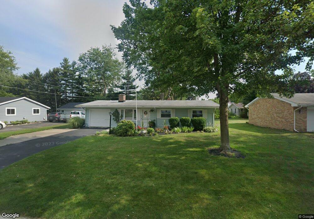
10651 Longnecker Rd Whitehouse, OH 43571
West Lucas County NeighborhoodEstimated Value: $162,000 - $240,000
3
Beds
1
Bath
1,008
Sq Ft
$193/Sq Ft
Est. Value
About This Home
This home is located at 10651 Longnecker Rd, Whitehouse, OH 43571 and is currently estimated at $195,031, approximately $193 per square foot. 10651 Longnecker Rd is a home located in Lucas County with nearby schools including Anthony Wayne High School and Lial Catholic School.
Ownership History
Date
Name
Owned For
Owner Type
Purchase Details
Closed on
Apr 19, 2004
Sold by
Telema Danny J and Telema Theresa F
Bought by
Kozlowski Eileen F
Current Estimated Value
Home Financials for this Owner
Home Financials are based on the most recent Mortgage that was taken out on this home.
Original Mortgage
$58,800
Outstanding Balance
$27,284
Interest Rate
5.46%
Mortgage Type
Purchase Money Mortgage
Estimated Equity
$167,747
Purchase Details
Closed on
Sep 16, 1991
Sold by
Kellar William D and Kellar Linda
Create a Home Valuation Report for This Property
The Home Valuation Report is an in-depth analysis detailing your home's value as well as a comparison with similar homes in the area
Home Values in the Area
Average Home Value in this Area
Purchase History
| Date | Buyer | Sale Price | Title Company |
|---|---|---|---|
| Kozlowski Eileen F | $110,900 | Northwest Title Agency Of Oh | |
| -- | $72,000 | -- |
Source: Public Records
Mortgage History
| Date | Status | Borrower | Loan Amount |
|---|---|---|---|
| Open | Kozlowski Eileen F | $58,800 |
Source: Public Records
Tax History Compared to Growth
Tax History
| Year | Tax Paid | Tax Assessment Tax Assessment Total Assessment is a certain percentage of the fair market value that is determined by local assessors to be the total taxable value of land and additions on the property. | Land | Improvement |
|---|---|---|---|---|
| 2024 | $870 | $44,975 | $12,040 | $32,935 |
| 2023 | $1,642 | $39,165 | $9,835 | $29,330 |
| 2022 | $1,681 | $39,165 | $9,835 | $29,330 |
| 2021 | $1,694 | $39,165 | $9,835 | $29,330 |
| 2020 | $1,456 | $32,130 | $7,980 | $24,150 |
| 2019 | $1,338 | $32,130 | $7,980 | $24,150 |
| 2018 | $1,262 | $32,130 | $7,980 | $24,150 |
| 2017 | $1,274 | $29,575 | $7,595 | $21,980 |
| 2016 | $1,260 | $84,500 | $21,700 | $62,800 |
| 2015 | $1,203 | $84,500 | $21,700 | $62,800 |
| 2014 | $1,202 | $29,300 | $7,530 | $21,770 |
| 2013 | $1,202 | $29,300 | $7,530 | $21,770 |
Source: Public Records
Map
Nearby Homes
- 7002 Red Stag Ct
- 6547 Lenderson Ave
- 6316 Pimlico Rd
- 6414 Lenderson Ave
- 6306 Weckerly Rd
- 10160 Blue Creek S
- 11149 West St
- 10751 Brexton Ct
- 6935 Big Buck Trail
- 10700 Brexton Ct
- 10706 Brexton Ct
- 10701 Brexton Ct
- 11158 Whitetail Way
- 11159 Whitetail Way
- 6715 Oakbrook Dr
- 6951 Red Stag Ct
- 6952 Red Stag Ct
- 7018 Red Stag Ct
- 11171 Whitetail Way
- 11500 Stiles Rd
- 10643 Longnecker Rd
- 6735 Indianapolis Ave
- 6743 Indianapolis Ave
- 10635 Longnecker Rd
- 6755 Indianapolis Ave
- 10654 Longnecker Rd
- 10622 Longnecker Rd
- 10636 Longnecker Rd
- 6765 Indianapolis Ave
- 10628 Longnecker Rd
- 10655 Babcock Dr
- 10645 Babcock Dr
- 6775 Indianapolis Ave
- 10637 Babcock Dr
- 10627 Babcock Dr
- 6755 Dennison Dr
- 10650 Waterville St
- 10642 Waterville St
- 10638 Waterville St
- 6717 Dennison Dr