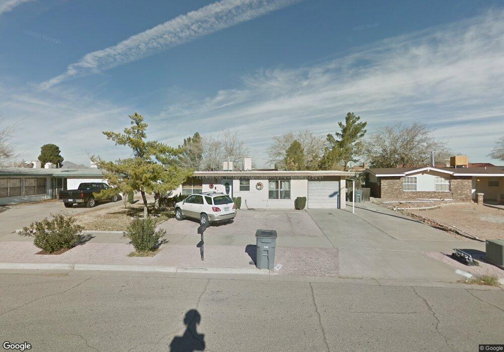
10653 Coralstone Dr El Paso, TX 79935
Pebble Hills NeighborhoodEstimated Value: $201,960 - $221,000
--
Bed
2
Baths
1,312
Sq Ft
$162/Sq Ft
Est. Value
About This Home
This home is located at 10653 Coralstone Dr, El Paso, TX 79935 and is currently estimated at $211,990, approximately $161 per square foot. 10653 Coralstone Dr is a home located in El Paso County with nearby schools including Robbin E L Washington Elementary School, J M Hanks High School, and New World Montessori School.
Ownership History
Date
Name
Owned For
Owner Type
Purchase Details
Closed on
Nov 30, 2000
Sold by
Dominguez Samuel B and Dominguez Leonor E
Bought by
Ingram Erwin K
Current Estimated Value
Home Financials for this Owner
Home Financials are based on the most recent Mortgage that was taken out on this home.
Original Mortgage
$64,000
Outstanding Balance
$30,582
Interest Rate
11.95%
Estimated Equity
$181,408
Purchase Details
Closed on
May 3, 1994
Sold by
Cisneros Henry G
Bought by
Dominguez Samuel B and Dominguez Leonor E
Home Financials for this Owner
Home Financials are based on the most recent Mortgage that was taken out on this home.
Original Mortgage
$61,950
Interest Rate
8.4%
Mortgage Type
FHA
Create a Home Valuation Report for This Property
The Home Valuation Report is an in-depth analysis detailing your home's value as well as a comparison with similar homes in the area
Home Values in the Area
Average Home Value in this Area
Purchase History
| Date | Buyer | Sale Price | Title Company |
|---|---|---|---|
| Ingram Erwin K | -- | -- | |
| Dominguez Samuel B | $62,500 | -- |
Source: Public Records
Mortgage History
| Date | Status | Borrower | Loan Amount |
|---|---|---|---|
| Open | Ingram Erwin K | $64,000 | |
| Previous Owner | Dominguez Samuel B | $61,950 |
Source: Public Records
Tax History Compared to Growth
Tax History
| Year | Tax Paid | Tax Assessment Tax Assessment Total Assessment is a certain percentage of the fair market value that is determined by local assessors to be the total taxable value of land and additions on the property. | Land | Improvement |
|---|---|---|---|---|
| 2025 | $1,983 | $178,736 | -- | -- |
| 2024 | $1,983 | $162,487 | -- | -- |
| 2023 | $1,891 | $147,715 | $0 | $0 |
| 2022 | $4,170 | $134,286 | $0 | $0 |
| 2021 | $3,968 | $125,125 | $21,575 | $103,550 |
| 2020 | $3,505 | $110,980 | $19,251 | $91,729 |
| 2018 | $3,425 | $110,129 | $19,251 | $90,878 |
| 2017 | $3,089 | $101,043 | $19,251 | $81,792 |
| 2016 | $3,089 | $101,043 | $19,251 | $81,792 |
| 2015 | $2,484 | $105,744 | $19,251 | $86,493 |
| 2014 | $2,484 | $106,024 | $19,251 | $86,773 |
Source: Public Records
Map
Nearby Homes
- 3425 Brookrock St
- 3400 Brookrock St
- 10602 Drillstone Dr
- 3369 Freeport Dr
- 3453 Guthrie St
- 10605 Kinross Ave Unit B
- 10816 Cardigan Dr
- 10405 Darin Rd
- 10649 Islerock Dr
- 3213 Isla Cocoa Ln
- 3332 Dungarvan Dr
- 3317 Dungarvan Dr
- 10216 Cardigan Dr
- 3345 Wexford Dr
- 3150 N Yarbrough Dr Unit A1
- 3318 Limerick Rd
- 10905 Sagebrush Way Unit A & B
- 3112 Eads Place
- 3324 Kilgore Place
- 3320 Tyrone Rd
- 10649 Coralstone Dr
- 10657 Coralstone Dr
- 10648 Birthstone Dr
- 10652 Birthstone Dr
- 10652 Birthstone Dr
- 10644 Birthstone Dr
- 10645 Coralstone Dr
- 10661 Coralstone Dr
- 10656 Birthstone Dr
- 10640 Birthstone Dr
- 10660 Coralstone Dr
- 10660 Coralstone Dr
- 3433 Brookrock St
- 3433 Brookrock St
- 10660 Birthstone Dr
- 10665 Coralstone Dr
- 10664 Coralstone Dr
- 10664 Birthstone Dr
- 3429 Brookrock St
- 10653 Birthstone Dr Unit 2