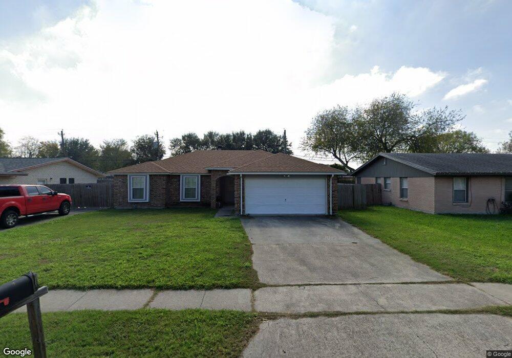
10655 Emmord Loop Corpus Christi, TX 78410
Northwest Corpus Christi NeighborhoodEstimated Value: $206,409 - $240,000
--
Bed
--
Bath
1,350
Sq Ft
$165/Sq Ft
Est. Value
About This Home
This home is located at 10655 Emmord Loop, Corpus Christi, TX 78410 and is currently estimated at $222,352, approximately $164 per square foot. 10655 Emmord Loop is a home located in Nueces County with nearby schools including Tuloso-Midway Primary School, Tuloso-Midway Intermediate School, and Tuloso-Midway Middle.
Ownership History
Date
Name
Owned For
Owner Type
Purchase Details
Closed on
Feb 29, 2008
Sold by
Elsner Ronald and Elsner Cheri L
Bought by
Garcia John
Current Estimated Value
Home Financials for this Owner
Home Financials are based on the most recent Mortgage that was taken out on this home.
Original Mortgage
$129,920
Outstanding Balance
$80,851
Interest Rate
5.72%
Mortgage Type
Purchase Money Mortgage
Estimated Equity
$141,501
Create a Home Valuation Report for This Property
The Home Valuation Report is an in-depth analysis detailing your home's value as well as a comparison with similar homes in the area
Home Values in the Area
Average Home Value in this Area
Purchase History
| Date | Buyer | Sale Price | Title Company |
|---|---|---|---|
| Garcia John | -- | San Jacinto Title Services |
Source: Public Records
Mortgage History
| Date | Status | Borrower | Loan Amount |
|---|---|---|---|
| Open | Garcia John | $129,920 |
Source: Public Records
Tax History Compared to Growth
Tax History
| Year | Tax Paid | Tax Assessment Tax Assessment Total Assessment is a certain percentage of the fair market value that is determined by local assessors to be the total taxable value of land and additions on the property. | Land | Improvement |
|---|---|---|---|---|
| 2025 | $2,556 | $207,585 | -- | -- |
| 2024 | $4,275 | $188,714 | $0 | $0 |
| 2023 | $2,249 | $171,558 | $0 | $0 |
| 2022 | $3,951 | $155,962 | $30,281 | $125,681 |
| 2021 | $4,105 | $155,854 | $30,281 | $125,573 |
| 2020 | $4,153 | $155,854 | $30,281 | $125,573 |
| 2019 | $4,420 | $157,250 | $30,281 | $126,969 |
| 2018 | $4,289 | $155,011 | $30,281 | $124,730 |
| 2017 | $4,107 | $146,877 | $30,281 | $116,596 |
| 2016 | $3,897 | $140,215 | $30,281 | $109,934 |
| 2015 | $2,562 | $126,695 | $17,906 | $108,789 |
| 2014 | $2,562 | $118,525 | $17,906 | $100,619 |
Source: Public Records
Map
Nearby Homes
- 10639 Emmord Loop
- 10614 Emmord Loop
- 10610 Hurst Dr
- 2838 Bridle Ln
- 10761 Emmord Loop
- 2838 Sage Brush Dr
- 10725 Westview Dr
- 10518 Heizer Dr
- 2742 Blue Grass Dr
- 4249 Starlite Ln
- 4241 Starlite Ln
- 3101 Creek Side Dr
- 3014 Stone Creek Dr
- Upton Plan at Woodside
- Lakeway Plan at Woodside
- 10313 Stone Creek Dr
- 10802 Timbergrove Ln
- 2729 Gold Rush Ln
- 10506 Hemlock Rd
- 3229 Creek Side Dr
- 10649 Emmord Loop
- 10659 Emmord Loop
- 10638 Outpost Dr
- 10642 Outpost Dr
- 10681 Emmord Loop
- 0 Emmord Loop
- 10630 Outpost Dr
- 10646 Outpost Dr
- 10634 Outpost Dr
- 10656 Emmord Loop
- 10650 Emmord Loop
- 10658 Emmord Loop
- 10660 Emmord Loop
- 10650 Outpost Dr
- 10662 Emmord Loop
- 10641 Emmord Loop
- 10652 Emmord Loop
- 10689 Emmord Loop