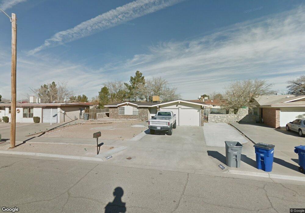
10657 Coralstone Dr El Paso, TX 79935
Pebble Hills NeighborhoodEstimated Value: $210,000 - $233,000
3
Beds
2
Baths
1,313
Sq Ft
$165/Sq Ft
Est. Value
About This Home
This home is located at 10657 Coralstone Dr, El Paso, TX 79935 and is currently estimated at $217,275, approximately $165 per square foot. 10657 Coralstone Dr is a home located in El Paso County with nearby schools including Robbin E L Washington Elementary School, J M Hanks High School, and New World Montessori School.
Ownership History
Date
Name
Owned For
Owner Type
Purchase Details
Closed on
Dec 26, 2013
Sold by
Trejo John P and Merrick Carrie Lynn
Bought by
Trejo John P
Current Estimated Value
Home Financials for this Owner
Home Financials are based on the most recent Mortgage that was taken out on this home.
Original Mortgage
$82,150
Outstanding Balance
$42,794
Interest Rate
4.26%
Mortgage Type
Credit Line Revolving
Estimated Equity
$174,481
Purchase Details
Closed on
May 4, 1998
Sold by
Fortenbery Dixie M
Bought by
Terjo John P and Merrick Carrie Lynn
Home Financials for this Owner
Home Financials are based on the most recent Mortgage that was taken out on this home.
Original Mortgage
$59,714
Interest Rate
7.09%
Mortgage Type
FHA
Create a Home Valuation Report for This Property
The Home Valuation Report is an in-depth analysis detailing your home's value as well as a comparison with similar homes in the area
Home Values in the Area
Average Home Value in this Area
Purchase History
| Date | Buyer | Sale Price | Title Company |
|---|---|---|---|
| Trejo John P | -- | None Available | |
| Terjo John P | -- | -- |
Source: Public Records
Mortgage History
| Date | Status | Borrower | Loan Amount |
|---|---|---|---|
| Open | Trejo John P | $82,150 | |
| Closed | Terjo John P | $59,714 |
Source: Public Records
Tax History Compared to Growth
Tax History
| Year | Tax Paid | Tax Assessment Tax Assessment Total Assessment is a certain percentage of the fair market value that is determined by local assessors to be the total taxable value of land and additions on the property. | Land | Improvement |
|---|---|---|---|---|
| 2025 | $2,925 | $186,814 | -- | -- |
| 2024 | $2,925 | $169,831 | -- | -- |
| 2023 | $2,702 | $154,392 | $0 | $0 |
| 2022 | $4,359 | $140,356 | $0 | $0 |
| 2021 | $4,148 | $130,794 | $22,300 | $108,494 |
| 2020 | $3,664 | $115,996 | $19,899 | $96,097 |
| 2018 | $3,579 | $115,103 | $19,899 | $95,204 |
| 2017 | $3,227 | $105,582 | $19,899 | $85,683 |
| 2016 | $3,227 | $105,582 | $19,899 | $85,683 |
| 2015 | $2,606 | $110,506 | $19,899 | $90,607 |
| 2014 | $2,606 | $110,760 | $19,899 | $90,861 |
Source: Public Records
Map
Nearby Homes
- 3425 Brookrock St
- 3400 Brookrock St
- 3369 Freeport Dr
- 3453 Guthrie St
- 10602 Drillstone Dr
- 10816 Cardigan Dr
- 10605 Kinross Ave Unit B
- 10649 Islerock Dr
- 10405 Darin Rd
- 3213 Isla Cocoa Ln
- 10905 Sagebrush Way Unit A & B
- 3332 Dungarvan Dr
- 3324 Kilgore Place
- 3317 Dungarvan Dr
- 10216 Cardigan Dr
- 3112 Eads Place
- 3345 Wexford Dr
- 3150 N Yarbrough Dr Unit A1
- 3318 Limerick Rd
- 3320 Tyrone Rd
- 10661 Coralstone Dr
- 10653 Coralstone Dr
- 10652 Birthstone Dr
- 10652 Birthstone Dr
- 10656 Birthstone Dr
- 10648 Birthstone Dr
- 10665 Coralstone Dr
- 10660 Birthstone Dr
- 10649 Coralstone Dr
- 10660 Coralstone Dr
- 10660 Coralstone Dr
- 10644 Birthstone Dr
- 10664 Birthstone Dr
- 10664 Coralstone Dr
- 10669 Coralstone Dr
- 10645 Coralstone Dr
- 10666 Coralstone Dr
- 3433 Brookrock St
- 3433 Brookrock St
- 10668 Birthstone Dr