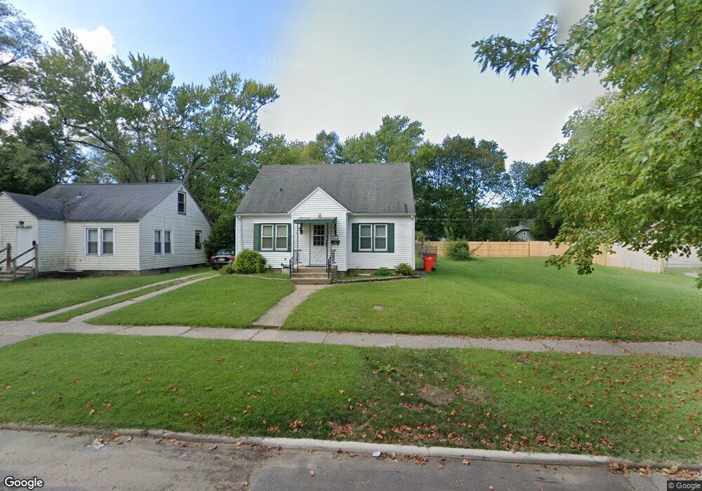
1066 Monroe St Benton Harbor, MI 49022
Estimated Value: $60,000 - $99,599
3
Beds
1
Bath
975
Sq Ft
$84/Sq Ft
Est. Value
About This Home
This home is located at 1066 Monroe St, Benton Harbor, MI 49022 and is currently estimated at $81,650, approximately $83 per square foot. 1066 Monroe St is a home located in Berrien County with nearby schools including Fair Plain Middle School, Benton Harbor High School, and Benton Harbor Charter School Academy.
Ownership History
Date
Name
Owned For
Owner Type
Purchase Details
Closed on
Sep 19, 2023
Sold by
Jeffries Milo Scott
Bought by
Cal-Sal Investments Llc
Current Estimated Value
Purchase Details
Closed on
Sep 3, 2021
Sold by
Jeffries Tiacy A
Bought by
Jeffries Milo
Purchase Details
Closed on
Sep 6, 2018
Sold by
Schaffer D Elaine
Bought by
Jefferies Wmilo and Jefferies Tracy
Purchase Details
Closed on
Jun 15, 2015
Sold by
George Carl D and George Alice L
Bought by
George Alice L and Elaine Schaefer D
Purchase Details
Closed on
Jun 11, 1991
Purchase Details
Closed on
Jun 19, 1963
Create a Home Valuation Report for This Property
The Home Valuation Report is an in-depth analysis detailing your home's value as well as a comparison with similar homes in the area
Home Values in the Area
Average Home Value in this Area
Purchase History
| Date | Buyer | Sale Price | Title Company |
|---|---|---|---|
| Cal-Sal Investments Llc | -- | None Listed On Document | |
| Jeffries Milo | -- | None Available | |
| Jefferies Wmilo | $32,000 | First American Title | |
| George Alice L | -- | None Available | |
| -- | $12,500 | -- | |
| -- | $12,500 | -- |
Source: Public Records
Tax History
| Year | Tax Paid | Tax Assessment Tax Assessment Total Assessment is a certain percentage of the fair market value that is determined by local assessors to be the total taxable value of land and additions on the property. | Land | Improvement |
|---|---|---|---|---|
| 2025 | $995 | $31,300 | $0 | $0 |
| 2024 | $958 | $27,600 | $0 | $0 |
| 2023 | $766 | $19,400 | $0 | $0 |
| 2022 | $869 | $14,400 | $0 | $0 |
| 2021 | $891 | $14,200 | $700 | $13,500 |
| 2020 | $890 | $15,700 | $0 | $0 |
| 2019 | $874 | $13,900 | $0 | $0 |
| 2018 | $589 | $13,800 | $0 | $0 |
| 2017 | $577 | $16,200 | $0 | $0 |
| 2016 | $0 | $0 | $0 | $0 |
| 2015 | $566 | $13,500 | $0 | $0 |
| 2014 | $527 | $16,400 | $0 | $0 |
Source: Public Records
Map
Nearby Homes
Your Personal Tour Guide
Ask me questions while you tour the home.