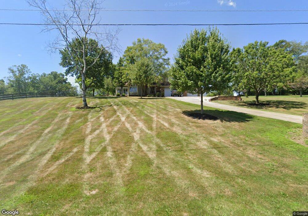
1066 Rainbow Cir NW Unit 83 Carrollton, OH 44615
Estimated Value: $425,055 - $475,000
3
Beds
4
Baths
3,838
Sq Ft
$120/Sq Ft
Est. Value
About This Home
This home is located at 1066 Rainbow Cir NW Unit 83, Carrollton, OH 44615 and is currently estimated at $459,514, approximately $119 per square foot. 1066 Rainbow Cir NW Unit 83 is a home located in Carroll County with nearby schools including Carrollton High School and Carroll County Christian Academy.
Ownership History
Date
Name
Owned For
Owner Type
Purchase Details
Closed on
Jul 2, 2019
Sold by
Guess Real Estate Development Ltd
Bought by
Cole Joshua S and Cole Morgan E
Current Estimated Value
Purchase Details
Closed on
Jul 20, 2018
Sold by
Miller John P and Miller Darlene Denise
Bought by
Cole Joshua S and Cole Morgan E
Home Financials for this Owner
Home Financials are based on the most recent Mortgage that was taken out on this home.
Original Mortgage
$205,000
Interest Rate
4.5%
Mortgage Type
New Conventional
Create a Home Valuation Report for This Property
The Home Valuation Report is an in-depth analysis detailing your home's value as well as a comparison with similar homes in the area
Home Values in the Area
Average Home Value in this Area
Purchase History
| Date | Buyer | Sale Price | Title Company |
|---|---|---|---|
| Cole Joshua S | $8,000 | None Available | |
| Cole Joshua S | $295,000 | None Available |
Source: Public Records
Mortgage History
| Date | Status | Borrower | Loan Amount |
|---|---|---|---|
| Previous Owner | Cole Joshua S | $205,000 |
Source: Public Records
Tax History Compared to Growth
Tax History
| Year | Tax Paid | Tax Assessment Tax Assessment Total Assessment is a certain percentage of the fair market value that is determined by local assessors to be the total taxable value of land and additions on the property. | Land | Improvement |
|---|---|---|---|---|
| 2024 | $4,146 | $121,470 | $11,600 | $109,870 |
| 2023 | $4,118 | $121,470 | $11,600 | $109,870 |
| 2022 | $4,088 | $100,810 | $9,630 | $91,180 |
| 2021 | $3,509 | $100,810 | $9,630 | $91,180 |
| 2020 | $3,339 | $100,810 | $9,630 | $91,180 |
| 2019 | $3,366 | $100,807 | $9,625 | $91,182 |
| 2018 | $2,441 | $70,190 | $9,540 | $60,650 |
| 2017 | $2,281 | $70,190 | $9,540 | $60,650 |
| 2016 | $2,204 | $66,950 | $8,750 | $58,200 |
| 2015 | $2,204 | $66,950 | $8,750 | $58,200 |
| 2014 | $2,204 | $66,950 | $8,750 | $58,200 |
| 2013 | $2,185 | $66,950 | $8,750 | $58,200 |
Source: Public Records
Map
Nearby Homes
- 615 Longhorn St NW Unit 20B
- 307 Lincoln Ave NW Unit 36
- 819 Courtview Dr SW Unit 81
- 1344 Meadowbrook Ln NE Unit 82
- 208 2nd St SW Unit 5
- 1188 Brenner Rd NE Unit 33A
- 238 High St SW Unit 3A
- 0 Mayham Rd NE
- 121 Waynesburg Rd NW Unit 4A
- 928 Overlook Ln NE
- 3044 Jasmine Rd NW Unit 11
- 2081 Waynesburg Rd NW Unit 16
- 144 Arrow Rd SW Unit 19
- 2173 Arrow Rd NW Unit 22
- 4177 Lunar Rd NE
- 0 Kensington Rd NE Unit 5168580
- 3190 Kensington Rd NE
- 2081 Antigua Rd SW Unit 17
- 2245 Scroll Rd SW Unit 17
- 3366 Bronze Rd NW
- 1072 Rainbow Cir NW Unit 83
- 1054 Rainbow Cir NW Unit 83
- 1047 Rainbow Cir NW Unit 83
- 1004 Fisherman Rd NW
- 1087 Countryside Dr NW Unit 88
- 1046 Rainbow Cir NW Unit 83
- 1053 Rainbow Cir NW Unit 83
- 1078 Rainbow Cir NW Unit 83
- 1018 Fisherman Rd NW Unit 3
- 1026 Fisherman Rd NW Unit 3
- 119 N Star St NW Unit 83
- 1075 Countryside Dr NW Unit 84
- 1028 Fisherman Rd NW Unit 3
- 1028 Fisherman Rd NW
- 1094 Countryside Dr NW
- 125 N Star St NW Unit 83
- 111 N Star St NW Unit 83
- 1069 Countryside Dr NW
- 1076 Countryside Dr NW Unit 84
- 131 N Star St NW Unit 83