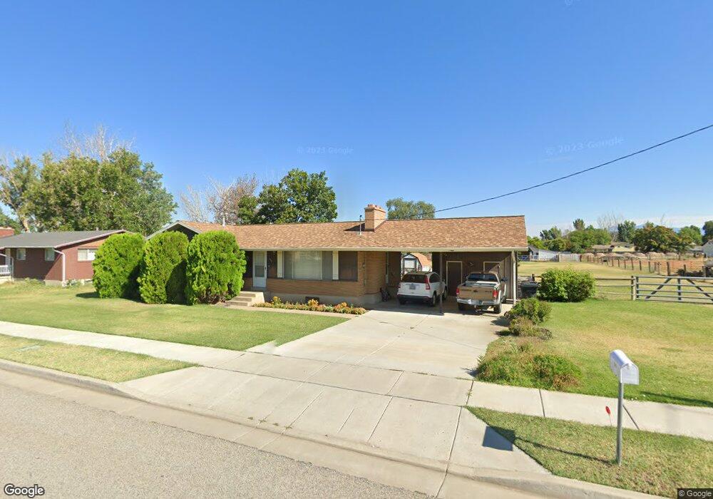
1066 W 800 N Clearfield, UT 84015
Estimated Value: $439,000 - $487,000
3
Beds
1
Bath
1,225
Sq Ft
$384/Sq Ft
Est. Value
About This Home
This home is located at 1066 W 800 N, Clearfield, UT 84015 and is currently estimated at $470,387, approximately $383 per square foot. 1066 W 800 N is a home located in Davis County with nearby schools including Clinton Elementary School, Sunset Junior High School, and Clearfield High School.
Ownership History
Date
Name
Owned For
Owner Type
Purchase Details
Closed on
Dec 16, 2011
Sold by
Mills Kathey A and Mcfarland Parley B
Bought by
Mills Eugene A and Mills Kathey
Current Estimated Value
Home Financials for this Owner
Home Financials are based on the most recent Mortgage that was taken out on this home.
Original Mortgage
$105,000
Interest Rate
3.94%
Mortgage Type
New Conventional
Purchase Details
Closed on
Mar 4, 1999
Sold by
Mcfarland Parley B
Bought by
Mcfarland Parley B
Create a Home Valuation Report for This Property
The Home Valuation Report is an in-depth analysis detailing your home's value as well as a comparison with similar homes in the area
Home Values in the Area
Average Home Value in this Area
Purchase History
| Date | Buyer | Sale Price | Title Company |
|---|---|---|---|
| Mills Eugene A | -- | First American Title | |
| Mcfarland Parley B | -- | -- |
Source: Public Records
Mortgage History
| Date | Status | Borrower | Loan Amount |
|---|---|---|---|
| Closed | Mills Eugene A | $105,000 |
Source: Public Records
Tax History
| Year | Tax Paid | Tax Assessment Tax Assessment Total Assessment is a certain percentage of the fair market value that is determined by local assessors to be the total taxable value of land and additions on the property. | Land | Improvement |
|---|---|---|---|---|
| 2025 | $2,465 | $237,050 | $155,000 | $82,050 |
| 2024 | $2,356 | $227,700 | $161,979 | $65,721 |
| 2023 | $2,030 | $363,000 | $199,217 | $163,783 |
| 2022 | $2,146 | $212,300 | $104,288 | $108,012 |
| 2021 | $1,928 | $283,000 | $161,122 | $121,878 |
| 2020 | $1,687 | $245,000 | $156,090 | $88,910 |
| 2019 | $1,684 | $239,000 | $148,146 | $90,854 |
| 2018 | $1,557 | $217,000 | $121,177 | $95,823 |
| 2016 | $1,307 | $94,105 | $50,681 | $43,424 |
| 2015 | $1,237 | $84,645 | $50,681 | $33,964 |
| 2014 | $1,134 | $78,847 | $50,681 | $28,166 |
| 2013 | -- | $84,627 | $39,937 | $44,690 |
Source: Public Records
Map
Nearby Homes
Your Personal Tour Guide
Ask me questions while you tour the home.