Estimated Value: $870,838 - $1,027,000
3
Beds
2
Baths
2,225
Sq Ft
$416/Sq Ft
Est. Value
About This Home
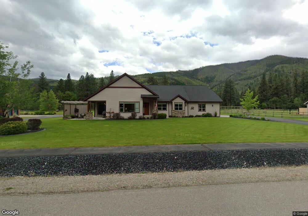
This home is located at 10660 Nez Perce Loop, Lolo, MT 59847 and is currently estimated at $926,210, approximately $416 per square foot. 10660 Nez Perce Loop is a home located in Missoula County with nearby schools including Lolo Elementary School, Lolo Middle School, and Sentinel High School.
Ownership History
Date
Name
Owned For
Owner Type
Purchase Details
Closed on
Jul 19, 2007
Sold by
Schultz Construction Inc
Bought by
White Calvin R and White Carol L
Current Estimated Value
Home Financials for this Owner
Home Financials are based on the most recent Mortgage that was taken out on this home.
Original Mortgage
$331,000
Outstanding Balance
$201,422
Interest Rate
6%
Mortgage Type
Unknown
Estimated Equity
$724,788
Create a Home Valuation Report for This Property
The Home Valuation Report is an in-depth analysis detailing your home's value as well as a comparison with similar homes in the area
Purchase History
| Date | Buyer | Sale Price | Title Company |
|---|---|---|---|
| White Calvin R | -- | Pte |
Source: Public Records
Mortgage History
| Date | Status | Borrower | Loan Amount |
|---|---|---|---|
| Open | White Calvin R | $331,000 |
Source: Public Records
Tax History
| Year | Tax Paid | Tax Assessment Tax Assessment Total Assessment is a certain percentage of the fair market value that is determined by local assessors to be the total taxable value of land and additions on the property. | Land | Improvement |
|---|---|---|---|---|
| 2025 | $7,523 | $940,300 | $208,500 | $731,800 |
| 2024 | $8,733 | $756,200 | $138,300 | $617,900 |
| 2023 | $7,455 | $756,200 | $138,300 | $617,900 |
| 2022 | $6,542 | $553,600 | $0 | $0 |
| 2021 | $5,828 | $553,600 | $0 | $0 |
| 2020 | $5,422 | $501,590 | $0 | $0 |
| 2019 | $5,388 | $501,590 | $0 | $0 |
| 2018 | $4,229 | $403,100 | $0 | $0 |
| 2017 | $4,262 | $403,100 | $0 | $0 |
| 2016 | $4,382 | $419,200 | $0 | $0 |
| 2015 | $4,199 | $419,200 | $0 | $0 |
| 2014 | $4,082 | $226,681 | $0 | $0 |
Source: Public Records
Map
Nearby Homes
- Nhn Nez Perce Loop
- 10636 Nez Perce Loop
- 10596 Nez Perce Loop
- 10131 Barns Ct
- 12196 Cowcatcher Dr
- 9883 Hatton Ln
- 9745 U S 12
- 11625 Highway 12 W
- 11327 Sleeman Ln
- 9280 Mormon Creek Rd
- 8350 Vann Dr
- 10200 Sleeman Creek Rd
- 12326 Nature Ct
- 12458 Nature Ct
- 15100 Rock Ridge Rd
- 12819 Anchor Rd
- 261 Capdevilla
- 6896 Jack Pine Ct
- 16485 Folsom Rd
- 10291 Coulter Pine St
- 10678 Nez Perce Loop
- 10677 Nez Perce Loop
- 10692 Nez Perce Loop
- 10587 Nez Perce Loop
- Lot 21 Nez Perce Loop
- LOT 24 Nez Perce Loop
- LOT 32 Nez Perce Loop
- Lot 5 Nez Perce Loop
- Lot 36 Nez Perce Loop
- Lot 21& 22 Nez Perce Loop
- 10550 Highway 12 W
- 10550 Highway 12 W
- 10569 Nez Perce Loop
- 12773 Conestoga Way
- 12773 Conestoga Way
- 10450 Highway 12 W
- 12780 Conestoga Way
- 10650 Allen Ln
- Lot 22 Nez Perce Loop
- 10551 Nez Perce Loop
Your Personal Tour Guide
Ask me questions while you tour the home.