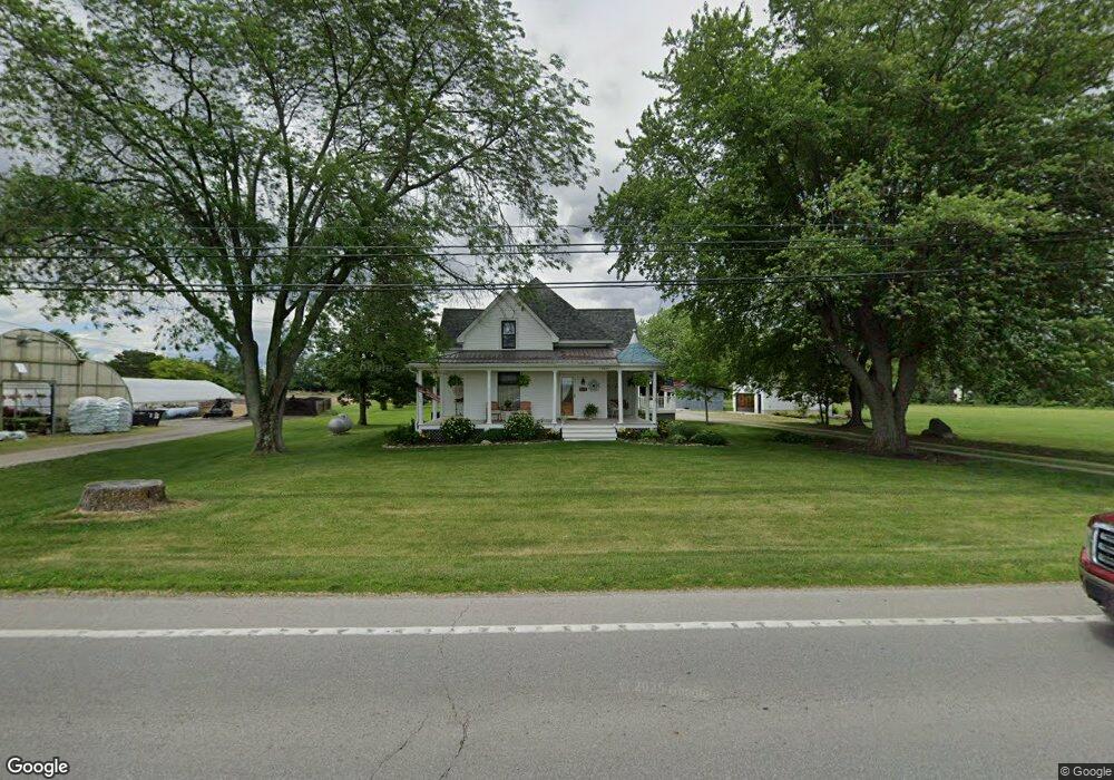
10661 Us Highway 22 and 3 Sabina, OH 45169
Estimated Value: $454,000 - $600,000
3
Beds
2
Baths
1,973
Sq Ft
$258/Sq Ft
Est. Value
About This Home
This home is located at 10661 Us Highway 22 and 3, Sabina, OH 45169 and is currently estimated at $509,166, approximately $258 per square foot. 10661 Us Highway 22 and 3 is a home located in Clinton County with nearby schools including East Clinton High School.
Ownership History
Date
Name
Owned For
Owner Type
Purchase Details
Closed on
Aug 13, 2025
Sold by
Ohearn Timothy D and Pappas Tammy J
Bought by
Manley Corey J and Manley Stefanie L
Current Estimated Value
Home Financials for this Owner
Home Financials are based on the most recent Mortgage that was taken out on this home.
Original Mortgage
$24,750
Outstanding Balance
$22,337
Interest Rate
6.72%
Mortgage Type
New Conventional
Estimated Equity
$486,829
Purchase Details
Closed on
Jan 9, 2018
Sold by
Fannie Mae
Bought by
Hearn Timothy D O and Pappas Tammy J
Purchase Details
Closed on
Nov 6, 2017
Sold by
Forsha Kevin J and Forsha Shandra L
Bought by
Federal National Mortgage Association and Fannie Mae
Purchase Details
Closed on
Jul 31, 1997
Bought by
Forsha Kevin J and Forsha Shandra L
Create a Home Valuation Report for This Property
The Home Valuation Report is an in-depth analysis detailing your home's value as well as a comparison with similar homes in the area
Home Values in the Area
Average Home Value in this Area
Purchase History
| Date | Buyer | Sale Price | Title Company |
|---|---|---|---|
| Manley Corey J | $577,500 | None Listed On Document | |
| Hearn Timothy D O | -- | None Available | |
| Federal National Mortgage Association | $60,000 | None Available | |
| Forsha Kevin J | $109,800 | -- |
Source: Public Records
Mortgage History
| Date | Status | Borrower | Loan Amount |
|---|---|---|---|
| Open | Manley Corey J | $24,750 | |
| Open | Manley Corey J | $486,034 |
Source: Public Records
Tax History Compared to Growth
Tax History
| Year | Tax Paid | Tax Assessment Tax Assessment Total Assessment is a certain percentage of the fair market value that is determined by local assessors to be the total taxable value of land and additions on the property. | Land | Improvement |
|---|---|---|---|---|
| 2024 | $3,289 | $84,630 | $30,310 | $54,320 |
| 2023 | $3,289 | $84,630 | $30,310 | $54,320 |
| 2022 | $2,063 | $45,210 | $12,370 | $32,840 |
| 2021 | $2,113 | $45,210 | $12,370 | $32,840 |
| 2020 | $2,118 | $45,210 | $12,370 | $32,840 |
| 2019 | $1,806 | $37,480 | $12,380 | $25,100 |
| 2018 | $1,580 | $37,480 | $12,380 | $25,100 |
| 2017 | $1,245 | $37,480 | $12,380 | $25,100 |
| 2016 | $1,248 | $37,830 | $14,310 | $23,520 |
| 2015 | $1,270 | $37,830 | $14,310 | $23,520 |
| 2013 | $1,317 | $37,830 | $14,310 | $23,520 |
Source: Public Records
Map
Nearby Homes
- 585 Florence Ave
- 400 Grand Ave
- 62 Union St
- 339 W Mound St
- 323 W Mound St
- 285 S Howard St
- 241 Roshon Ave
- 612 Darbyshire Rd
- 320 San Mar Gale Dr
- 42 Trahera Ln
- 729 N State Route 729
- 154 Eden Ave
- 591 Burnett Rd
- 350 Dakin Chapel Rd
- 653 Burnett Rd
- 32 Weller St
- 1393 S State Route 72
- 51 Cline Rd
- 719 Reed Rd
- 1365 Weaver Rd
- 640 Grand Ave
- 624 Grand Ave
- 653 Grand Ave
- 614 Grand Ave
- 647 Grand Ave
- 608 Grand Ave
- 641 Grand Ave
- 629 Grand Ave
- 598 Grand Ave
- 619 Grand Ave
- 658 Florence Ave
- 586 Grand Ave
- 650 Florence Ave
- 605 Grand Ave
- 640 Florence Ave
- 630 Florence Ave
- 597 Grand Ave
- 620 Florence Ave
- 561 W Washington St
- 587 Grand Ave