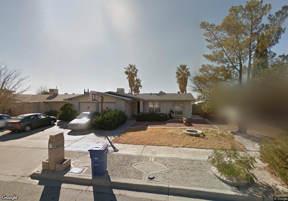
10668 Coralstone Dr El Paso, TX 79935
Pebble Hills NeighborhoodEstimated Value: $224,000 - $245,000
4
Beds
2
Baths
1,522
Sq Ft
$154/Sq Ft
Est. Value
About This Home
This home is located at 10668 Coralstone Dr, El Paso, TX 79935 and is currently estimated at $234,678, approximately $154 per square foot. 10668 Coralstone Dr is a home located in El Paso County with nearby schools including Robbin E L Washington Elementary School, J M Hanks High School, and New World Montessori School.
Ownership History
Date
Name
Owned For
Owner Type
Purchase Details
Closed on
Aug 14, 2021
Sold by
Dela Isla Carmen R and De La Isla
Bought by
Dela Isla Jr Salvador and De La Isla
Current Estimated Value
Purchase Details
Closed on
Jan 17, 2017
Sold by
Isla Carmen R La
Bought by
Isla Salvador D La and Isla Carmen R La
Home Financials for this Owner
Home Financials are based on the most recent Mortgage that was taken out on this home.
Original Mortgage
$77,989
Outstanding Balance
$52,139
Interest Rate
4.3%
Mortgage Type
New Conventional
Estimated Equity
$182,539
Purchase Details
Closed on
Aug 6, 2002
Sold by
Bryant Lynda R
Bought by
Delaisla Carmen
Home Financials for this Owner
Home Financials are based on the most recent Mortgage that was taken out on this home.
Original Mortgage
$81,000
Interest Rate
6.53%
Create a Home Valuation Report for This Property
The Home Valuation Report is an in-depth analysis detailing your home's value as well as a comparison with similar homes in the area
Home Values in the Area
Average Home Value in this Area
Purchase History
| Date | Buyer | Sale Price | Title Company |
|---|---|---|---|
| Dela Isla Jr Salvador | -- | None Available | |
| Isla Salvador D La | -- | None Available | |
| Delaisla Carmen | -- | -- |
Source: Public Records
Mortgage History
| Date | Status | Borrower | Loan Amount |
|---|---|---|---|
| Open | Isla Salvador D La | $77,989 | |
| Closed | Delaisla Carmen | $81,000 |
Source: Public Records
Tax History Compared to Growth
Tax History
| Year | Tax Paid | Tax Assessment Tax Assessment Total Assessment is a certain percentage of the fair market value that is determined by local assessors to be the total taxable value of land and additions on the property. | Land | Improvement |
|---|---|---|---|---|
| 2025 | $2,158 | $193,213 | -- | -- |
| 2024 | $2,158 | $174,049 | -- | -- |
| 2023 | $2,062 | $158,226 | $0 | $0 |
| 2022 | $4,467 | $143,842 | $0 | $0 |
| 2021 | $4,251 | $150,702 | $20,952 | $129,750 |
| 2020 | $3,755 | $118,877 | $18,696 | $100,181 |
| 2018 | $3,706 | $119,178 | $18,696 | $100,482 |
| 2017 | $3,361 | $109,956 | $18,696 | $91,260 |
| 2016 | $3,361 | $109,956 | $18,696 | $91,260 |
| 2015 | $2,268 | $115,201 | $18,696 | $96,505 |
| 2014 | $2,268 | $115,842 | $18,696 | $97,146 |
Source: Public Records
Map
Nearby Homes
- 3425 Brookrock St
- 3400 Brookrock St
- 3369 Freeport Dr
- 3453 Guthrie St
- 10602 Drillstone Dr
- 10816 Cardigan Dr
- 10605 Kinross Ave Unit B
- 10649 Islerock Dr
- 10405 Darin Rd
- 3213 Isla Cocoa Ln
- 10905 Sagebrush Way Unit A & B
- 3332 Dungarvan Dr
- 3324 Kilgore Place
- 3317 Dungarvan Dr
- 10216 Cardigan Dr
- 3112 Eads Place
- 3345 Wexford Dr
- 3150 N Yarbrough Dr Unit A1
- 3318 Limerick Rd
- 3320 Tyrone Rd
- 10672 Coralstone Dr
- 10666 Coralstone Dr
- 3425 Dial Rock Ln
- 3429 Dial Rock Ln
- 10676 Coralstone Dr
- 10664 Coralstone Dr
- 10673 Coralstone Dr
- 10669 Coralstone Dr
- 3428 Brookrock St
- 3431 Dial Rock Ln
- 10677 Coralstone Dr
- 10680 Coralstone Dr
- 10665 Coralstone Dr
- 3421 Dial Rock Ln
- 3424 Brookrock St
- 3421 Dialrock Ln
- 10660 Coralstone Dr
- 10660 Coralstone Dr
- 10681 Coralstone Dr
- 10661 Coralstone Dr