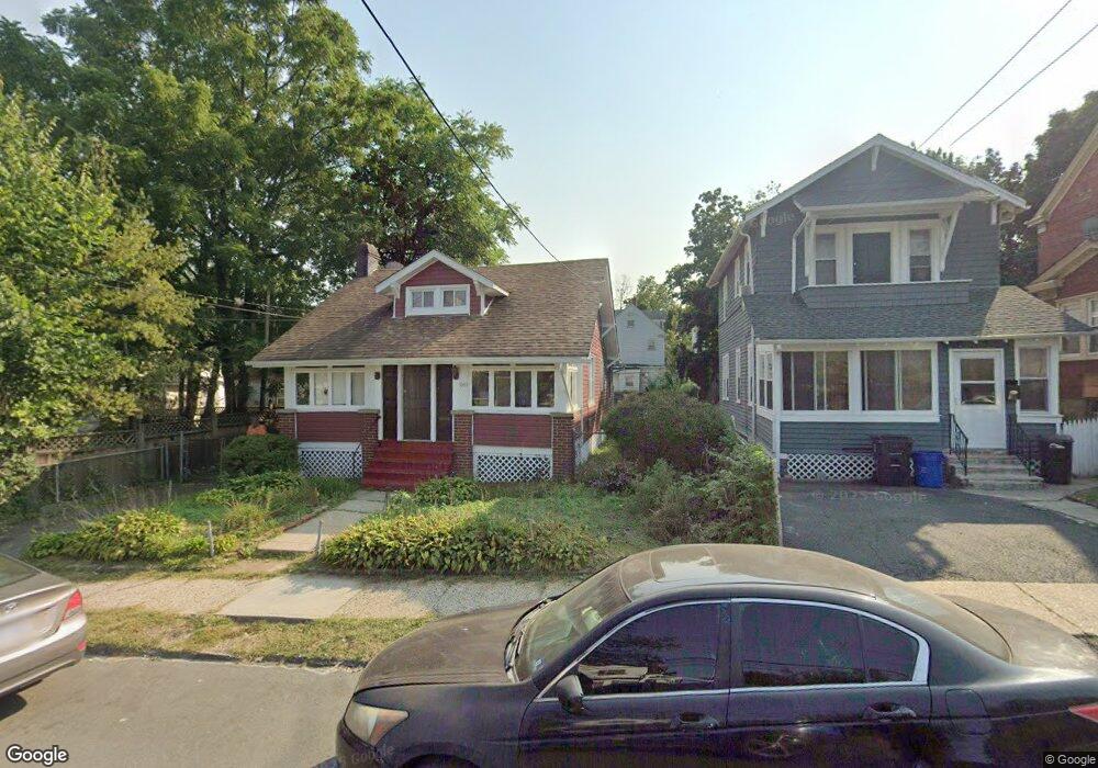
1067 18th Ave Unit 1069 Newark, NJ 07106
Lower Vailsburg NeighborhoodEstimated Value: $390,000 - $483,000
Studio
--
Bath
1,833
Sq Ft
$244/Sq Ft
Est. Value
About This Home
This home is located at 1067 18th Ave Unit 1069, Newark, NJ 07106 and is currently estimated at $447,666, approximately $244 per square foot. 1067 18th Ave Unit 1069 is a home located in Essex County with nearby schools including Lincoln Elementary School, Mt. Vernon School, and Hawthorne Avenue Elementary School.
Ownership History
Date
Name
Owned For
Owner Type
Purchase Details
Closed on
Jul 27, 2001
Sold by
Roystre Frederick
Bought by
Fernandez Keithroy and Fernandez Vernie
Current Estimated Value
Home Financials for this Owner
Home Financials are based on the most recent Mortgage that was taken out on this home.
Original Mortgage
$103,276
Outstanding Balance
$40,315
Interest Rate
7.16%
Mortgage Type
FHA
Estimated Equity
$407,351
Purchase Details
Closed on
Apr 25, 1996
Sold by
Goodman Lottie
Bought by
Royster Frederick
Create a Home Valuation Report for This Property
The Home Valuation Report is an in-depth analysis detailing your home's value as well as a comparison with similar homes in the area
Home Values in the Area
Average Home Value in this Area
Purchase History
| Date | Buyer | Sale Price | Title Company |
|---|---|---|---|
| Fernandez Keithroy | $104,000 | -- | |
| -- | $104,900 | -- | |
| Royster Frederick | $64,000 | -- |
Source: Public Records
Mortgage History
| Date | Status | Borrower | Loan Amount |
|---|---|---|---|
| Open | -- | $103,276 |
Source: Public Records
Tax History
| Year | Tax Paid | Tax Assessment Tax Assessment Total Assessment is a certain percentage of the fair market value that is determined by local assessors to be the total taxable value of land and additions on the property. | Land | Improvement |
|---|---|---|---|---|
| 2025 | $5,218 | $137,200 | $17,400 | $119,800 |
| 2024 | $5,115 | $137,200 | $17,400 | $119,800 |
| 2022 | $5,126 | $137,200 | $17,400 | $119,800 |
| 2021 | $5,123 | $137,200 | $17,400 | $119,800 |
| 2020 | $5,214 | $137,200 | $17,400 | $119,800 |
| 2019 | $5,160 | $137,200 | $17,400 | $119,800 |
| 2018 | $5,067 | $137,200 | $17,400 | $119,800 |
| 2017 | $4,884 | $137,200 | $17,400 | $119,800 |
| 2016 | $4,720 | $137,200 | $17,400 | $119,800 |
| 2015 | $4,540 | $137,200 | $17,400 | $119,800 |
| 2014 | $4,255 | $137,200 | $17,400 | $119,800 |
Source: Public Records
Map
Nearby Homes
- 1081 18th Ave
- 10 Lenox St
- 42 Mead St
- 14 Helen Place
- 164 Stuyvesant Ave
- 575-577 Sanford Ave
- 182 Norwood St
- 23-25 Varsity Rd
- 42 Richelieu Place Unit 44
- 553 Sanford Ave
- 44 Richelieu Place
- 206-212 Brookdale Ave
- 163-165 Brookdale Ave
- 68 Richelieu Place Unit 70
- 68-70 Richelieu Place
- 71-73 Lindsley Ave
- 71 Lindsley Ave
- 34 Cleveland Ave
- 50 Unity Ave
- 184 Sunset Ave
- 1071 18th Ave
- 1073 18th Ave Unit 1075
- 87 Mead St Unit 89
- 91 Mead St
- 91 Mead St
- 91 Mead St Unit A
- 91 Mead St
- 1077 18th Ave
- 41 Commonwealth Ave Unit 43
- 45 Commonwealth Ave Unit 47
- 93 Mead St Unit 95
- 45-47 Commonwealth Ave
- 1079 18th Ave
- 97 Mead St Unit 101
- 97-101 Mead St
- 49 Commonwealth Ave Unit 51
- 1072 18th Ave Unit 1074
- 1070 18th Ave
- 79 Mead St Unit 81
- 53 Commonwealth Ave
Your Personal Tour Guide
Ask me questions while you tour the home.