D
Seller's Agent in 2025
Diane Foster
Century 21 Signature Real Estate
(641) 990-1210
12 Total Sales
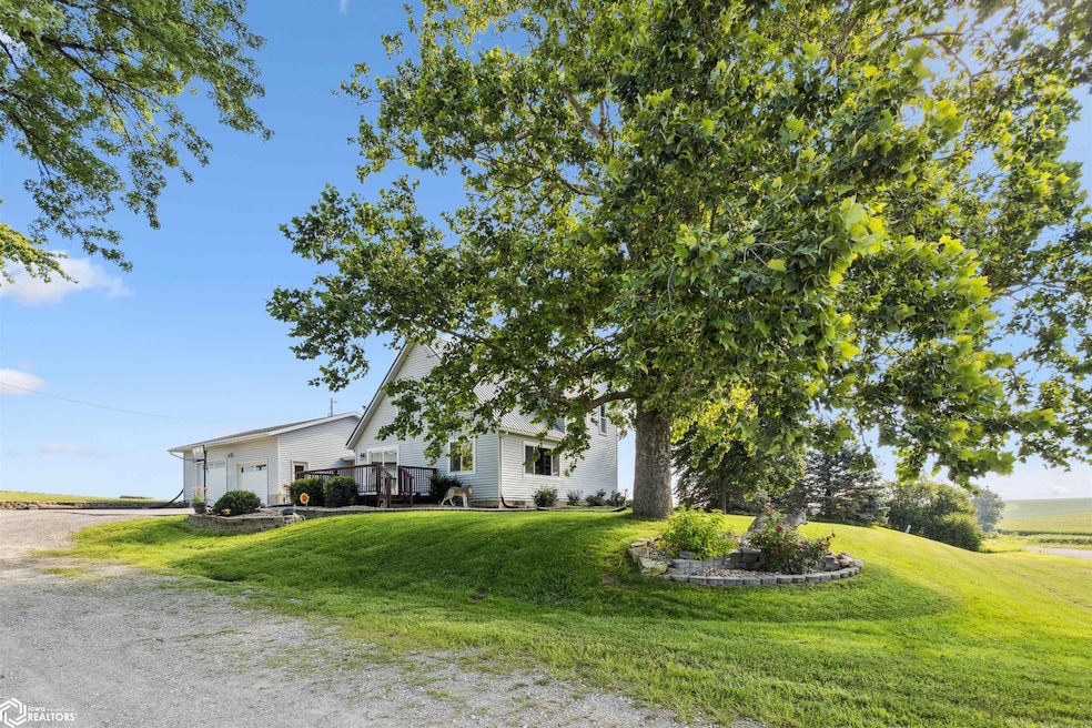
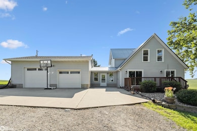
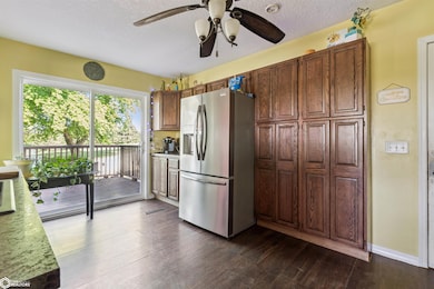
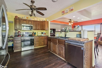
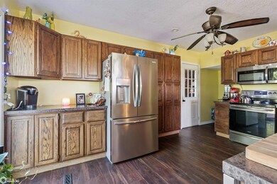
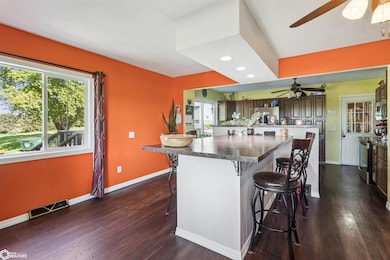
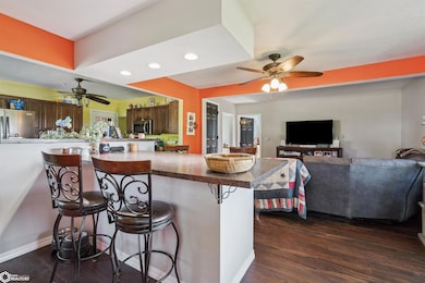
Looking for an acreage to enjoy the peaceful country living? Main floor is an open concept. Kitchen with bar area that is open to your living area. Appliances are negotiable. Kitchen was redone approximately 8 years ago. Main floor bedroom or could be an office. Large, spacious bath with laundry. New ceramic tile and plumbing. Be the first to occupy the three bedrooms that are upstairs. All bedrooms have new carpet, light fixtures and paint. From the kitchen step out to the rustic feeling breezeway that has new ceramic tile. The basement is unfinished but has a shower and sink. Let's make our way to the garage that is just off the breezeway. The garage is insulated and has a heater. Lots of storage space. Speaking of storage lets go to the man cave/she shed. The 48x30 building was built in 2023. Insulated and heated with a small patio out the back door. There are 2 other smaller sheds that will stay. To end the day take a dip in the pool or enjoy the outdoors on your deck looking at the sunsets. This is a must see!
Last Agent to Sell the Property
Century 21 Signature Real Estate License #*** Listed on: 08/06/2025
Last Buyer's Agent
Listing Agent (Do Not Use) Outside
OLD Outside Offc Do Not Use
| Date | Type | Sale Price | Title Company |
|---|---|---|---|
| Warranty Deed | $310,000 | None Listed On Document | |
| Special Warranty Deed | $74,800 | None Available | |
| Warranty Deed | $194,250 | None Available |
| Date | Status | Loan Amount | Loan Type |
|---|---|---|---|
| Open | $320,230 | VA | |
| Previous Owner | $72,903 | FHA | |
| Previous Owner | $132,795 | VA |
| Date | Event | Price | List to Sale | Price per Sq Ft |
|---|---|---|---|---|
| 12/12/2025 12/12/25 | Sold | $310,000 | -1.6% | $158 / Sq Ft |
| 10/21/2025 10/21/25 | Pending | -- | -- | -- |
| 10/11/2025 10/11/25 | Price Changed | $315,000 | -3.1% | $160 / Sq Ft |
| 08/06/2025 08/06/25 | For Sale | $325,000 | -- | $165 / Sq Ft |
| Year | Tax Paid | Tax Assessment Tax Assessment Total Assessment is a certain percentage of the fair market value that is determined by local assessors to be the total taxable value of land and additions on the property. | Land | Improvement |
|---|---|---|---|---|
| 2025 | $2,616 | $257,280 | $63,110 | $194,170 |
| 2024 | $2,210 | $240,600 | $56,850 | $183,750 |
| 2023 | $2,180 | $204,860 | $56,850 | $148,010 |
| 2022 | $2,156 | $173,370 | $45,470 | $127,900 |
| 2021 | $2,156 | $163,560 | $42,900 | $120,660 |
| 2020 | $1,826 | $140,590 | $35,750 | $104,840 |
| 2019 | $1,424 | $140,590 | $35,750 | $104,840 |
| 2018 | $1,388 | $110,550 | $27,500 | $83,050 |
| 2017 | $1,442 | $110,550 | $27,500 | $83,050 |
| 2016 | $1,444 | $110,550 | $27,500 | $83,050 |
| 2015 | $1,444 | $110,550 | $27,500 | $83,050 |
| 2014 | $1,288 | $99,780 | $22,230 | $77,550 |
D
Seller's Agent in 2025
Diane Foster
Century 21 Signature Real Estate
(641) 990-1210
12 Total Sales
L
Buyer's Agent in 2025
Listing Agent (Do Not Use) Outside
OLD Outside Offc Do Not Use
Source: NoCoast MLS
MLS Number: NOC6330523
APN: 530-3374600
Disclaimer: Certain information contained herein is derived from information provided by parties other than Homes.com. All information provided is deemed reliable, but is not guaranteed to be accurate and should be independently verified.
![]() Based on information submitted to the MLS GRID. All data is obtained from various sources and may not have been verified by broker or MLS GRID. Supplied Open House Information is subject to change without notice. All information should be independently reviewed and verified for accuracy. Properties may or may not be listed by the office/agent presenting the information. Some IDX listings have been excluded from this website. IDX information is provided exclusively for personal, non-commercial use, and may not be used for any purpose other than to identify prospective properties consumers may be interested in purchasing.
Based on information submitted to the MLS GRID. All data is obtained from various sources and may not have been verified by broker or MLS GRID. Supplied Open House Information is subject to change without notice. All information should be independently reviewed and verified for accuracy. Properties may or may not be listed by the office/agent presenting the information. Some IDX listings have been excluded from this website. IDX information is provided exclusively for personal, non-commercial use, and may not be used for any purpose other than to identify prospective properties consumers may be interested in purchasing.
Information is deemed reliable but not guaranteed.
Based on information submitted to the MLS GRID
Ask me questions while you tour the home.
