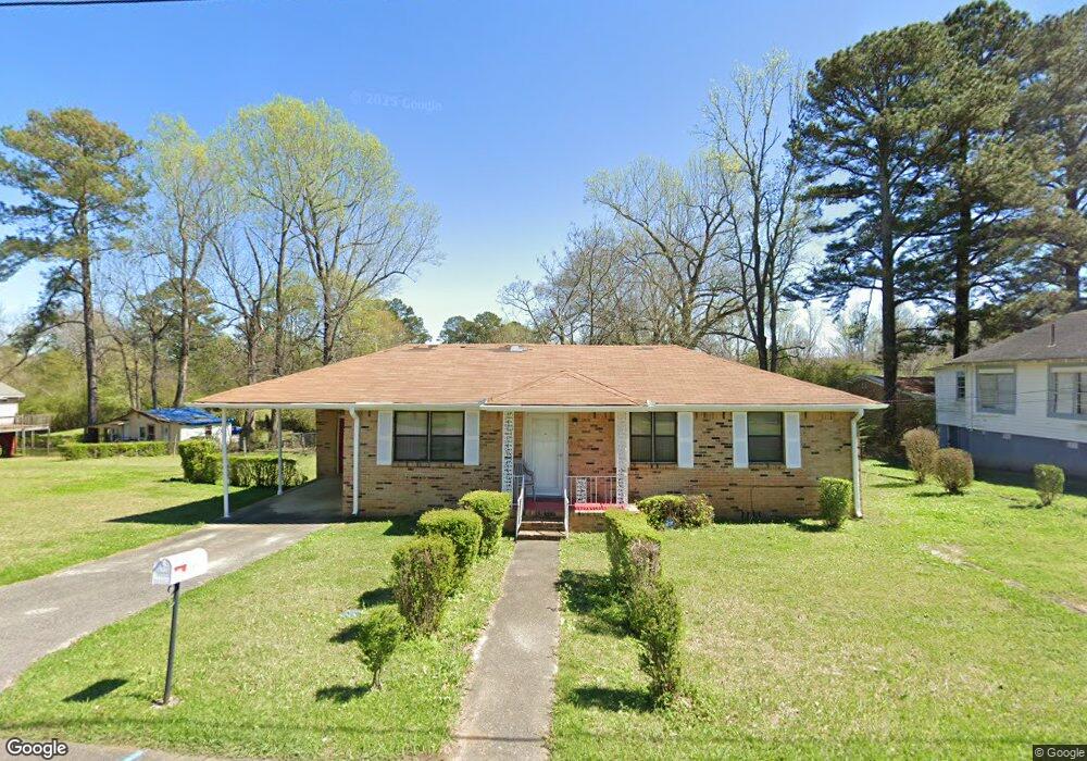
1067 7th St SE Graysville, AL 35073
Estimated Value: $110,710 - $129,000
3
Beds
1
Bath
1,008
Sq Ft
$115/Sq Ft
Est. Value
About This Home
This home is located at 1067 7th St SE, Graysville, AL 35073 and is currently estimated at $115,928, approximately $115 per square foot. 1067 7th St SE is a home located in Jefferson County with nearby schools including Brookville Elementary School, Minor Middle School, and Minor High School.
Ownership History
Date
Name
Owned For
Owner Type
Purchase Details
Closed on
Jul 31, 2000
Sold by
Y W Homes Inc
Bought by
Mcwilliams Willie B
Current Estimated Value
Home Financials for this Owner
Home Financials are based on the most recent Mortgage that was taken out on this home.
Original Mortgage
$27,859
Outstanding Balance
$10,030
Interest Rate
8.12%
Estimated Equity
$105,898
Purchase Details
Closed on
May 31, 2000
Sold by
Moody Albert
Bought by
Y W Homes Inc
Home Financials for this Owner
Home Financials are based on the most recent Mortgage that was taken out on this home.
Original Mortgage
$48,000
Interest Rate
8.14%
Create a Home Valuation Report for This Property
The Home Valuation Report is an in-depth analysis detailing your home's value as well as a comparison with similar homes in the area
Home Values in the Area
Average Home Value in this Area
Purchase History
| Date | Buyer | Sale Price | Title Company |
|---|---|---|---|
| Mcwilliams Willie B | $60,000 | -- | |
| Y W Homes Inc | $48,000 | -- |
Source: Public Records
Mortgage History
| Date | Status | Borrower | Loan Amount |
|---|---|---|---|
| Open | Mcwilliams Willie B | $27,859 | |
| Previous Owner | Y W Homes Inc | $48,000 | |
| Closed | Mcwilliams Willie B | $30,000 |
Source: Public Records
Tax History Compared to Growth
Tax History
| Year | Tax Paid | Tax Assessment Tax Assessment Total Assessment is a certain percentage of the fair market value that is determined by local assessors to be the total taxable value of land and additions on the property. | Land | Improvement |
|---|---|---|---|---|
| 2024 | -- | $7,200 | -- | -- |
| 2022 | $0 | $5,390 | $700 | $4,690 |
| 2021 | $0 | $5,390 | $700 | $4,690 |
| 2020 | $0 | $5,390 | $700 | $4,690 |
| 2019 | $0 | $5,400 | $0 | $0 |
| 2018 | $0 | $4,540 | $0 | $0 |
| 2017 | $0 | $4,540 | $0 | $0 |
| 2016 | $0 | $4,540 | $0 | $0 |
| 2015 | -- | $4,540 | $0 | $0 |
| 2014 | $261 | $4,480 | $0 | $0 |
| 2013 | $261 | $4,480 | $0 | $0 |
Source: Public Records
Map
Nearby Homes
- 399 12th Ave SE
- 1193 7th St SE
- 1451 S Main St
- 1545 3rd St SE
- 1533 1st St SE
- 928 2nd St SE
- 5628 Sanders Ave
- 588 S Main St
- 451 10th Ave SW
- 153 2nd St SE
- 5453 Robin Cir
- 64 3rd St NE
- 485 7th Ave SW
- 5317 Adams Ave
- 544 7th Ave SW
- 271 7th St NE
- 405 Union Grove Rd
- 3449 Honeycutt Rd Unit 123
- 5208 Highland Ave
- 178 2nd St NW
- 1035 7th St SE
- 1064 7th St SE
- 1060 7th St SE
- 1071 7th St SE
- 1070 7th St SE
- 730 11th Ave SE
- 736 11th Ave SE
- 715 10th Ave SE
- 1025 7th St SE
- 744 11th Ave SE
- 1078 7th St SE
- 1047 7th Cir SE
- 711 10th Ave SE
- 719 10th Ave SE
- 754 11th Ave SE
- 984 7th St SE
- 1020 7th Cir SE
- 1102 11th Ave SE
- 758 11th Ave SE
- 755 11th Ave SE