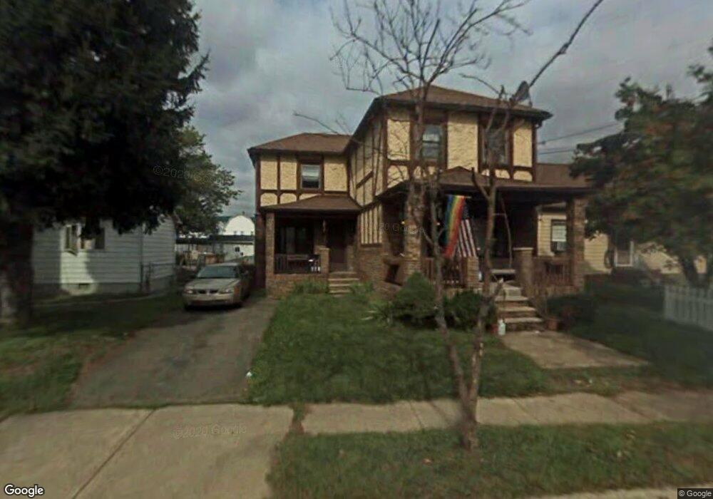
1067 Albright Ave Scranton, PA 18508
The Plot NeighborhoodEstimated Value: $166,000 - $181,000
--
Bed
--
Bath
2,320
Sq Ft
$74/Sq Ft
Est. Value
About This Home
This home is located at 1067 Albright Ave, Scranton, PA 18508 and is currently estimated at $171,333, approximately $73 per square foot. 1067 Albright Ave is a home located in Lackawanna County with nearby schools including Pinchbeck Elementary School, Isaac Tripp Elementary School, and Columbia Heights Elementary School.
Ownership History
Date
Name
Owned For
Owner Type
Purchase Details
Closed on
Oct 20, 2009
Sold by
Saita Carmine and Saita Linda L
Bought by
Saita Carmine G and Saita Linda L
Current Estimated Value
Purchase Details
Closed on
Jun 19, 2009
Sold by
Deutsche Bank National Trust Company
Bought by
Saita Carmine
Purchase Details
Closed on
Apr 21, 2009
Sold by
Barnett Timothy A and Barnett Melody A
Bought by
Deutsche Bank National Trust Company
Purchase Details
Closed on
Jun 7, 2006
Sold by
Mckeown Jeffrey S and Mckeown Lori
Bought by
Barnett Timothy A and Barnett Melody A
Home Financials for this Owner
Home Financials are based on the most recent Mortgage that was taken out on this home.
Original Mortgage
$123,600
Interest Rate
10.5%
Mortgage Type
Adjustable Rate Mortgage/ARM
Create a Home Valuation Report for This Property
The Home Valuation Report is an in-depth analysis detailing your home's value as well as a comparison with similar homes in the area
Home Values in the Area
Average Home Value in this Area
Purchase History
| Date | Buyer | Sale Price | Title Company |
|---|---|---|---|
| Saita Carmine G | -- | None Available | |
| Saita Carmine | $50,050 | None Available | |
| Deutsche Bank National Trust Company | $2,150 | None Available | |
| Barnett Timothy A | $123,600 | None Available |
Source: Public Records
Mortgage History
| Date | Status | Borrower | Loan Amount |
|---|---|---|---|
| Previous Owner | Barnett Timothy A | $123,600 |
Source: Public Records
Tax History Compared to Growth
Tax History
| Year | Tax Paid | Tax Assessment Tax Assessment Total Assessment is a certain percentage of the fair market value that is determined by local assessors to be the total taxable value of land and additions on the property. | Land | Improvement |
|---|---|---|---|---|
| 2025 | $2,522 | $7,500 | $1,750 | $5,750 |
| 2024 | $2,312 | $7,500 | $1,750 | $5,750 |
| 2023 | $2,312 | $7,500 | $1,750 | $5,750 |
| 2022 | $2,262 | $7,500 | $1,750 | $5,750 |
| 2021 | $2,262 | $7,500 | $1,750 | $5,750 |
| 2020 | $2,221 | $7,500 | $1,750 | $5,750 |
| 2019 | $2,092 | $7,500 | $1,750 | $5,750 |
| 2018 | $2,092 | $7,500 | $1,750 | $5,750 |
| 2017 | $2,057 | $7,500 | $1,750 | $5,750 |
| 2016 | $698 | $7,500 | $1,750 | $5,750 |
| 2015 | $1,563 | $7,500 | $1,750 | $5,750 |
| 2014 | -- | $7,500 | $1,750 | $5,750 |
Source: Public Records
Map
Nearby Homes
- 375 Grove St
- 1121 Albright Ave
- 1206 Blair Ave Unit Rear
- 942 Providence Rd
- 938 Providence Rd
- 656 Philo St
- 1227 Providence Rd
- 1311 Short Ave
- 1008 Mount Vernon Ave
- 1513 Meylert Ave
- 4 Plum Place
- 7 Plum Place
- 1519 1521 von Storch Ave
- 1430 N Main Ave
- 934 Capouse Ave
- 1421 Monsey Ave
- 18 Green Ridge St
- 1235 N Sumner Ave
- 1436 Church Ave
- 525 Green Ridge St
- 1069 Albright Ave
- 1063 Albright Ave
- 1073 Albright Ave
- 1073-1075 Albright Ave
- 1075 Albright Ave
- 1059 Albright Ave
- 1077 Albright Ave Unit 1079
- 1068 Albright Ave
- 1064 Albright Ave
- 1055 Albright Ave
- 1072 Albright Ave
- 1035 Gunster Ave
- 1060 Albright Ave
- 1076 Albright Ave
- 1051 Albright Ave
- 1056 Albright Ave
- 1103 Albright Ave
- 1068 Meade Ave
- 1072 Meade Ave
- 1076 Meade Ave