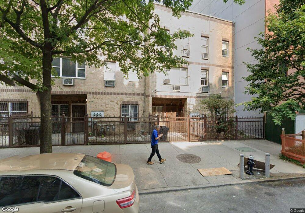
1067 Anderson Ave Bronx, NY 10452
Highbridge NeighborhoodEstimated Value: $1,003,000 - $1,046,000
Studio
--
Bath
3,162
Sq Ft
$326/Sq Ft
Est. Value
About This Home
This home is located at 1067 Anderson Ave, Bronx, NY 10452 and is currently estimated at $1,030,667, approximately $325 per square foot. 1067 Anderson Ave is a home located in Bronx County with nearby schools including P.S. 73 Bronx, Metropolitan Lighthouse Charter School, and Sacred Heart School.
Ownership History
Date
Name
Owned For
Owner Type
Purchase Details
Closed on
Nov 4, 1999
Sold by
Nyc Partnership Housing Development Fund
Bought by
Bernard Sarah and Bernard Jose T
Current Estimated Value
Home Financials for this Owner
Home Financials are based on the most recent Mortgage that was taken out on this home.
Original Mortgage
$208,120
Interest Rate
7.91%
Mortgage Type
Purchase Money Mortgage
Create a Home Valuation Report for This Property
The Home Valuation Report is an in-depth analysis detailing your home's value as well as a comparison with similar homes in the area
Home Values in the Area
Average Home Value in this Area
Purchase History
| Date | Buyer | Sale Price | Title Company |
|---|---|---|---|
| Bernard Sarah | $318,000 | Fidelity National Title Ins |
Source: Public Records
Mortgage History
| Date | Status | Borrower | Loan Amount |
|---|---|---|---|
| Previous Owner | Bernard Sarah | $208,120 | |
| Closed | Bernard Sarah | $64,269 |
Source: Public Records
Tax History
| Year | Tax Paid | Tax Assessment Tax Assessment Total Assessment is a certain percentage of the fair market value that is determined by local assessors to be the total taxable value of land and additions on the property. | Land | Improvement |
|---|---|---|---|---|
| 2025 | $8,336 | $41,818 | $10,526 | $31,292 |
| 2024 | $8,336 | $41,502 | $9,471 | $32,031 |
| 2023 | $5,494 | $39,154 | $7,691 | $31,463 |
| 2022 | $4,916 | $56,460 | $13,200 | $43,260 |
| 2021 | $7,334 | $45,900 | $13,200 | $32,700 |
| 2020 | $7,376 | $44,040 | $13,200 | $30,840 |
| 2019 | $7,235 | $40,020 | $13,200 | $26,820 |
| 2018 | $6,240 | $32,628 | $12,440 | $20,188 |
| 2017 | $5,499 | $30,782 | $11,761 | $19,021 |
| 2016 | $4,665 | $29,040 | $10,019 | $19,021 |
| 2015 | $1,995 | $29,520 | $10,019 | $19,501 |
| 2014 | $1,995 | $29,520 | $10,019 | $19,501 |
Source: Public Records
Map
Nearby Homes
- 1068 Woodycrest Ave
- 1045 Anderson Ave Unit 2G
- 1045 Anderson Ave Unit 3D
- 130 W 165th St
- 1015 Anderson Ave Unit 4C
- 67 W 164th St
- 1177 Anderson Ave Unit 3B
- 1177 Anderson Ave Unit 2 B
- 1177 Anderson Ave Unit 2D
- 1200 Woodycrest Ave Unit 2G
- 1200 Woodycrest Ave Unit 3E
- 941 Jerome Ave Unit 11C
- 941 Jerome Ave Unit D5
- 941 Jerome Ave Unit 12G
- 941 Jerome Ave Unit 10F11F
- 941 Jerome Ave Unit 6C
- 941 Jerome Ave Unit 8F
- 941 Jerome Ave Unit 3B
- 136 W 168th St Unit 5A
- 1226 Shakespeare Ave
- 1065 Anderson Ave
- 1069 Anderson Ave
- 1063 Anderson Ave
- 1061 Anderson Ave
- 1086 Woodycrest Ave
- 1059 Anderson Ave
- 1081 Anderson Ave
- 1072 Woodycrest Ave Unit 1
- 1072 Woodycrest Ave Unit 2B
- 1072 Woodycrest Ave Unit 1A
- 1072 Woodycrest Ave Unit 5D
- 1072 Woodycrest Ave Unit C1
- 1072 Woodycrest Ave Unit 1C
- 1072 Woodycrest Ave Unit 6F
- 1072 Woodycrest Ave
- 1057 Anderson Ave
- 1088 Woodycrest Ave
- 1085 Anderson Ave
- 1090 Woodycrest Ave
- 1055 Anderson Ave
Your Personal Tour Guide
Ask me questions while you tour the home.