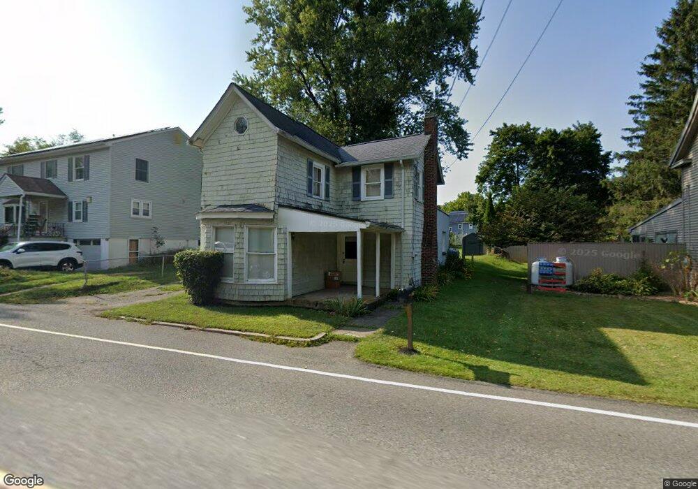
1067 Anderson Rd Port Murray, NJ 07865
Estimated Value: $177,176 - $470,000
--
Bed
--
Bath
1,216
Sq Ft
$248/Sq Ft
Est. Value
About This Home
This home is located at 1067 Anderson Rd, Port Murray, NJ 07865 and is currently estimated at $301,794, approximately $248 per square foot. 1067 Anderson Rd is a home located in Warren County with nearby schools including Mansfield Twp Elementary School, Warren Hills Regional Middle School, and Warren Hills Reg High School.
Ownership History
Date
Name
Owned For
Owner Type
Purchase Details
Closed on
Mar 26, 2007
Sold by
Demonti Michael J
Bought by
Postma Harmen
Current Estimated Value
Home Financials for this Owner
Home Financials are based on the most recent Mortgage that was taken out on this home.
Original Mortgage
$135,000
Outstanding Balance
$82,026
Interest Rate
6.33%
Mortgage Type
Purchase Money Mortgage
Estimated Equity
$219,768
Purchase Details
Closed on
Apr 5, 2000
Sold by
Demonti Michael J and Demonti Lisa A
Bought by
Demonti Michael J
Create a Home Valuation Report for This Property
The Home Valuation Report is an in-depth analysis detailing your home's value as well as a comparison with similar homes in the area
Home Values in the Area
Average Home Value in this Area
Purchase History
| Date | Buyer | Sale Price | Title Company |
|---|---|---|---|
| Postma Harmen | $150,000 | None Available | |
| Demonti Michael J | -- | -- |
Source: Public Records
Mortgage History
| Date | Status | Borrower | Loan Amount |
|---|---|---|---|
| Open | Postma Harmen | $135,000 |
Source: Public Records
Tax History Compared to Growth
Tax History
| Year | Tax Paid | Tax Assessment Tax Assessment Total Assessment is a certain percentage of the fair market value that is determined by local assessors to be the total taxable value of land and additions on the property. | Land | Improvement |
|---|---|---|---|---|
| 2025 | $2,883 | $81,500 | $23,600 | $57,900 |
| 2024 | $2,895 | $81,500 | $23,600 | $57,900 |
| 2023 | $2,844 | $81,500 | $23,600 | $57,900 |
| 2022 | $2,307 | $81,500 | $23,600 | $57,900 |
| 2021 | $2,647 | $81,500 | $23,600 | $57,900 |
| 2020 | $2,835 | $81,500 | $23,600 | $57,900 |
| 2019 | $2,742 | $81,500 | $23,600 | $57,900 |
| 2018 | $2,685 | $81,500 | $23,600 | $57,900 |
| 2017 | $2,685 | $81,500 | $23,600 | $57,900 |
| 2016 | $2,623 | $81,500 | $23,600 | $57,900 |
| 2015 | $2,568 | $81,500 | $23,600 | $57,900 |
| 2014 | $2,487 | $81,500 | $23,600 | $57,900 |
Source: Public Records
Map
Nearby Homes
- 5 Thomas Knoll Blvd
- 0 Harrison Ave
- 0 Adams St
- Palladio Plan at Mansfield Meadows 55+
- Bramante Plan at Mansfield Meadows 55+
- Alberti Plan at Mansfield Meadows 55+
- 0 Anderson Rd
- 1 Wilson St
- 0 Frome St Unit 3951790
- 25 Adams St
- 0 Port Murray Rd Unit 3950462
- 0 Port Murray Rd Unit 3946276
- 0 Port Murray Rd Unit 3951792
- 21 Gulick St
- 2 Clover Ave
- 14 Butler Park Rd
- 1333 New Jersey 57
- 103 Mountain Top Rd
- 106 Mountain Top Rd
- 46 48cherry Tree Bend Rd
- 1071 Anderson Rd
- 1063 Anderson Rd
- 5 Komar Rd
- 1059 Anderson Rd
- 9 Komar Rd
- 696 State Route 57
- 702 State Route 57
- 696 New Jersey 57
- 1055 Anderson Rd
- 695 State Route 57
- 699 State Route 57
- 1032 Anderson Rd
- 705 State Route 57
- 1045 Anderson Rd
- 711 State Route 57
- 680 Us 57
- 680 New Jersey 57
- 715 State Route 57
- 678 New Jersey 57
- 719 State Route 57