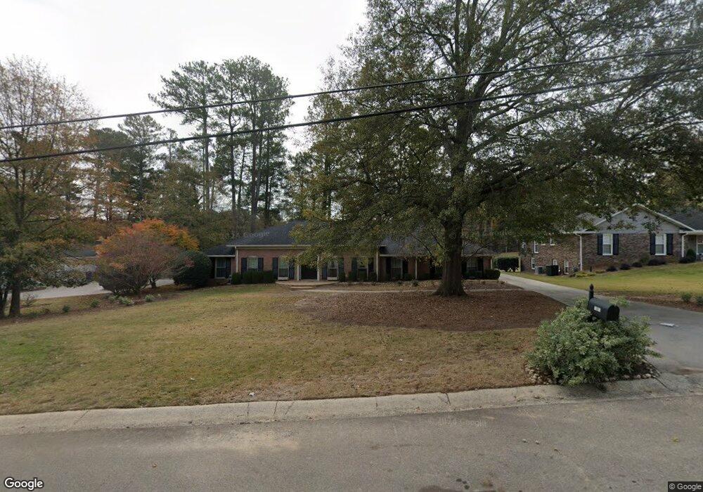
1067 Coronation Dr Atlanta, GA 30338
Estimated Value: $809,142 - $1,000,000
4
Beds
3
Baths
3,268
Sq Ft
$276/Sq Ft
Est. Value
About This Home
This home is located at 1067 Coronation Dr, Atlanta, GA 30338 and is currently estimated at $900,786, approximately $275 per square foot. 1067 Coronation Dr is a home located in DeKalb County with nearby schools including Austin Elementary School, Peachtree Middle School, and Dunwoody High School.
Ownership History
Date
Name
Owned For
Owner Type
Purchase Details
Closed on
Sep 17, 2021
Sold by
Bloodworth Mary Claire
Bought by
Benator Eileen E and Benator Barry I
Current Estimated Value
Purchase Details
Closed on
May 29, 2019
Sold by
Jones Andrew Evan
Bought by
Hitson Maryclair and Bloodworth Corey
Home Financials for this Owner
Home Financials are based on the most recent Mortgage that was taken out on this home.
Original Mortgage
$385,000
Interest Rate
4.1%
Mortgage Type
New Conventional
Purchase Details
Closed on
Feb 23, 2006
Sold by
Hardy Doris M
Bought by
Jones Andrew E
Home Financials for this Owner
Home Financials are based on the most recent Mortgage that was taken out on this home.
Original Mortgage
$400,000
Interest Rate
6.04%
Purchase Details
Closed on
Mar 25, 2004
Sold by
Hardy James E
Bought by
Hardy Doris M
Create a Home Valuation Report for This Property
The Home Valuation Report is an in-depth analysis detailing your home's value as well as a comparison with similar homes in the area
Home Values in the Area
Average Home Value in this Area
Purchase History
| Date | Buyer | Sale Price | Title Company |
|---|---|---|---|
| Benator Eileen E | $663,000 | -- | |
| Hitson Maryclair | $475,000 | -- | |
| Jones Andrew E | $335,000 | -- | |
| Hardy Doris M | -- | -- |
Source: Public Records
Mortgage History
| Date | Status | Borrower | Loan Amount |
|---|---|---|---|
| Previous Owner | Hitson Maryclair | $385,000 | |
| Previous Owner | Jones Andrew E | $400,000 |
Source: Public Records
Tax History Compared to Growth
Tax History
| Year | Tax Paid | Tax Assessment Tax Assessment Total Assessment is a certain percentage of the fair market value that is determined by local assessors to be the total taxable value of land and additions on the property. | Land | Improvement |
|---|---|---|---|---|
| 2024 | $7,304 | $262,200 | $72,000 | $190,200 |
| 2023 | $7,304 | $247,240 | $72,000 | $175,240 |
| 2022 | $7,101 | $251,320 | $72,000 | $179,320 |
| 2021 | $6,035 | $215,640 | $72,000 | $143,640 |
| 2020 | $7,871 | $188,640 | $72,000 | $116,640 |
| 2019 | $6,437 | $152,920 | $72,000 | $80,920 |
| 2018 | $6,284 | $156,120 | $72,000 | $84,120 |
| 2017 | $6,335 | $151,480 | $80,680 | $70,800 |
| 2016 | $5,662 | $136,720 | $80,680 | $56,040 |
| 2014 | $5,244 | $120,600 | $80,680 | $39,920 |
Source: Public Records
Map
Nearby Homes
- 5631 Queensborough Dr
- 1128 Aurora Ct
- 5662 Queensborough Dr
- 525 Spender Trace
- 7632 Auden Trail
- 5625 Roberts Dr
- 4006 Wingate Way
- 4008 Wingate Way
- 2015 Wingate Way
- 812 Stratford Ct
- 5697 Whitehall Walk
- 1120 Whitehall Pointe
- 3020 Wingate Way
- 5816 Chamblee Dunwoody Rd
- 1503 Wingate Way
- 1293 Witham Dr
- 5337 Redfield Rd Unit 1
- 7967 Magnolia Square
- 1067 Coronation Dr
- 1075 Coronation Dr
- 1059 Coronation Dr
- 1083 Coronation Dr
- 1051 Coronation Dr
- 5583 Queensborough Dr
- 1076 Coronation Dr
- 1084 Coronation Dr
- 1091 Coronation Dr
- 1043 Coronation Dr Unit 2
- 5593 Queensborough Dr
- 1092 Coronation Dr
- 3981 Spalding Dr
- 00 Spalding Dr
- 1101 Coronation Dr
- 5466 Redstone Terrace
- 5580 Queensborough Dr
- 5594 Coronation Ct
- 1029 Coronation Dr
- 5601 Queensborough Dr