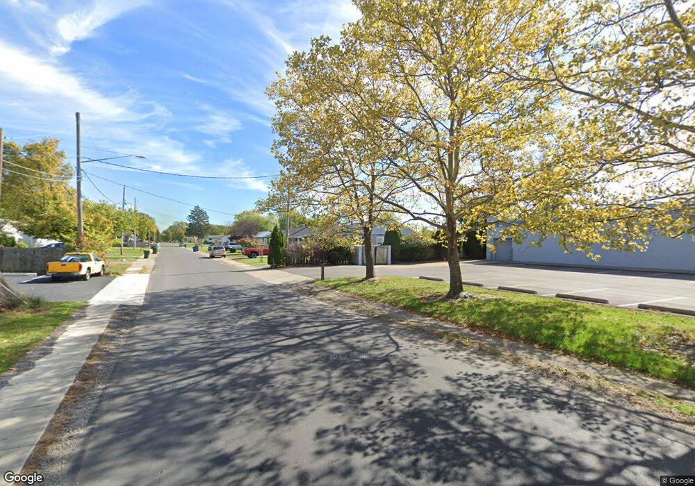
1067 E Innis Ave Columbus, OH 43207
Innis Gardens Village NeighborhoodEstimated Value: $148,000 - $193,129
3
Beds
2
Baths
1,400
Sq Ft
$124/Sq Ft
Est. Value
About This Home
This home is located at 1067 E Innis Ave, Columbus, OH 43207 and is currently estimated at $173,532, approximately $123 per square foot. 1067 E Innis Ave is a home located in Franklin County with nearby schools including Moler Elementary School, South High School, and Summit Academy Community School-Columbus.
Ownership History
Date
Name
Owned For
Owner Type
Purchase Details
Closed on
May 27, 2015
Sold by
Queens Holdings Co Llc
Bought by
Cummings Deborah A
Current Estimated Value
Purchase Details
Closed on
May 7, 2008
Sold by
Us Bank Na
Bought by
Queens Holding Co Llc
Purchase Details
Closed on
Jan 28, 2008
Sold by
Frost Julie and Altegra Credit Co
Bought by
Us Bank Na and Pooling & Servicing Agreement Credit Bas
Purchase Details
Closed on
Apr 4, 1985
Bought by
Perrigo Gerald E
Purchase Details
Closed on
Dec 1, 1984
Create a Home Valuation Report for This Property
The Home Valuation Report is an in-depth analysis detailing your home's value as well as a comparison with similar homes in the area
Home Values in the Area
Average Home Value in this Area
Purchase History
| Date | Buyer | Sale Price | Title Company |
|---|---|---|---|
| Cummings Deborah A | $54,000 | None Available | |
| Queens Holding Co Llc | $54,900 | Accutitle Agency Inc | |
| Us Bank Na | $30,000 | None Available | |
| Perrigo Gerald E | -- | -- | |
| -- | -- | -- |
Source: Public Records
Tax History Compared to Growth
Tax History
| Year | Tax Paid | Tax Assessment Tax Assessment Total Assessment is a certain percentage of the fair market value that is determined by local assessors to be the total taxable value of land and additions on the property. | Land | Improvement |
|---|---|---|---|---|
| 2024 | $3,768 | $56,210 | $13,370 | $42,840 |
| 2023 | $2,490 | $56,210 | $13,370 | $42,840 |
| 2022 | $1,829 | $23,490 | $5,110 | $18,380 |
| 2021 | $1,220 | $23,490 | $5,110 | $18,380 |
| 2020 | $1,222 | $23,490 | $5,110 | $18,380 |
| 2019 | $1,228 | $20,240 | $4,450 | $15,790 |
| 2018 | $1,229 | $20,240 | $4,450 | $15,790 |
| 2017 | $1,273 | $20,240 | $4,450 | $15,790 |
| 2016 | $1,320 | $19,920 | $4,130 | $15,790 |
| 2015 | $1,232 | $19,920 | $4,130 | $15,790 |
| 2014 | $1,235 | $19,920 | $4,130 | $15,790 |
| 2013 | -- | $20,965 | $4,340 | $16,625 |
Source: Public Records
Map
Nearby Homes
- 990 Reeb Ave
- 1777 Lockbourne Rd
- 1861 Berkeley Rd
- 1833 Berkeley Rd
- 1680 Linwood Ave
- 1710 S Champion Ave
- 1580 Linwood Ave
- 1642 Berkeley Rd
- 1548 Wilson Ave
- 1299 Yolanda Dr
- 1360 Frebis Ave
- 1619 Liscomb Rd
- 2496 Navarre Rd
- 868 Lawndale Ave
- 1871 Holburn Ave Unit 873
- 69 E Woodrow Ave
- 1673 Liscomb Rd
- 1472 S Champion Ave
- 1204 Koebel Rd
- 1418-1422 Miller Ave
- 1075 E Innis Ave
- 1990 Lockbourne Rd
- 1081 E Innis Ave
- 2000 Lockbourne Rd
- 1087 E Innis Ave
- 2012 Lockbourne Rd
- 1070 E Innis Ave
- 1078 E Innis Ave
- 1095 E Innis Ave
- 1084 E Innis Ave
- 1090 E Innis Ave
- 1101 E Innis Ave
- 1098 E Innis Ave
- 1115 Lawrence Dr
- 1107 E Innis Ave
- 1104 E Innis Ave
- 1117 Lawrence Dr
- 1967 Lockbourne Rd
- 1119 Lawrence Dr
- 1110 E Innis Ave
