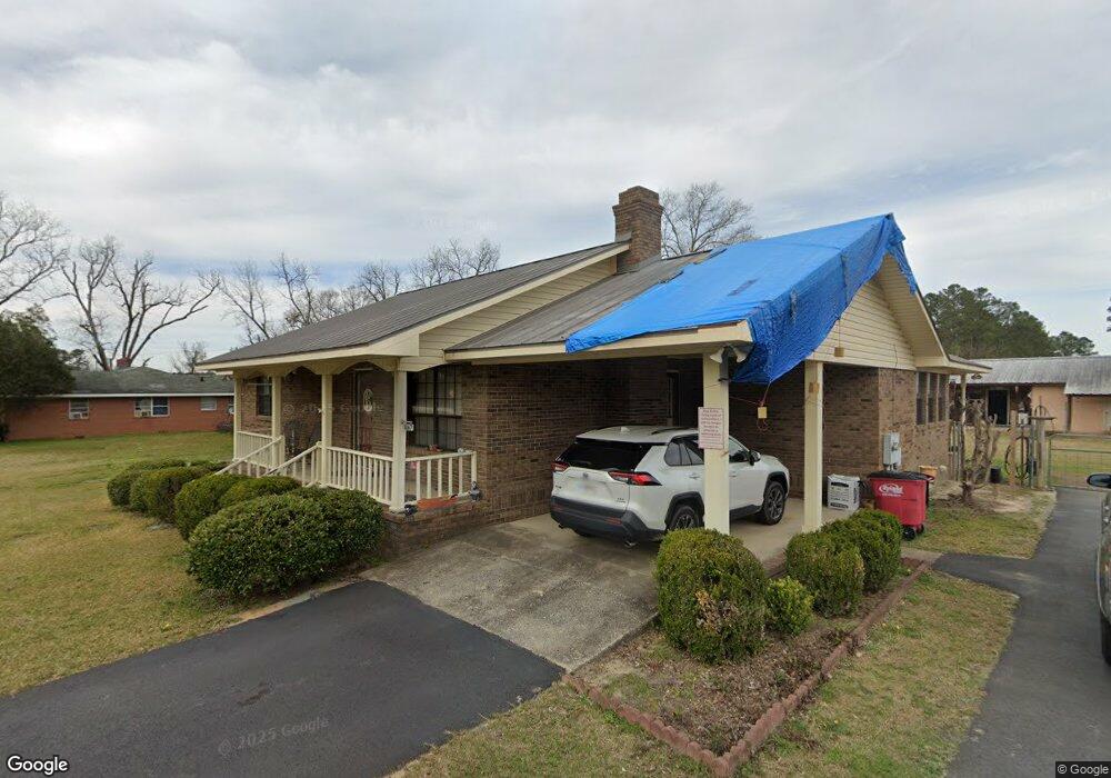
1067 Ga Highway 242 Sandersville, GA 31082
Estimated Value: $157,000 - $234,000
--
Bed
--
Bath
2,250
Sq Ft
$92/Sq Ft
Est. Value
About This Home
This home is located at 1067 Ga Highway 242, Sandersville, GA 31082 and is currently estimated at $207,325, approximately $92 per square foot. 1067 Ga Highway 242 is a home located in Washington County with nearby schools including Ridge Road Primary School, Ridge Road Elementary School, and T.J. Elder Middle School.
Ownership History
Date
Name
Owned For
Owner Type
Purchase Details
Closed on
Jul 31, 2006
Sold by
Dierker Donald E
Bought by
Calhoun David Mercer and Calhoun Nora Frances
Current Estimated Value
Purchase Details
Closed on
Aug 30, 2000
Sold by
Brooks James G and Brooks Kat
Bought by
Dierker Donald E and Dierker J
Purchase Details
Closed on
Mar 20, 1990
Bought by
Brooks James G and Brooks Kat
Purchase Details
Closed on
Feb 26, 1980
Create a Home Valuation Report for This Property
The Home Valuation Report is an in-depth analysis detailing your home's value as well as a comparison with similar homes in the area
Home Values in the Area
Average Home Value in this Area
Purchase History
| Date | Buyer | Sale Price | Title Company |
|---|---|---|---|
| Calhoun David Mercer | $137,000 | -- | |
| Dierker Donald E | $100,000 | -- | |
| Brooks James G | -- | -- | |
| -- | -- | -- |
Source: Public Records
Tax History Compared to Growth
Tax History
| Year | Tax Paid | Tax Assessment Tax Assessment Total Assessment is a certain percentage of the fair market value that is determined by local assessors to be the total taxable value of land and additions on the property. | Land | Improvement |
|---|---|---|---|---|
| 2024 | $2,998 | $85,538 | $3,160 | $82,378 |
| 2023 | $1,031 | $53,218 | $2,760 | $50,458 |
| 2022 | $1,494 | $53,218 | $2,760 | $50,458 |
| 2021 | $1,535 | $53,218 | $2,760 | $50,458 |
| 2020 | $1,548 | $53,218 | $2,760 | $50,458 |
| 2019 | $1,543 | $53,218 | $2,760 | $50,458 |
| 2018 | $1,547 | $53,218 | $2,760 | $50,458 |
| 2017 | $1,916 | $62,350 | $2,762 | $59,588 |
| 2016 | $1,831 | $62,350 | $2,762 | $59,588 |
| 2015 | $1,509 | $806 | $2,762 | $59,588 |
| 2014 | $1,509 | $61,773 | $2,184 | $59,588 |
| 2013 | $1,509 | $61,772 | $2,184 | $59,588 |
Source: Public Records
Map
Nearby Homes
- 766 McElrath St
- 407 Riddleville Rd
- 408 Moye Dr
- 530 E Church St
- 525 E Church St
- 520 E Church St
- 415 Riddleville Rd
- 518 Cooley Dr
- 0 Franklin Haynes Dr
- 406 S Smith St
- 704 Martin Luther King Junior Ave
- 210 E Church St
- 2417 Ga Highway 242
- 219 Cypress St
- 908 E Mccarty St
- 1282 E Mccarty St
- 849 E Mccarty St
- 821 E Mccarty St
- 47 Anderson Ln
- 324 Railroad Ave
- 1091 Ga Highway 242
- 1045 Ga Highway 242
- 1189 Ga Highway 242
- 734 Riddleville Rd
- 0 Waco Mill Rd Unit 7594076
- 513 Industrial Dr
- 104 Pierce St
- 728 Alfred C Carson Dr
- 640 Alfred C Carson Dr
- 638 Alfred C Carson Dr
- 636 Alfred C Carson Dr
- 509 Riddleville Rd
- 634 Alfred C Carson Dr
- 636 Alfred C Carson St
- 727 Alfred C Carson Dr
- 632 Alfred C Carson Dr
- 514 Riddleville Rd
- 630 Alfred C Carson Dr
- 731 Alfred C Carson Dr
- 510 Riddleville Rd