Estimated Value: $614,000 - $652,000
4
Beds
3
Baths
1,726
Sq Ft
$364/Sq Ft
Est. Value
About This Home
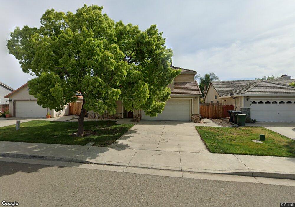
This home is located at 1067 Lourence Dr, Tracy, CA 95376 and is currently estimated at $627,686, approximately $363 per square foot. 1067 Lourence Dr is a home located in San Joaquin County with nearby schools including Louis J. Villalovoz Elementary School, Earle E. Williams Middle School, and Merrill F. West High School.
Ownership History
Date
Name
Owned For
Owner Type
Purchase Details
Closed on
Feb 24, 1995
Sold by
Bright Development
Bought by
Richardson Stephen Victor and Richardson Noriko
Current Estimated Value
Home Financials for this Owner
Home Financials are based on the most recent Mortgage that was taken out on this home.
Original Mortgage
$136,450
Interest Rate
7.25%
Create a Home Valuation Report for This Property
The Home Valuation Report is an in-depth analysis detailing your home's value as well as a comparison with similar homes in the area
Home Values in the Area
Average Home Value in this Area
Purchase History
| Date | Buyer | Sale Price | Title Company |
|---|---|---|---|
| Richardson Stephen Victor | $171,000 | Chicago Title Company |
Source: Public Records
Mortgage History
| Date | Status | Borrower | Loan Amount |
|---|---|---|---|
| Closed | Richardson Stephen Victor | $136,450 |
Source: Public Records
Tax History
| Year | Tax Paid | Tax Assessment Tax Assessment Total Assessment is a certain percentage of the fair market value that is determined by local assessors to be the total taxable value of land and additions on the property. | Land | Improvement |
|---|---|---|---|---|
| 2025 | $3,450 | $289,879 | $100,767 | $189,112 |
| 2024 | $3,186 | $284,196 | $98,792 | $185,404 |
| 2023 | $3,134 | $278,624 | $96,855 | $181,769 |
| 2022 | $3,067 | $273,161 | $94,956 | $178,205 |
| 2021 | $3,027 | $267,806 | $93,095 | $174,711 |
| 2020 | $3,005 | $265,061 | $92,141 | $172,920 |
| 2019 | $2,954 | $259,865 | $90,335 | $169,530 |
| 2018 | $3,144 | $254,770 | $88,564 | $166,206 |
| 2017 | $3,000 | $249,776 | $86,828 | $162,948 |
| 2016 | $3,022 | $244,880 | $85,126 | $159,754 |
| 2014 | $2,854 | $236,477 | $82,205 | $154,272 |
Source: Public Records
Map
Nearby Homes
- 901 Appalosa Way
- 1007 Lourence Dr
- 605 Natalie Ln
- 50 S Hickory Ave
- 864 Bogetti Ln
- 1423 Sienna Park Dr
- 1091 Plymouth Dr
- 1120 Gatetree Ct
- 1380 Parkside Dr
- 448 Burlington Dr
- 389 Burlington Dr
- 213 W South St
- 1363 Egret Dr
- 145 Machado Ct
- 230 Thomas Dehaven Ln
- 1781 Summertime Ct
- 1745 Parkside Dr
- 1445 Yorkshire Loop
- 550 Fawn Glen Dr
- 455 Loma Verde Dr
- 1077 Lourence Dr
- 1057 Lourence Dr
- 984 Gotland Ct
- 1087 Lourence Dr
- 1047 Lourence Dr
- 974 Gotland Ct
- 994 Gotland Ct
- 1076 Lourence Dr
- 1086 Lourence Dr
- 1066 Lourence Dr
- 1037 Lourence Dr
- 1096 Lourence Dr
- 1080 Appalosa Way
- 964 Gotland Ct
- 1060 Appalosa Way
- 1056 Lourence Dr
- 1040 Appalosa Way
- 995 Gotland Ct
- 1106 Lourence Dr
- 1017 Lourence Dr
Your Personal Tour Guide
Ask me questions while you tour the home.