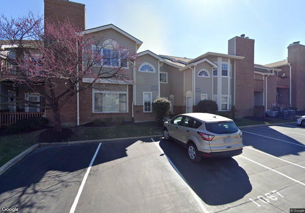
1067 N Spoede Rd Unit 1067 Saint Louis, MO 63146
Estimated Value: $208,000 - $261,000
2
Beds
2
Baths
1,368
Sq Ft
$164/Sq Ft
Est. Value
About This Home
This home is located at 1067 N Spoede Rd Unit 1067, Saint Louis, MO 63146 and is currently estimated at $224,991, approximately $164 per square foot. 1067 N Spoede Rd Unit 1067 is a home located in St. Louis County with nearby schools including Spoede Elementary School, Ladue 5th Grade Center, and Ladue Middle.
Ownership History
Date
Name
Owned For
Owner Type
Purchase Details
Closed on
Mar 29, 2007
Sold by
Nall Lori
Bought by
Franck Gloria
Current Estimated Value
Purchase Details
Closed on
May 27, 2005
Sold by
Crabtree Marlene J
Bought by
Nall Lori
Home Financials for this Owner
Home Financials are based on the most recent Mortgage that was taken out on this home.
Original Mortgage
$127,200
Interest Rate
4.87%
Mortgage Type
Fannie Mae Freddie Mac
Purchase Details
Closed on
Jun 9, 2000
Sold by
Fauser Rebecca C and Fauser Rebecca C
Bought by
Crabtree Marlene J
Home Financials for this Owner
Home Financials are based on the most recent Mortgage that was taken out on this home.
Original Mortgage
$99,000
Interest Rate
8.42%
Create a Home Valuation Report for This Property
The Home Valuation Report is an in-depth analysis detailing your home's value as well as a comparison with similar homes in the area
Home Values in the Area
Average Home Value in this Area
Purchase History
| Date | Buyer | Sale Price | Title Company |
|---|---|---|---|
| Franck Gloria | $167,500 | None Available | |
| Nall Lori | $159,000 | -- | |
| Crabtree Marlene J | $125,000 | -- |
Source: Public Records
Mortgage History
| Date | Status | Borrower | Loan Amount |
|---|---|---|---|
| Previous Owner | Nall Lori | $127,200 | |
| Previous Owner | Crabtree Marlene J | $99,000 |
Source: Public Records
Tax History Compared to Growth
Tax History
| Year | Tax Paid | Tax Assessment Tax Assessment Total Assessment is a certain percentage of the fair market value that is determined by local assessors to be the total taxable value of land and additions on the property. | Land | Improvement |
|---|---|---|---|---|
| 2025 | $2,364 | $37,540 | $12,480 | $25,060 |
| 2024 | $2,364 | $34,300 | $7,790 | $26,510 |
| 2023 | $2,361 | $34,300 | $7,790 | $26,510 |
| 2022 | $2,026 | $28,330 | $7,790 | $20,540 |
| 2021 | $2,010 | $28,330 | $7,790 | $20,540 |
| 2020 | $2,056 | $28,620 | $8,570 | $20,050 |
| 2019 | $2,040 | $28,620 | $8,570 | $20,050 |
| 2018 | $1,764 | $22,860 | $3,650 | $19,210 |
| 2017 | $1,762 | $22,860 | $3,650 | $19,210 |
| 2016 | $1,679 | $21,240 | $5,720 | $15,520 |
| 2015 | $1,569 | $21,240 | $5,720 | $15,520 |
| 2014 | $1,856 | $24,320 | $7,390 | $16,930 |
Source: Public Records
Map
Nearby Homes
- 1060 Port Diane Dr
- 1033 Wilton Royal Dr Unit 210
- 1033 Wilton Royal Dr Unit 107
- 1033 Wilton Royal Dr Unit 204
- 18 Sona Ln
- 866 Deaver Ln
- 11017 Sandistan Dr
- 1054 Willow Brook Dr
- 832 Larkin Ave
- 50 Willow Brook Dr
- 817 Larkin Ave
- 10469 Briarbend Dr Unit 3
- 814 Mary Meadows Ln
- 11045 Graeser Ln
- 10401 Briarbend Dr Unit 2
- 2 Wedgewood Ln
- 942 Guelbreth Ln Unit 200
- 11220 Trieste Dr
- 10352 Forest Brook Ln Unit H
- 10387 Forest Brook Ln
- 10901 Vauxhall Dr Unit 10901
- 10915 Vauxhall Dr Unit 10915
- 1083 N Spoede Rd
- 1077 N Spoede Rd
- 1075 N Spoede Rd
- 1073 N Spoede Rd Unit 1073
- 10919 Vauxhall Dr Unit 10919
- 1079 N Spoede Rd Unit 1079
- 10917 Vauxhall Dr Unit 10917
- 10911 Vauxhall Dr Unit 10911
- 10907 Vauxhall Dr Unit 10907
- 10927 Vauxhall Dr Unit 10927
- 1071 N Spoede Rd Unit 1071
- 1069 N Spoede Rd Unit 1069
- 10905 Vauxhall Dr Unit 10905
- 10903 Vauxhall Dr Unit 10903
- 10923 Vauxhall Dr Unit 10923
- 1065 N Spoede Rd Unit 1065
- 10925 Vauxhall Dr
- 1087 N Spoede Rd Unit 1087